Chiang Kham District
Chiang Kham District (Thai: เชียงคำ, pronounced [t͡ɕʰīa̯ŋ kʰām]) is a district (amphoe) in the northeastern part of Phayao Province, northern Thailand.
Chiang Kham
เชียงคำ | |
|---|---|
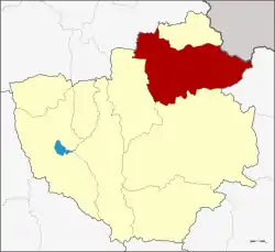 District location in Phayao Province | |
| Coordinates: 19°31′24″N 100°18′6″E | |
| Country | Thailand |
| Province | Phayao |
| Subdistricts | 10 |
| Mubans | 135 |
| Area | |
| • Total | 784.061 km2 (302.728 sq mi) |
| Population (2015) | |
| • Total | 77,194 |
| • Density | 98.5/km2 (255/sq mi) |
| Time zone | UTC+7 (ICT) |
| Postal code | 56110 |
| Geocode | 5603 |
Geography
Neighboring districts are (from the south clockwise): Pong, Chun of Phayao Province; Thoeng of Chiang Rai Province; and Phu Sang of Phayao Province. To the northeast is Xaignabouli Province of Laos.
Administration
Central administration
Chiang Kham District is divided into 10 sub-districts (tambons), which are further subdivided into 135 administrative villages (mubans).
| No. | Name | Thai | Villages | Pop.[1] |
|---|---|---|---|---|
| 1. | Yuan | หย่วน | 15 | 11,522 |
| 6. | Nam Waen | น้ำแวน | 14 | 7,133 |
| 7. | Wiang | เวียง | 10 | 5,672 |
| 8. | Fai Kwang | ฝายกวาง | 17 | 8,843 |
| 9. | Chedi Kham | เจดีย์คำ | 12 | 5,987 |
| 10. | Rom Yen | ร่มเย็น | 22 | 12,259 |
| 11. | Chiang Ban | เชียงบาน | 11 | 7,443 |
| 12. | Mae Lao | แม่ลาว | 14 | 6,485 |
| 13. | Ang Thong | อ่างทอง | 13 | 8,383 |
| 14. | Thung Pha Suk | ทุ่งผาสุข | 7 | 3,467 |
Local administration
There are four sub-district municipalities (thesaban tambons) in the district:
- Chiang Kham (Thai: เทศบาลตำบลเชียงคำ) consisting of parts of sub-district Yuan.
- Wiang (Thai: เทศบาลตำบลเวียง) consisting of sub-district Wiang.
- Fai Kwang (Thai: เทศบาลตำบลฝายกวาง) consisting of sub-district Fai Kwang.
- Yuan (Thai: เทศบาลตำบลหย่วน) consisting of parts of sub-district Yuan.
There are seven sub-district administrative organizations (SAO) in the district:
- Nam Waen (Thai: องค์การบริหารส่วนตำบลน้ำแวน) consisting of sub-district Nam Waen.
- Chedi Kham (Thai: องค์การบริหารส่วนตำบลเจดีย์คำ) consisting of sub-district Chedi Kham.
- Rom Yen (Thai: องค์การบริหารส่วนตำบลร่มเย็น) consisting of sub-district Rom Yen.
- Chiang Ban (Thai: องค์การบริหารส่วนตำบลเชียงบาน) consisting of sub-district Chiang Ban.
- Mae Lao (Thai: องค์การบริหารส่วนตำบลแม่ลาว) consisting of sub-district Mae Lao.
- Ang Thong (Thai: องค์การบริหารส่วนตำบลอ่างทอง) consisting of sub-district Ang Thong.
- Thung Pha Suk (Thai: องค์การบริหารส่วนตำบลทุ่งผาสุข) consisting of sub-district Thung Pha Suk.
References
- "Population statistics 2015" (in Thai). Department of Provincial Administration. Retrieved 2016-06-09.
External links
- amphoe.com (Thai)
This article is issued from Wikipedia. The text is licensed under Creative Commons - Attribution - Sharealike. Additional terms may apply for the media files.