Pong District
Pong (Thai: ปง, pronounced [pōŋ]) is a district (amphoe) of Phayao Province in northern Thailand.
Pong
ปง | |
|---|---|
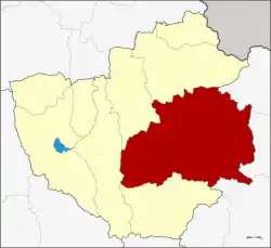 Amphoe location in Phayao Province | |
| Coordinates: 19°8′54″N 100°16′30″E | |
| Country | Thailand |
| Province | Phayao |
| Seat | Pong |
| Area | |
| • Total | 1,783.452 km2 (688.595 sq mi) |
| Population (2005) | |
| • Total | 53,212 |
| • Density | 29.8/km2 (77/sq mi) |
| Time zone | UTC+7 (ICT) |
| Postal code | 56140 |
| Geocode | 5606 |
Geography
Neighboring districts are (from the east clockwise) Song Khwae, Tha Wang Pha, Mueang Nan of Nan Province, Chiang Muan, Dok Khamtai, Chun and Chiang Kham of Phayao Province.
Doi Phu Nang National Park is in the district.[1]
History
Originally named Mueang Pong, the district was renamed Ban Muang (บ้านม่วง) in 1917.[2] In 1939 it was renamed simply "Pong".[3] In 1952 the district was reassigned to Chiang Rai Province, except sub-district Sa-iap which was split off and added to Song District in Phrae.[4] With the creation of the Province of Phayao in 1977 it was added to the new province.
Administration
The district is divided into seven sub-districts (tambon), which are further subdivided into 88 villages (muban). There are two townships (thesaban tambon) - Pong covers which covers parts of tambon Pong and Na Prang, and Ngim covers parts of tambon Ngim. There are a further seven tambon administrative organization (TAO).
| No. | Name | Thai name | Pop. | ||
|---|---|---|---|---|---|
| 1. | Pong | ปง | 8,203 | ||
| 2. | Khuan | ควร | 5,634 | ||
| 3. | Oi | ออย | 7,344 | ||
| 4. | Ngim | งิม | 12,242 | ||
| 5. | Pha Chang Noi | ผาช้างน้อย | 4,914 | ||
| 6. | Na Prang | นาปรัง | 5,913 | ||
| 7. | Khun Khuan | ขุนควร | 8,962 |
References
- Doi Phu Nang National Park
- ประกาศกระทรวงมหาดไทย เรื่อง เปลี่ยนชื่ออำเภอ (PDF). Royal Gazette (in Thai). 34 (ก): 40–68. April 29, 1917.
- พระราชกฤษฎีกาเปลี่ยนนามอำเภอ กิ่งอำเภอ และตำบลบางแห่ง พุทธศักราช ๒๔๘๒ (PDF). Royal Gazette (in Thai). 56 (ก): 354–364. April 17, 1939.
- "พระราชบัญญัติเปลี่ยนแปลงเขตจังหวัดน่าน จังหวัดเชียงราย และจังหวัดแพร่ พ.ศ. ๒๔๙๕" (PDF). Royal Gazette. 69 (77 ก): 1440–1441. December 30, 1952.
