Chun District
Chun District (Thai: จุน, pronounced [t͡ɕūn]) is a district (amphoe) of Phayao Province in northern Thailand.
Chun
จุน | |
|---|---|
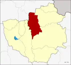 District location in Phayao Province | |
| Coordinates: 19°20′14″N 100°8′6″E | |
| Country | Thailand |
| Province | Phayao |
| Area | |
| • Total | 571.2 km2 (220.5 sq mi) |
| Population (2005) | |
| • Total | 52,066 |
| • Density | 91.2/km2 (236/sq mi) |
| Time zone | UTC+7 (ICT) |
| Postal code | 56150 |
| Geocode | 5602 |
History
Chun District dates back to an ancient city named Wiang Lo, which is of similar age as Mueang Phayao.
Geography
Neighboring districts are (from the east clockwise): Chiang Kham, Pong and Dok Khamtai of Phayao Province, Pa Daet and Thoeng of Chiang Rai Province.
The important water resources are the Ing and Chun Rivers.
Administration
The district is divided into seven sub-districts (tambons), which are further subdivided into 88 villages (mubans). Huai Khao Kam is a township (thesaban tambon) covering parts of tambon Huai Khao Kam. There are a further six tambon administrative organization (TAO).
| No. | Name | Thai name | Pop. | ||
|---|---|---|---|---|---|
| 1. | Huai Khao Kam | ห้วยข้าวก่ำ | 8,893 | ||
| 2. | Chun | จุน | 9,889 | ||
| 3. | Lo | ลอ | 6,724 | ||
| 4. | Hong Hin | หงส์หิน | 7,157 | ||
| 5. | Thung Ruang Thong | ทุ่งรวงทอง | 8,072 | ||
| 6. | Huai Yang Kham | ห้วยยางขาม | 6,102 | ||
| 7. | Phra That Khing Kaeng | พระธาตุขิงแกง | 5,229 |
References
External links
- amphoe.com (Thai)
This article is issued from Wikipedia. The text is licensed under Creative Commons - Attribution - Sharealike. Additional terms may apply for the media files.
