Cibola, Arizona
Cibola is a census-designated place (CDP) in La Paz County, Arizona, United States. The population was 250 at the 2010 census,[2] up from 172 at the 2000 census. It is named for the famed city of gold of the same name.
Cibola, Arizona | |
|---|---|
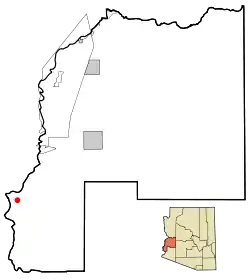 Location in La Paz County and the state of Arizona | |
 Cibola, Arizona Location in the United States | |
| Coordinates: 33°18′59″N 114°39′54″W | |
| Country | United States |
| State | Arizona |
| County | La Paz |
| Area | |
| • Total | 20.19 sq mi (52.29 km2) |
| • Land | 19.52 sq mi (50.56 km2) |
| • Water | 0.67 sq mi (1.73 km2) |
| Elevation | 243 ft (74 m) |
| Population (2010) | |
| • Total | 250 |
| • Density | 12.8/sq mi (4.94/km2) |
| Time zone | UTC-7 (MST (no DST)) |
| ZIP code | 85328 |
| Area code(s) | 928 |
| FIPS code | 04-13470 |
| GNIS feature ID | U.S. Geological Survey Geographic Names Information System: 24371 |
Geography
Cibola is located in southwestern La Paz County at 33°18′59″N 114°39′54″W (33.3164215, -114.6649570),[3] in the Cibola Valley on the east side of the Colorado River. The community is bordered to the west, across the river, by the state of California. The river is crossed by River Road in the eastern part of the CDP; River Road leads south 2.5 miles (4.0 km) to Cibola Park in the center of the CDP, while to the north Neighbors Boulevard leads 8 miles (13 km) to Ripley, California. The northern end of Cibola National Wildlife Refuge occupies the southern part of the CDP.
According to the United States Census Bureau, the CDP has a total area of 20.2 square miles (52.3 km2), of which 19.5 square miles (50.6 km2) are land and 0.66 square miles (1.7 km2), or 3.31%, are water.[2]
Climate
This area has a large amount of sunshine year round due to its stable descending air and high pressure. According to the Köppen Climate Classification system, Cibola has a desert climate, abbreviated "Bwh" on climate maps.[4]
Demographics
| Historical population | |||
|---|---|---|---|
| Census | Pop. | %± | |
| U.S. Decennial Census[5] | |||
As of the census[6] of 2000, there were 172 people, 65 households, and 39 families residing in the CDP. The population density was 9.5 people per square mile (3.7/km2). There were 161 housing units at an average density of 8.9/sq mi (3.5/km2). The racial makeup of the CDP was 75.58% White, 3.49% Black or African American, 6.40% Native American, 11.63% from other races, and 2.91% from two or more races. Hispanic or Latino of any race were 33.72% of the population.
There were 65 households, out of which 29.2% had children under the age of 18 living with them, 53.8% were married couples living together, 6.2% had a female householder with no husband present, and 38.5% were non-families. 27.7% of all households were made up of individuals, and 12.3% had someone living alone who was 65 years of age or older. The average household size was 2.65 and the average family size was 3.33.
In the CDP, the population was spread out, with 30.8% under the age of 18, 3.5% from 18 to 24, 25.0% from 25 to 44, 24.4% from 45 to 64, and 16.3% who were 65 years of age or older. The median age was 36 years. For every 100 females, there were 135.6 males. For every 100 females age 18 and over, there were 124.5 males.
The median income for a household in the CDP was $21,719, and the median income for a family was $43,250. Males had a median income of $60,313 versus $17,500 for females. The per capita income for the CDP was $15,772. None of the families and 12.6% of the population were living below the poverty line, including no under eighteens and 26.7% of those over 64.
Cibola in popular culture
- Epitome of Far from Civilization, Paul Auster uses the town in his 1994 novel Mr. Vertigo.
References
- "2016 U.S. Gazetteer Files". United States Census Bureau. Retrieved Jul 18, 2017.
- "Geographic Identifiers: 2010 Census Summary File 1 (G001), Cibola CDP, Arizona". American FactFinder. U.S. Census Bureau. Archived from the original on February 13, 2020. Retrieved August 15, 2019.
- "US Gazetteer files: 2010, 2000, and 1990". United States Census Bureau. 2011-02-12. Retrieved 2011-04-23.
- Climate Summary for Cibola, Arizona
- "Census of Population and Housing". Census.gov. Retrieved June 4, 2016.
- "U.S. Census website". United States Census Bureau. Retrieved 2008-01-31.
Municipalities and communities of La Paz County, Arizona, United States | ||
|---|---|---|
| Towns | 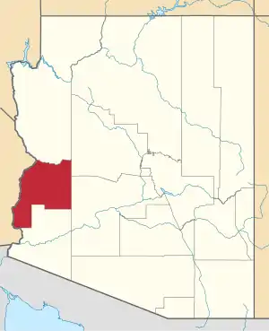 | |
| CDPs | ||
| Populated places | ||
| Indian reservations | ||
| Ghost towns | ||
| ||
| Authority control |
|
|---|