City of Footscray
The City of Footscray was a local government area about 5 kilometres (3 mi) west of Melbourne, the state capital of Victoria, Australia. The city covered an area of 17.10 square kilometres (6.60 sq mi) and existed from 1859 until 1994.
| City of Footscray Victoria | |||||||||||||||
|---|---|---|---|---|---|---|---|---|---|---|---|---|---|---|---|
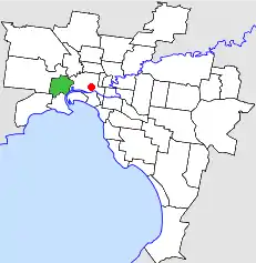 Location in Melbourne | |||||||||||||||
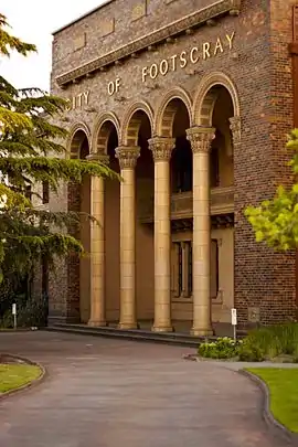 City of Footscray building, located corner of Napier and Hyde Street in Footscray | |||||||||||||||
| Population | 47,900 (1992)[1] | ||||||||||||||
| • Density | 2,801/km2 (7,255/sq mi) | ||||||||||||||
| Established | 1859 | ||||||||||||||
| Area | 17.10 km2 (6.6 sq mi) | ||||||||||||||
| Council seat | Footscray | ||||||||||||||
| Region | Melbourne | ||||||||||||||
| County | Bourke | ||||||||||||||
| |||||||||||||||
History
Footscray was first incorporated as a municipality on 10 June 1859, and was made a borough in 1863. It became a town on 25 February 1887, and was proclaimed a city on 23 January 1891. On 6 January 1922 and 5 February 1941, Footscray annexed land previously part of the Shire of Werribee, which became the West Ward (later to be known as Kingsville Ward). Further additions to this ward were made at the expense of the City of Williamstown, on 12 May 1943.[2]
On 15 December 1994, the City of Footscray was abolished, and, along with parts of the City of Sunshine, was merged into the newly created City of Maribyrnong. The only exception was the suburb of South Kingsville, which was transferred to the City of Hobsons Bay.[3]
Wards
At dissolution, the City of Footscray was divided into four wards, each electing three councillors:
- North West Ward
- North Ward
- South Ward
- Kingsville Ward (formerly West Ward)
Prior to the 1988 elections, an additional Middle Ward existed.[2]
Suburbs
- Footscray
- Kingsville
- Maribyrnong (shared with the City of Sunshine)
- Seddon
- South Kingsville
- Spotswood (shared with the City of Williamstown)
- West Footscray
- Yarraville
- Maidstone
Population
| Year | Population |
|---|---|
| 1954 | 57,915 |
| 1958 | 61,700* |
| 1961 | 60,734 |
| 1966 | 58,666 |
| 1971 | 57,810 |
| 1976 | 51,635 |
| 1981 | 49,756 |
| 1986 | 47,330 |
| 1991 | 46,844 |
* Estimate in the 1958 Victorian Year Book.
References
- Australian Bureau of Statistics, Victoria Office (1994). Victorian Year Book. p. 49. ISSN 0067-1223.
- Victorian Municipal Directory. Brunswick: Arnall & Jackson. 1992. pp. 374–375. Accessed at State Library of Victoria, La Trobe Reading Room.
- Australian Bureau of Statistics (1 August 1995). Victorian local government amalgamations 1994-1995: Changes to the Australian Standard Geographical Classification (PDF). Commonwealth of Australia. p. 8. ISBN 0-642-23117-6. Retrieved 16 December 2007.
