Cléden-Poher
Cléden-Poher (Breton: Kledenn-Poc'hêr) is a commune in the Finistère department of Brittany in north-western France.
Cléden-Poher
Kledenn-Poc'hêr | |
|---|---|
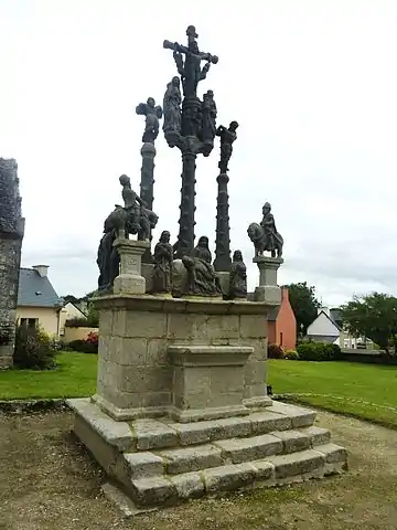 The calvary in Cléden-Poher | |
Location of Cléden-Poher 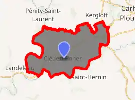
| |
 Cléden-Poher  Cléden-Poher | |
| Coordinates: 48°14′11″N 3°40′02″W | |
| Country | France |
| Region | Brittany |
| Department | Finistère |
| Arrondissement | Châteaulin |
| Canton | Carhaix-Plouguer |
| Intercommunality | Poher |
| Government | |
| • Mayor (2014–2020) | Jacques Quiltu |
| Area 1 | 29.81 km2 (11.51 sq mi) |
| Population (2017-01-01)[1] | 1,158 |
| • Density | 39/km2 (100/sq mi) |
| Time zone | UTC+01:00 (CET) |
| • Summer (DST) | UTC+02:00 (CEST) |
| INSEE/Postal code | 29029 /29270 |
| Elevation | 53–155 m (174–509 ft) |
| 1 French Land Register data, which excludes lakes, ponds, glaciers > 1 km2 (0.386 sq mi or 247 acres) and river estuaries. | |
Population
Inhabitants of Cléden-Poher are called in French Clédinois.
|
|
|
See also
References
- "Populations légales 2017". INSEE. Retrieved 6 January 2020.
External links
| Wikimedia Commons has media related to Cléden-Poher. |
- Base Mérimée: Search for heritage in the commune, Ministère français de la Culture. (in French)
- Mayors of Finistère Association (in French)
| Authority control |
|
|---|
This article is issued from Wikipedia. The text is licensed under Creative Commons - Attribution - Sharealike. Additional terms may apply for the media files.