Clarksville, Pennsylvania
Clarksville is a borough in Greene County, Pennsylvania, United States. The population was 230 at the 2010 census.[3]
Clarksville, Pennsylvania | |
|---|---|
 Houses on Center Street | |
 Location of Clarksville in Greene County, Pennsylvania. | |
 Clarksville Location of Clarksville in Greene County, Pennsylvania.  Clarksville Clarksville (the United States) | |
| Coordinates: 39°58′27″N 80°2′41″W | |
| Country | United States |
| State | Pennsylvania |
| County | Greene |
| Established | 1769 |
| Government | |
| • Mayor | David Teagarden |
| Area | |
| • Total | 0.10 sq mi (0.25 km2) |
| • Land | 0.10 sq mi (0.25 km2) |
| • Water | 0.00 sq mi (0.00 km2) |
| Elevation | 805 ft (245 m) |
| Population (2010) | |
| • Total | 230 |
| • Estimate (2019)[2] | 218 |
| • Density | 2,247.42/sq mi (865.04/km2) |
| Time zone | UTC-4 (EST) |
| • Summer (DST) | UTC-5 (EDT) |
| Area code(s) | 724 |
| FIPS code | 42-13896 |
Geography
Clarksville is located in the northeast corner of Greene County at 39°58′27″N 80°2′41″W (39.974170, -80.044833),[4] at the confluence of Tenmile Creek with its South Fork. The borough is bordered by Morgan Township to the west, by Jefferson Township to the south and east across the South Fork Tenmile Creek, and by East Bethlehem Township in Washington County to the north across Tenmile Creek. Clarksville is 3 miles (5 km) southwest of Millsboro, where Tenmile Creek joins the Monongahela River.
An adjacent part of East Bethlehem Township, Washington County adjacent to the borough is often colloquially considered to be part of Clarksville.
According to the United States Census Bureau, Clarksville has a total area of 0.10 square miles (0.25 km2), all of it land.[3]
Demographics
| Historical population | |||
|---|---|---|---|
| Census | Pop. | %± | |
| 1880 | 205 | — | |
| 1910 | 208 | — | |
| 1920 | 234 | 12.5% | |
| 1930 | 457 | 95.3% | |
| 1940 | 428 | −6.3% | |
| 1950 | 428 | 0.0% | |
| 1960 | 332 | −22.4% | |
| 1970 | 269 | −19.0% | |
| 1980 | 251 | −6.7% | |
| 1990 | 211 | −15.9% | |
| 2000 | 234 | 10.9% | |
| 2010 | 230 | −1.7% | |
| 2019 (est.) | 218 | [2] | −5.2% |
| Sources:[5][6][7] | |||
As of the census[6] of 2000, there were 234 people, 78 households, and 52 families residing in the borough. The population density was 2,387.1 people per square mile (903.5/km2). There were 90 housing units at an average density of 918.1 per square mile (347.5/km2). The racial makeup of the borough was 96.15% White, 1.28% African American, 0.43% Native American and 2.14% Pacific Islander. Hispanic or Latino of any race were 0.43% of the population.
There were 78 households, out of which 26.9% had children under the age of 18 living with them, 55.1% were married couples living together, 11.5% had a female householder with no husband present, and 33.3% were non-families. 28.2% of all households were made up of individuals, and 17.9% had someone living alone who was 65 years of age or older. The average household size was 2.51 and the average family size was 3.12.
In the borough the population was spread out, with 20.5% under the age of 18, 7.3% from 18 to 24, 21.4% from 25 to 44, 23.1% from 45 to 64, and 27.8% who were 65 years of age or older. The median age was 46 years. For every 100 females there were 93.4 males. For every 100 females age 18 and over, there were 84.2 males.
The median income for a household in the borough was $25,833, and the median income for a family was $26,429. Males had a median income of $26,667 versus $31,250 for females. The per capita income for the borough was $13,720. About 7.1% of families and 7.2% of the population were below the poverty line, including 7.4% of those under the age of eighteen and 5.4% of those sixty five or over.
Notable person
- Joseph Yablonski, United Mine Works labor leader
References
- "2019 U.S. Gazetteer Files". United States Census Bureau. Retrieved July 28, 2020.
- "Population and Housing Unit Estimates". United States Census Bureau. May 24, 2020. Retrieved May 27, 2020.
- "Geographic Identifiers: 2010 Demographic Profile Data (G001): Clarksville borough, Pennsylvania". American Factfinder. U.S. Census Bureau. Retrieved January 27, 2017.
- "US Gazetteer files: 2010, 2000, and 1990". United States Census Bureau. 2011-02-12. Retrieved 2011-04-23.
- "Census of Population and Housing". U.S. Census Bureau. Retrieved 11 December 2013.
- "U.S. Census website". United States Census Bureau. Retrieved 2008-01-31.
- "Incorporated Places and Minor Civil Divisions Datasets: Subcounty Resident Population Estimates: April 1, 2010 to July 1, 2012". Population Estimates. U.S. Census Bureau. Archived from the original on 11 June 2013. Retrieved 11 December 2013.
Municipalities and communities of Greene County, Pennsylvania, United States | ||
|---|---|---|
| Boroughs | 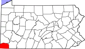 | |
| Townships | ||
| CDPs | ||
| Unincorporated communities | ||
| ||
