Clay Center, Nebraska
Clay Center is a city in and the county seat of Clay County, Nebraska, United States.[6] It is part of the Hastings, Nebraska Micropolitan Statistical Area. The population was 760 at the 2010 census.
Clay Center, Nebraska | |
|---|---|
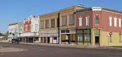 Downtown Clay Center | |
 Location of Clay Center, Nebraska | |
| Coordinates: 40°31′20″N 98°3′18″W | |
| Country | United States |
| State | Nebraska |
| County | Clay |
| Government | |
| • Mayor | L. Wayne Johnson |
| Area | |
| • Total | 0.73 sq mi (1.89 km2) |
| • Land | 0.73 sq mi (1.89 km2) |
| • Water | 0.00 sq mi (0.00 km2) |
| Elevation | 1,785 ft (544 m) |
| Population | |
| • Total | 760 |
| • Estimate (2019)[3] | 724 |
| • Density | 990.42/sq mi (382.32/km2) |
| Time zone | UTC-6 (Central (CST)) |
| • Summer (DST) | UTC-5 (CDT) |
| ZIP code | 68933 |
| Area code(s) | 402 |
| FIPS code | 31-09375[4] |
| GNIS feature ID | 0828169[5] |
Geography
Clay Center is located at 40°31′20″N 98°3′18″W (40.522291, -98.055076).[7]
According to the United States Census Bureau, the city has a total area of 0.72 square miles (1.86 km2), all land.[8]
History
Clay Center was laid out in 1879.[9] The city was named after Henry Clay, a statesman from Kentucky.[10] A post office has been in operation at Clay Center since 1879.[11]
Demographics
| Historical population | |||
|---|---|---|---|
| Census | Pop. | %± | |
| 1880 | 68 | — | |
| 1890 | 390 | 473.5% | |
| 1900 | 590 | 51.3% | |
| 1910 | 1,065 | 80.5% | |
| 1920 | 965 | −9.4% | |
| 1930 | 933 | −3.3% | |
| 1940 | 715 | −23.4% | |
| 1950 | 824 | 15.2% | |
| 1960 | 792 | −3.9% | |
| 1970 | 952 | 20.2% | |
| 1980 | 962 | 1.1% | |
| 1990 | 825 | −14.2% | |
| 2000 | 861 | 4.4% | |
| 2010 | 760 | −11.7% | |
| 2019 (est.) | 724 | [3] | −4.7% |
| U.S. Decennial Census[12] | |||
2010 census
As of the census[2] of 2010, there were 760 people, 332 households, and 214 families residing in the city. The population density was 1,055.6 inhabitants per square mile (407.6/km2). There were 360 housing units at an average density of 500.0 per square mile (193.1/km2). The racial makeup of the city was 95.4% White, 0.4% African American, 0.1% Asian, 2.2% from other races, and 1.8% from two or more races. Hispanic or Latino of any race were 4.6% of the population.
There were 332 households, of which 27.7% had children under the age of 18 living with them, 54.8% were married couples living together, 7.2% had a female householder with no husband present, 2.4% had a male householder with no wife present, and 35.5% were non-families. 32.8% of all households were made up of individuals, and 13.8% had someone living alone who was 65 years of age or older. The average household size was 2.27 and the average family size was 2.89.
The median age in the city was 42.8 years. 23.7% of residents were under the age of 18; 7.4% were between the ages of 18 and 24; 21.5% were from 25 to 44; 30.4% were from 45 to 64; and 17% were 65 years of age or older. The gender makeup of the city was 49.6% male and 50.4% female.
2000 census
As of the census[4] of 2000, there were 861 people, 343 households, and 243 families residing in the city. The population density was 1,215.3 people per square mile (468.2/km2). There were 373 housing units at an average density of 526.5 per square mile (202.8/km2). The racial makeup of the city was 96.17% White, 0.58% African American, 0.23% Native American, 0.93% Asian, 1.16% from other races, and 0.93% from two or more races. Hispanic or Latino of any race were 3.02% of the population.
There were 343 households, out of which 35.9% had children under the age of 18 living with them, 60.6% were married couples living together, 7.6% had a female householder with no husband present, and 28.9% were non-families. 27.4% of all households were made up of individuals, and 11.7% had someone living alone who was 65 years of age or older. The average household size was 2.50 and the average family size was 3.04.
In the city, the population was spread out, with 28.6% under the age of 18, 6.2% from 18 to 24, 25.7% from 25 to 44, 26.2% from 45 to 64, and 13.4% who were 65 years of age or older. The median age was 38 years. For every 100 females, there were 91.3 males. For every 100 females age 18 and over, there were 90.4 males.
As of 2000 the median income for a household in the city was $36,597, and the median income for a family was $45,893. Males had a median income of $30,982 versus $20,446 for females. The per capita income for the city was $17,577. About 7.6% of families and 9.1% of the population were below the poverty line, including 14.5% of those under age 18 and 1.7% of those age 65 or over.
Education
Accredited "A" by the State Board of Education, Clay Center High School (CCHS) has an exceptional academic reputation with test scores consistently above the state and national averages.
The K-12 system enjoys a modern high school facility and gym. In the past five years, CCHS has earned five state championships in various sports. An experienced administration and staff provide an average 1 to 10 teacher-to-pupil ratio. Community scholarships are available to graduating seniors.
Served by Educational Service Unit No. 9 of Hastings, CCHS receives resources and expertise for its teachers and students.
Clay Center is located near several post-secondary institutions. It is one and one-half hours from the University of Nebraska/Lincoln and University of Nebraska/Kearney; one-half hour from Hastings College and the Mary Lanning School of Nursing, and 20 minutes from Central Community College in Hastings.
Notable people
- Abby Miller, actress
- Joe Saldana, race-car driver
- Howard Bradley Smith, (author)
Popular culture
- The novel, Clay Center by Phil Condon, was named after the town.
References
- "2019 U.S. Gazetteer Files". United States Census Bureau. Retrieved July 26, 2020.
- "U.S. Census website". United States Census Bureau. Retrieved 2012-06-24.
- "Population and Housing Unit Estimates". United States Census Bureau. May 24, 2020. Retrieved May 27, 2020.
- "U.S. Census website". United States Census Bureau. Retrieved 2008-01-31.
- "US Board on Geographic Names". United States Geological Survey. 2007-10-25. Retrieved 2008-01-31.
- "Find a County". National Association of Counties. Archived from the original on 2011-05-31. Retrieved 2011-06-07.
- "US Gazetteer files: 2010, 2000, and 1990". United States Census Bureau. 2011-02-12. Retrieved 2011-04-23.
- "US Gazetteer files 2010". United States Census Bureau. Archived from the original on 2012-01-25. Retrieved 2012-06-24.
- Burr, George L. (1921). History of Hamilton and Clay Counties, Nebraska, Volume 1. S.J. Clarke Publishing Company. p. 104.
- Federal Writers' Project (1938). Origin of Nebraska place names. Lincoln, NE: Works Progress Administration. p. 8.
- "Post offices". Jim Forte Postal History. Archived from the original on 13 October 2015. Retrieved 30 August 2016.
- "Census of Population and Housing". Census.gov. Retrieved June 4, 2015.
Municipalities and communities of Clay County, Nebraska, United States | ||
|---|---|---|
| Cities | Map of Nebraska highlighting Clay County | |
| Villages | ||
| Townships | ||
| CDP | ||
| Other unincorporated communities | ||
| Ghost town | ||
| Footnotes | ‡This populated place also has portions in an adjacent county or counties | |
| ||