Clifford, Ontario
Clifford is an unincorporated community in the Town of Minto in Wellington County in Southwestern Ontario, Canada.[1] It is on Ontario Highway 9 and Coon Creek, a stream in the Saugeen River drainage basin.
Clifford | |
|---|---|
Unincorporated community | |
.jpg.webp) | |
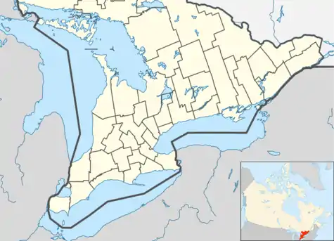
 Clifford Location in southern Ontario | |
| Coordinates: 43°58′09″N 80°58′45″W[1] | |
| Country | Canada |
| Province | Ontario |
| County | Wellington |
| Municipality | Minto |
| Founded (as Minto Village) | 1855 |
| Present Name | 1856 |
| Incorporated (village) | 1873 |
| Amalgamated | 1999 |
| Named for | Clifford in West Yorkshire, England |
| Elevation | 375 m (1,230 ft) |
| Population ([2]) | |
| • Total | 800 |
| Time zone | UTC-5 (Eastern Time Zone) |
| • Summer (DST) | UTC-4 (Eastern Time Zone) |
| Postal codes in Canada | N0G 1M0 |
| Area code(s) | 519, 226, 548 |
The village of Clifford was founded around 1855 as Minto Village.[3] After the opening of the post office in 1856, the settlement was renamed Clifford by the first postmaster Francis Brown after Clifford in West Yorkshire, England. Clifford was incorporated as a village in 1873. In 1999, Clifford was amalgamated with Palmerston, Harriston and Minto Township to create Minto.
The first telephones in the community were installed in 1890 by Bell Canada.[3] Wightman Telecom, based in Clifford and owned by the Wightman family, has owned and operated a communication system in Clifford since 1908, with a telephone system that was originally operated out of a kitchen in Howick Township. Wightman bought out Bell's operations in Clifford, Ayton and Neustadt in 1928. The firm continues to operate the system as of March 2016.[3][4]
On 17 March 2016 a 200-metre (660 ft) wide EF1 tornado touched down near the community.[5]
People
Famous people from Clifford include John A. Kruspe, a former CFL player. Kruspe was a member of the Ottawa Rough Riders during the 1973 Grey Cup win against the Edmonton Eskimos.
References
- "Clifford". Geographical Names Data Base. Natural Resources Canada. Retrieved 2016-03-17.
- Taken from Google Earth at geographic coordinates. Accessed 2016-03-17.
- Harrison, Clifford M (1978). "Two towns and a village". The Way It Was : A History of Minto Township. Township of Minto. pp. 114–120. OCLC 63015327. Retrieved 2016-03-17. Also OCLC 22093320.
- "Who is Wightman Telecom?". Wightman Telecom. Archived from the original on 2016-03-24. Retrieved 2016-03-17.
- "Environment Canada confirms tornado touched down near Clifford Ont". 680 News. 2016-03-17. Retrieved 2016-03-17.
Other map sources:
- Map 4 (PDF) (Map). 1 : 700,000. Official road map of Ontario. Ministry of Transportation of Ontario. 2014. Retrieved 2016-03-17.
- Restructured municipalities - Ontario map #6 (Map). Restructuring Maps of Ontario. Ontario Ministry of Municipal Affairs and Housing. 2006. Retrieved 2016-03-17.
- "Township of Minto" (JPG). Canadian County Atlas Project. McGill University. 2001. Retrieved 2016-03-17.
