Clinton Falls, Minnesota
Clinton Falls is an unincorporated community in Clinton Falls Township, Steele County, Minnesota, United States.
Clinton Falls | |
|---|---|
 Clinton Falls Location of the community of Clinton Falls within Clinton Falls Township, Steele County  Clinton Falls Clinton Falls (the United States) | |
| Coordinates: 44°08′20″N 93°14′49″W | |
| Country | United States |
| State | Minnesota |
| County | Steele |
| Township | Clinton Falls Township |
| Elevation | 1,132 ft (345 m) |
| Time zone | UTC-6 (Central (CST)) |
| • Summer (DST) | UTC-5 (CDT) |
| ZIP code | 55049 and 55060 |
| Area code(s) | 507 |
| GNIS feature ID | 641339[1] |
The community is located between Medford and Owatonna near Interstate 35 and Steele County Road 9. Crane Creek and the Straight River meet near Clinton Falls.
Clinton Falls was platted in 1855.[2] A post office was established at Clinton Falls in 1857, and remained in operation until 1933.[3]
| Historical population | |||
|---|---|---|---|
| Census | Pop. | %± | |
| 1880 | 61 | — | |
| U.S. Decennial Census[4] | |||
References
- "Clinton Falls, Minnesota". Geographic Names Information System. United States Geological Survey.
- Upham, Warren (1920). Minnesota Geographic Names: Their Origin and Historic Significance. Minnesota Historical Society. p. 532.
- "Steele County". Jim Forte Postal History. Retrieved 9 August 2015.
- "Census of Population and Housing". Census.gov. Retrieved June 29, 2019.
Municipalities and communities of Steele County, Minnesota, United States | ||
|---|---|---|
| Cities | 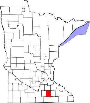 Map of Minnesota highlighting Steele County | |
| Townships | ||
| Unincorporated communities | ||
| Ghost town | ||
| Footnotes | ‡This populated place also has portions in an adjacent county or counties | |
| ||
This article is issued from Wikipedia. The text is licensed under Creative Commons - Attribution - Sharealike. Additional terms may apply for the media files.
