Clintonville, Pennsylvania
Clintonville is a borough in Venango County, Pennsylvania, United States. The population was 508 at the 2010 census.
Clintonville, Pennsylvania | |
|---|---|
 Location of Clintonville in Venango County, Pennsylvania. | |
 Clintonville Location of Clintonville in Venango County, Pennsylvania. | |
| Coordinates: 41°11′58″N 79°52′28″W | |
| Country | United States |
| State | Pennsylvania |
| County | Venango |
| Settled | 1833 |
| Incorporated | 1878 |
| Government | |
| • Type | Borough Council |
| Area | |
| • Total | 1.09 sq mi (2.83 km2) |
| • Land | 1.09 sq mi (2.83 km2) |
| • Water | 0.00 sq mi (0.01 km2) |
| Population (2010) | |
| • Total | 508 |
| • Estimate (2019)[2] | 466 |
| • Density | 427.13/sq mi (164.92/km2) |
| Time zone | UTC-5 (Eastern (EST)) |
| • Summer (DST) | UTC-4 (EDT) |
| Zip code | 16372 |
| Area code(s) | 814 |
| FIPS code | 42-14376 |
Geography
Clintonville is located at 41°11′58″N 79°52′28″W (41.199578, -79.874360).[3]
According to the United States Census Bureau, the borough has a total area of 1.1 square miles (2.8 km2), all of it land.
Demographics
| Historical population | |||
|---|---|---|---|
| Census | Pop. | %± | |
| 1880 | 339 | — | |
| 1890 | 253 | −25.4% | |
| 1900 | 262 | 3.6% | |
| 1910 | 335 | 27.9% | |
| 1920 | 320 | −4.5% | |
| 1930 | 354 | 10.6% | |
| 1940 | 329 | −7.1% | |
| 1950 | 307 | −6.7% | |
| 1960 | 311 | 1.3% | |
| 1970 | 321 | 3.2% | |
| 1980 | 512 | 59.5% | |
| 1990 | 520 | 1.6% | |
| 2000 | 528 | 1.5% | |
| 2010 | 508 | −3.8% | |
| 2019 (est.) | 466 | [2] | −8.3% |
| Sources:[4][5][6] | |||
As of the census[5] of 2000, there were 528 people, 215 households, and 147 families residing in the borough. The population density was 463.5 people per square mile (178.8/km2). There were 242 housing units at an average density of 212.4 per square mile (82.0/km2). The racial makeup of the borough was 97.16% White, 1.52% African American, 0.57% Native American, 0.19% from other races, and 0.57% from two or more races. Hispanic or Latino of any race were 0.19% of the population.
There were 215 households, out of which 35.8% had children under the age of 18 living with them, 51.2% were married couples living together, 10.2% had a female householder with no husband present, and 31.6% were non-families. 27.4% of all households were made up of individuals, and 17.2% had someone living alone who was 65 years of age or older. The average household size was 2.46 and the average family size was 2.95.
In the borough the population was spread out, with 26.1% under the age of 18, 9.5% from 18 to 24, 27.5% from 25 to 44, 21.4% from 45 to 64, and 15.5% who were 65 years of age or older. The median age was 35 years. For every 100 females there were 97.8 males. For every 100 females age 18 and over, there were 90.2 males.
The median income for a household in the borough was $22,083, and the median income for a family was $29,135. Males had a median income of $23,667 versus $16,932 for females. The per capita income for the borough was $15,488. About 14.4% of families and 13.4% of the population were below the poverty line, including 16.4% of those under age 18 and 7.1% of those age 65 or over.
References
- "2019 U.S. Gazetteer Files". United States Census Bureau. Retrieved July 28, 2020.
- "Population and Housing Unit Estimates". United States Census Bureau. May 24, 2020. Retrieved May 27, 2020.
- "US Gazetteer files: 2010, 2000, and 1990". United States Census Bureau. 2011-02-12. Retrieved 2011-04-23.
- "Census of Population and Housing". U.S. Census Bureau. Retrieved 11 December 2013.
- "U.S. Census website". United States Census Bureau. Retrieved 2008-01-31.
- "Incorporated Places and Minor Civil Divisions Datasets: Subcounty Resident Population Estimates: April 1, 2010 to July 1, 2012". Population Estimates. U.S. Census Bureau. Archived from the original on 11 June 2013. Retrieved 11 December 2013.
Municipalities and communities of Venango County, Pennsylvania, United States | ||
|---|---|---|
| Cities | 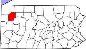 | |
| Boroughs | ||
| Townships | ||
| CDPs | ||
| Unincorporated communities | ||
| Ghost town | ||
| Footnotes | ‡This populated place also has portions in an adjacent county or counties | |
| ||
