Clyde, North Carolina
Clyde is a town in Haywood County, North Carolina, United States. The 2010 census recorded the population at 1,223 people. It is part of the Asheville Metropolitan Statistical Area.
Clyde, North Carolina | |
|---|---|
.jpg.webp) Depot Street in Downtown Clyde | |
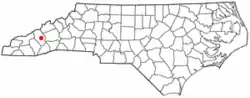 Location of Clyde, North Carolina | |
| Coordinates: 35°31′59″N 82°54′42″W | |
| Country | United States |
| State | North Carolina |
| County | Haywood |
| Government | |
| • Type | Council-Manager |
| • Mayor | Jerry Walker |
| Area | |
| • Total | 0.87 sq mi (2.25 km2) |
| • Land | 0.87 sq mi (2.25 km2) |
| • Water | 0.00 sq mi (0.00 km2) |
| Elevation | 2,543 ft (775 m) |
| Population (2010) | |
| • Total | 1,223 |
| • Estimate (2019)[2] | 1,304 |
| • Density | 1,502.30/sq mi (580.22/km2) |
| Time zone | UTC-5 (Eastern (EST)) |
| • Summer (DST) | UTC-4 (EDT) |
| ZIP code | 28721 |
| Area code(s) | 828 |
| FIPS code | 37-13280[3] |
| GNIS feature ID | 1019707[4] |
History
The Shook-Welch-Smathers House was listed on the National Register of Historic Places in 2008.[5] the city was founded in 1890
Geography
Clyde is located at 35°31′59″N 82°54′42″W (35.533021, -82.911686).[6]
According to the United States Census Bureau, the town has a total area of 0.8 square miles (2.1 km2), all of it land.
Demographics
| Historical population | |||
|---|---|---|---|
| Census | Pop. | %± | |
| 1890 | 90 | — | |
| 1900 | 244 | 171.1% | |
| 1910 | 344 | 41.0% | |
| 1920 | 363 | 5.5% | |
| 1930 | 458 | 26.2% | |
| 1940 | 516 | 12.7% | |
| 1950 | 598 | 15.9% | |
| 1960 | 680 | 13.7% | |
| 1970 | 814 | 19.7% | |
| 1980 | 1,008 | 23.8% | |
| 1990 | 1,041 | 3.3% | |
| 2000 | 1,324 | 27.2% | |
| 2010 | 1,223 | −7.6% | |
| 2019 (est.) | 1,304 | [2] | 6.6% |
| U.S. Decennial Census[7] | |||
As of the census[3] of 2000, there were 1,324 people, 547 households, and 373 families residing in the town. The population density was 1,579.2 people per square mile (608.6/km2). There were 607 housing units at an average density of 724.0 per square mile (279.0/km2). The racial makeup of the town was 94.94% White, 2.49% African American, 0.98% Native American, 0.83% from other races, and 0.76% from two or more races. Hispanic or Latino of any race were 1.89% of the population.
There were 547 households, out of which 29.3% had children under the age of 18 living with them, 51.6% were married couples living together, 12.8% had a female householder with no husband present, and 31.8% were non-families. 26.7% of all households were made up of individuals, and 10.2% had someone living alone who was 65 years of age or older. The average household size was 2.33 and the average family size was 2.82.
In the town, the population was spread out, with 22.6% under the age of 18, 9.3% from 18 to 24, 28.1% from 25 to 44, 22.1% from 45 to 64, and 18.0% who were 65 years of age or older. The median age was 38 years. For every 100 females, there were 85.4 males. For every 100 females age 18 and over, there were 82.1 males.
The median income for a household in the town was $33,000, and the median income for a family was $39,531. Males had a median income of $28,542 versus $21,034 for females. The per capita income for the town was $15,991. About 11.0% of families and 15.0% of the population were below the poverty line, including 22.1% of those under age 18 and 12.1% of those age 65 or over.
Education
Haywood County's only institution of higher education is Haywood Community College, a two-year college located just outside the city limits of Clyde.
They also have Haywood Early College High School which is located on Haywood Community College's campus. Elementary Schools are Clyde Elementary and Lake Junaluska Elementary. Students attend middle school at Canton Middle School then move to Pisgah High School. Clyde is also home to Haywood county’s alternative school central Haywood high school.
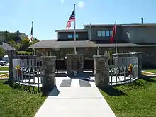
Points of interest
References
- "2019 U.S. Gazetteer Files". United States Census Bureau. Retrieved July 27, 2020.
- "Population and Housing Unit Estimates". United States Census Bureau. May 24, 2020. Retrieved May 27, 2020.
- "U.S. Census website". United States Census Bureau. Retrieved 2008-01-31.
- "US Board on Geographic Names". United States Geological Survey. 2007-10-25. Retrieved 2008-01-31.
- "National Register Information System". National Register of Historic Places. National Park Service. July 9, 2010.
- "US Gazetteer files: 2010, 2000, and 1990". United States Census Bureau. 2011-02-12. Retrieved 2011-04-23.
- "Census of Population and Housing". Census.gov. Retrieved June 4, 2015.
External links
Municipalities and communities of Haywood County, North Carolina, United States | ||
|---|---|---|
| Towns | 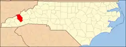 | |
| CDPs | ||
| Unincorporated communities | ||
| Indian reservation | ||
| Footnotes | ‡This populated place also has portions in an adjacent county or counties | |
| ||
| Authority control |
|---|