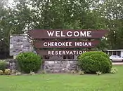
Qualla Boundary
The Qualla Boundary or The Qualla is territory held as a land trust by the United States government for the federally recognized Eastern Band of Cherokee Indians, who reside in western North Carolina. The area is part of the large historic Cherokee territory in the Southeast, which extended into eastern Tennessee, western South Carolina, northern Georgia and Alabama.
The tribe purchased this land in the 1870s, and it was subsequently placed under federal protective trust; it is not a reservation created by the government.[1][2] Individuals can buy, own, and sell the land, provided they are enrolled members of the Tribe of the Eastern Band of the Cherokee Indians. Their headquarters is located in Cherokee, North Carolina.
Location
The Qualla Boundary is located at 35°30′N 83°16′W.
The main part of the Qualla Boundary lies in eastern Swain and northern Jackson counties (just south of Great Smoky Mountains National Park). A small portion of the main trust lands extends eastward into Haywood County. The trust lands include many smaller non-contiguous sections to the southwest in Marble, Hiwassee, and Hanging Dog areas of Cherokee County, North Carolina, and the Snowbird community in Graham County, North Carolina. The total land area of these regions is 213.934 km² (82.6 sq mi), with a 2000 census resident population of 8,092 people.
History
.jpg.webp)
The Cherokee and their ancestors have long occupied this area, having migrated here centuries before the Europeans arrived. During their colonial expansion west, European settlers sometimes came into conflict with the Cherokee, whose territory extended into present-day Tennessee and northern Georgia; after the late eighteenth century and warfare with American settlers during and after the Revolutionary War, many of the Cherokee moved further south along the Tennessee River, into Georgia and westward into Alabama, establishing at least eleven new towns.
The Cherokee were forcibly removed in the late 1830s from much of this area, especially the Black Belt in Georgia and Alabama, under federal authority as authorized by Congress in the 1830 Indian Removal Act. They were relocated to Indian Territory west of the Mississippi River, in what is the present-day state of Oklahoma.
During the winter of 1838 and early the spring of 1839, the U.S. Federal Government relocated approximately 11,000 Cherokee from their homeland in North Carolina, in what is known as the Trail of Tears. Some of the Cherokee were able to evade the initial removal and hide in the Great Smoky Mountains, some were free to stay on their lands due to earlier treaties, but the majority of the Cherokee people were removed from the land. This was when the main struggle for land at what became the Qualla Boundary began.[3]
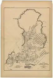
The Qualla Boundary was first surveyed in 1876 by M. S. Temple under the auspices of the United States Land Office. These pieces were embodied in a map published as the Map of the Qualla Indian reserve.[4]
The Qualla Boundary is a land trust supervised by the United States Bureau of Indian Affairs. The land is a fragment of the extensive historical homeland of the Cherokee in the region, and was considered part of the Cherokee Nation during the nineteenth century, prior to certain treaties and Indian Removal in the 1830s. William Holland Thomas had lived and worked among the Cherokee people for a good portion of his life. He had a knowledge of their traditions and language, and was close friends with some members of the tribe. The Cherokee valued and respected Thomas; he had studied law and was adopted into the tribe and named as successor by its hereditary chief. He is the only European American to have served as chief in their history.[5]
Thomas purchased lands around the Oconaluftee River for the tribe, the total area adding up to around 50,000 acres; this land is still a large part of what makes up the Boundary today. The Cherokee organized and formed a corporation in 1870 to be able to purchase and hold additional lands.[1] The Cherokee who gained the ability to live in North Carolina were considered to be an independent band from the Cherokee Nation living in Oklahoma.[6]
A United States Department of Interior sign, entitled "Qualla Indian Reservation", reads:
The Cherokee domain once extended far beyond the distant mountains, but the white man, with broken treaties and fruitless promises, brought trouble to the Indians and caused their banishment to an Oklahoma reservation. A few escaped capture and fled into the Great Smokies, eventually forming the Eastern Band that now lives on the Qualla Reservation in the valley below.
Law and government
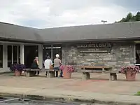
The tribal community functions like most municipalities, operating schools, law enforcement, and rescue services, in addition to their own hospital and gaming casino, known as Harrah's Cherokee. They have opened a second location of the casino on their land in Murphy, North Carolina. The Tribe has operated a court system since 1987.
Tribal police have exclusive police jurisdiction on Indian lands. The FBI and other federal agencies have jurisdiction to handle certain major federal criminal offenses. NC State Troopers, motor vehicle inspectors, wildlife officers, state alcohol agents, SBI agents, and other state peace officers assigned to counties that overlap with the Qualla Boundary can be called to assist tribal law enforcement officers, and can be commissioned as "special officers" of the Department of Interior to assist in federal investigations. Non-tribal members charged with a crime in Qualla Boundary are referred to local county courts.
Representation in media
In the mid-1950s, much of Disney's five-part television series, Davy Crockett (starring Fess Parker), was filmed here.
References
- "History & Culture". Eastern Band of Cherokee. Archived from the original on April 15, 2015. Retrieved April 15, 2015.
- Qualla Boundary, NCPedia.org (retrieved 15 April 2015)
- "NCGenWeb Project | North Carolina Genealogy Resources". Retrieved May 1, 2020.
- [http🖉"Map of the Qualla Indian Reserve (Boundary) N.C. :: North Carolina Maps]". dc.lib.unc.edu.
- Mitchell, Anne (1997). "Culture, History, and Development on the Qualla Boundary". Appalachian Journal and Appalachian State University. 24.
- Denning, Shea (July 10, 2019). "Criminal Jurisdiction on the Qualla Boundary". NC Criminal Law Blog | UNC Chapel Hill School of Government. Retrieved March 31, 2020.
Further reading
- "Eastern Cherokee Reservation, North Carolina", United States Census Bureau
- "Indians, Eastern Band of Cherokees of North Carolina," by Thomas Donaldson, 1892, 11th Census of the United States, Robert P. Porter, Superintendent, US Printing Office, Washington, D.C. Published online at Eastern Band of Cherokees of North Carolina, Access Genealogy. Retrieved on 2009-01-08
External links
| Wikimedia Commons has media related to Qualla Boundary. |
Municipalities and communities of Cherokee County, North Carolina, United States | ||
|---|---|---|
| Towns | 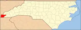 | |
| CDP | ||
| Unincorporated communities | ||
| Indian reservation | ||
| Footnotes | ‡This populated place also has portions in an adjacent county or counties | |
| ||
Municipalities and communities of Graham County, North Carolina, United States | ||
|---|---|---|
| Towns | 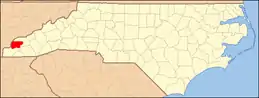 | |
| Unincorporated community | ||
| Indian reservation | ||
| Footnotes | ‡This populated place also has portions in an adjacent county or counties | |
| ||
Municipalities and communities of Haywood County, North Carolina, United States | ||
|---|---|---|
| Towns | 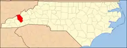 | |
| CDPs | ||
| Unincorporated communities | ||
| Indian reservation | ||
| Footnotes | ‡This populated place also has portions in an adjacent county or counties | |
| ||
Municipalities and communities of Jackson County, North Carolina, United States | ||
|---|---|---|
| Towns | 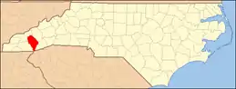 | |
| Village | ||
| CDPs | ||
| Unincorporated communities | ||
| Indian reservation | ||
| Footnotes | ‡This populated place also has portions in an adjacent county or counties | |
| ||
Municipalities and communities of Swain County, North Carolina, United States | ||
|---|---|---|
| Town | 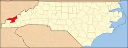 | |
| CDP | ||
| Unincorporated communities | ||
| Indian reservation | ||
| Footnotes | ‡This populated place also has portions in an adjacent county or counties | |
| ||