College View, Nebraska
College View is a neighborhood in southeast Lincoln, Nebraska, United States which was previously a village in Lancaster County.[2]
College View, Nebraska | |
|---|---|
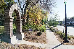 College View neighborhood at Union College in Lincoln, Nebraska | |
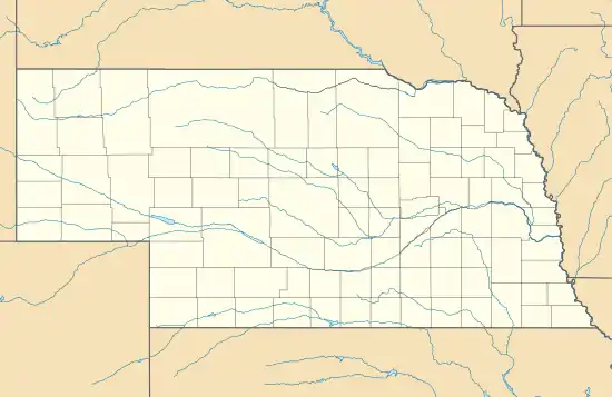 College View Location in Nebraska  College View Location in the United States | |
| Coordinates: Community 40°46′20″N 96°39′08″W | |
| Country | United States |
| State | Nebraska |
| County | Lancaster |
| Elevation | 1,302 ft (397 m) |
| Time zone | UTC-6 (Central (CST)) |
| • Summer (DST) | UTC-5 (CDT) |
| ZIP code | 68506 |
| Area code(s) | 402 |
| FIPS code | 31-09900 |
| GNIS feature ID | 828264[1] |
History
In 1891, Union College was founded southeast of nearby Lincoln and a small village formed around it.[3] The first post office was established in College View in 1891.[4] In 1892, the village had grown to around 1,000 residents and was incorporated as College View.[3]
During the second world war, Medical Recruits marched and trained in College View. There are pictures of soldiers such as Desmond T. Doss marching under the Clocktower on the Union College campus.
In 1929, the population of College View had grown to 2,900 people.[3] The city of Lincoln had grown southward and annexed College View in 1929.[3]
Since annexation, College View has become a vibrant neighborhood in Lincoln. The area is home to many small businesses and historic buildings. Union College continues to operate.
See also
References
- "US Board on Geographic Names". United States Geological Survey. 2007-10-25. Retrieved 2008-01-31.
- U.S. Geological Survey Geographic Names Information System: College View, Nebraska
- Network, University of Nebraska-Lincoln | Web Developer. "CASDE | Lincoln -- Lancaster County". casde.unl.edu. Retrieved 2018-03-20.
- "Lancaster County". Jim Forte Postal History. Archived from the original on 20 August 2014. Retrieved 19 August 2014.
Municipalities and communities of Lancaster County, Nebraska, United States | ||
|---|---|---|
| Cities | Map of Nebraska highlighting Lancaster County | |
| Villages | ||
| CDPs | ||
| Other unincorporated communities | ||
| Footnotes | ‡This populated place also has portions in an adjacent county or counties | |
| ||