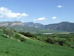
Conca de Dalt
Conca de Dalt is a municipality in the comarca of the Pallars Jussà in Catalonia, Spain. The municipal territory extends to both the east and west of la Pobla de Segur, on the sides of the valley of the Noguera Pallaresa river. The municipality was known as Pallars Jussà from its formation in 1969 (by the fusion of twelve smaller municipalities) until 1995, when the name was changed to avoid confusion with the comarca.
Conca de Dalt | |
|---|---|
 Conca de dalt | |
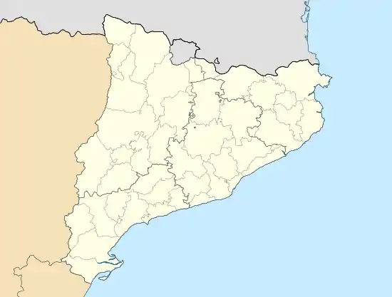 Conca de Dalt Location in Catalonia | |
| Coordinates: 42°14′46″N 0°58′23″E | |
| Country | |
| Community | |
| Province | Lleida |
| Comarca | Pallars Jussà |
| Government | |
| • Mayor | Martí Cardona Rocafort (2015)[1] |
| Area | |
| • Total | 166.5 km2 (64.3 sq mi) |
| Elevation | 507 m (1,663 ft) |
| Population (2018)[3] | |
| • Total | 428 |
| • Density | 2.6/km2 (6.7/sq mi) |
| Website | www |
Subdivisions
The municipality of Conca de Dalt is composed of twelve settlements: populations are given as of 2005.
- Aramunt (103)
- Claverol (26)
- Erinyà (29), near the gorge formed by the Flamicell river through the Sant Gervàs range
- Hortoneda (45)
- Pessonada (50)
- El Pont de Claverol (11), seat of the ajuntament (town hall), to the west of la Pobla de Segur
- Rivert (37)
- Sant Martí de Canals (51)
- Serradell (16)
- Sossís (32), with a coal mine and hydroelectric power station
- Toralla (23)
- Torallola (16)
Demography
| 1900 | 1930 | 1950 | 1970 | 1986 | 2007 |
|---|---|---|---|---|---|
| 2014 | 1789 | 1289 | 665 | 481 | 434 |
References
- "Ajuntament de Conca de Dalt". Generalitat of Catalonia. Retrieved 2015-11-13.
- "El municipi en xifres: Conca de Dalt". Statistical Institute of Catalonia. Retrieved 2015-11-23.
- Municipal Register of Spain 2018. National Statistics Institute.
External links
- Official website (in Catalan)
- Government data pages (in Catalan)
Places adjacent to Conca de Dalt | |
|---|---|
Municipalities of Pallars Jussà | ||
|---|---|---|
This article is issued from Wikipedia. The text is licensed under Creative Commons - Attribution - Sharealike. Additional terms may apply for the media files.