Coole Pilate
Coole Pilate is a civil parish in the unitary authority of Cheshire East and the ceremonial county of Cheshire, England, which lies to the north of Audlem and to the south of Nantwich. The area is predominantly rural with scattered farms, and a total population of 60 people. At the 2011 Census the population remained less than 100. Details are included in the civil parish of Austerson. Nearby villages include Broomhall Green, Hankelow, Hatherton and Newhall.
| Coole Pilate | |
|---|---|
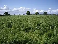
 Typical flat farmland in Coole Pilate | |
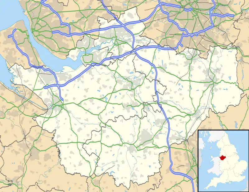
 Coole Pilate Location within Cheshire | |
| OS grid reference | SJ655466 |
| Civil parish |
|
| Unitary authority | |
| Ceremonial county | |
| Region | |
| Country | England |
| Sovereign state | United Kingdom |
| Post town | NANTWICH |
| Postcode district | CW5 |
| Dialling code | 01270 |
| Police | Cheshire |
| Fire | Cheshire |
| Ambulance | North West |
| UK Parliament | |
History

Coole Pilate means a croft growing pill oats.[1] A brine spring is shown on an 1831 map of the area,[2] and is presumably the source of local place names such as "Brine Pit".
Little is known of the early history of the area. A square perforated stone hoe believed to date from the Bronze Age was found in a field to the west of Old Hall in 1936, suggesting possible settlement during that period.[3] Coole Pilate is not mentioned by name in the Domesday survey. Most of the area of the modern civil parish fell within the ancient parish of Acton in the Nantwich Hundred; it was served by St Mary's Church, Acton.[4] A loom weight was found in the area, suggesting that weaving was carried out locally around the 16th century.[5] There is evidence of a local brickworks and pottery around the 18th–19th centuries.[6]
In around 1836, landowners in the parish included the Earl of Kilmorey, a major landowner locally, as well as Charles Wicksted, Richard Johnson and the Reverend Jeremiah Smith.[7][8] The Birmingham and Liverpool Junction Canal, now part of the Shropshire Union, was completed in 1835.[9] The Nantwich and Market Drayton Railway, constructed in 1863, ran north–south through the parish; a halt at Coole Pilate was opened in 1935.[7][10] The halt closed in 1963 and the line was subsequently dismantled, although the supports of the former railway bridge over the Shropshire Union Canal still remain near Austin's Bridge.[11][12]
The parish had a platoon in the Home Guard during the Second World War, which guarded the canal bridges and reinforced the RAF at the nearby Hack Green Radar Station.[13]
Governance
Coole Pilate has been administered since 1950 by Sound and District Parish Council.[14] From 1974 the civil parish was served by Crewe and Nantwich Borough Council, which was succeeded on 1 April 2009 by the new unitary authority of Cheshire East.[15] Coole Pilate falls in the parliamentary constituency of Crewe and Nantwich,[16] which has been represented by Edward Timpson since a by-election in 2008.
Geography, transport and economy

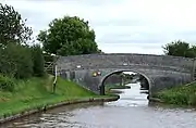
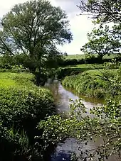
The civil parish has a total area of 715 acres (289 ha).[17] The terrain is relatively flat, with an average elevation of around 50 metres. The land use is almost entirely agricultural.[18] The Shropshire Union Canal runs north–south through the parish; it is crossed by the Cool Lane roadbridge and the Austin's and Hall's footbridges. The River Weaver runs along the eastern border, and Finnaker brook runs north–south in the west of the parish. Several small meres and ponds are scattered across the farmland, and there are also a few small areas of woodland.[19][20]
Coole Lane, which connects Nantwich with the A525 near Audlem, runs north–south through the parish and is the major road. Brine Pits Lane runs from Coole Lane to Brinepits Farm. The A529 lies to the east of the parish. The South Cheshire Way long-distance footpath runs east–west through the parish.[19][20]
Demography
In 2006, the total population of the civil parish was estimated as 50.[17] The 2001 census recorded a population of 60.[21] Historical population figures were 39 (1801), 43 (1851), 53 (1901) and 70 (1951).[22]
Landmarks
Coole Pilate Chapel on Coole Lane at SJ651472 was built in 1850 by the Wesleyan Methodist Association.[10][23] Other landmarks include the large farms of Old Hall at the junction of Coole Lane and Brine Pits Lane (SJ651469), and Brinepits at the end of Brine Pits Lane (SJ662466).[19]
Education
There are no educational facilities within the civil parish. Coole Pilate falls within the catchment areas of Sound and District Primary School in Sound and Brine Leas High School in Nantwich.[24]
Notable residents
Isabella Whitney, the first woman known to have published secular poetry in the English language, is thought to have been born at Coole Pilate.[25] Her brother, Geoffrey Whitney, is likewise believed to have been born there; also a poet, he is known for his collection Choice of Emblemes.[26]
References
- Latham, p. 16
- Latham, p. 82
- Latham, p. 12
- Latham, p. 9
- Latham, p. 25
- Latham, p. 83
- Cheshire County Council: e-Mapping Victorian Cheshire Archived 21 May 2012 at the Wayback Machine (accessed 16 August 2007)
- Latham, p. 23
- Acton, Edleston and Henhull Parish Plan Archived 29 July 2007 at the Wayback Machine (accessed 17 August 2007)
- The Village of Audlem: Village History Archived 13 February 2008 at the Wayback Machine (accessed 16 August 2007)
- Latham, p. 114
- Geograph: Site of former Railway Bridge, Shropshire Union Canal, near Audlem, Cheshire (accessed 2 April 2008)
- BBC: WW2 People's War: Goodwin, F. The Home Guard in South Cheshire (21 September 2005) (accessed 16 August 2007)
- Latham, p. 140
- Cheshire (Structural Changes) Order 2008 Archived 17 May 2009 at the Wayback Machine
- Cheshire County Council: Interactive Mapping: Crewe and Nantwich Archived 1 October 2011 at the Wayback Machine (accessed 27 January 2009)
- Crewe & Nantwich Borough Council: Parish Statistics (downloaded from ; 5 April 2010)
- Latham, p. 81
- Ordnance Survey Explorer 257: Crewe & Nantwich: Whitchurch & Tattenhall
- Cheshire County Council: Interactive Mapping: Coole Pilate CP Archived 1 October 2011 at the Wayback Machine (accessed 2 April 2008)
- Combining Cheshire County Council: Local Statistics: Austerton – Coole Pilate Archived 27 September 2007 at the Wayback Machine & Neighbourhood Statistics: Austerson CP (accessed 17 August 2007)
- Genuki: Coole Pilate (accessed 16 August 2007)
- Latham, pp. 70–71
- Cheshire County Council: Interactive Mapping: Coole Pilate CP: Primary and secondary schools Archived 1 October 2011 at the Wayback Machine (accessed 2 April 2008)
- Travitsky BS. 'Whitney, Isabella (fl. 1566–1573)', Oxford Dictionary of National Biography, Oxford University Press, 2004 (accessed 21 April 2010)
- Dictionary of National Biography, vol. LXI, pp. 142–143 (Oxford University Press, 1900)
Sources
- Latham FA, ed. Acton, p. 9, (The Local History Group; 1995) (ISBN 0-9522284-1-6)
External links
![]() Media related to Coole Pilate at Wikimedia Commons
Media related to Coole Pilate at Wikimedia Commons