Coppell, Ontario
Coppell is a dispersed rural community and unincorporated place in geographic Lowther Township,[3] Cochrane District in Northeastern Ontario, Canada.[1] It is about 22 kilometres (14 mi) southwest of Hearst, and is counted as part of Unorganized Cochrane North Part in Canadian census data.
Coppell | |
|---|---|
dispersed rural community Unincorporated area | |
 Coppell and the Algoma Central Railway | |
 Coppell Location in Ontario | |
| Coordinates: 49°32′10″N 83°49′45″W[1] | |
| Country | Canada |
| Province | Ontario |
| District | Cochrane |
| Geographic Township | Lowther |
| Elevation | 280 m (920 ft) |
| Time zone | UTC-5 (Eastern Time Zone) |
| • Summer (DST) | UTC-4 (Eastern Time Zone) |
| Postal Code | P0L |
| Area code(s) | 705, 249 |
The community is located on Ontario Highway 583 and the Algoma Central Railway, in both cases between the communities of Mead to the south and Jogues to the north.
References
- "Coppell". Geographical Names Data Base. Natural Resources Canada. Retrieved 2014-08-29.
- Taken from Google Earth at geographic coordinates, accessed 2014-08-29.
- "Lowther" (PDF). Geology Ontario - Historic Claim Maps. Ontario Ministry of Northern Development, Mines and Forestry. Archived from the original (PDF) on 2014-09-03. Retrieved 2014-08-29.
Other map sources:
- Map 14 (PDF) (Map). 1 : 1,600,000. Official road map of Ontario. Ministry of Transportation of Ontario. 2010-01-01. Retrieved 2014-08-29.
- Restructured municipalities - Ontario map #3 (Map). Restructuring Maps of Ontario. Ontario Ministry of Municipal Affairs and Housing. 2006. Retrieved 2014-08-29.
| City | 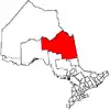 | |
|---|---|---|
| Towns | ||
| Townships | ||
| First Nations | ||
| Indian reserves | ||
| Indian settlements | ||
| Unorganized territories | ||
| Local services boards | ||
| Unincorporated communities | ||
| ||
This article is issued from Wikipedia. The text is licensed under Creative Commons - Attribution - Sharealike. Additional terms may apply for the media files.