Fauquier-Strickland
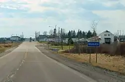
Fauquier-Strickland (/ˈfoʊkieɪ/ or /ˈfoʊkɪər/)[3] is a township municipality in Cochrane District in Northeastern Ontario, Canada. The three main communities in the township are Fauquier, Strickland, and Gregoires Mill.[1][4][5][6][7] All are located along Ontario Highway 11 between the community of Departure Lake to the east and the municipality of Moonbeam to the west.
Fauquier-Strickland | |
|---|---|
| Township of Fauquier-Strickland Canton de Fauquier-Strickland | |
 | |
| Motto(s): Ad augusta per angusta (Latin for "Towards success by effort") | |
 Fauquier-Strickland | |
| Coordinates: 49°16′35″N 82°02′14″W[1] | |
| Country | Canada |
| Province | Ontario |
| District | Cochrane |
| Settled | 1909 |
| Incorporated | December 24, 1921 |
| Government | |
| • Type | Township |
| • Reeve | Madeleine Tremblay |
| • Governing Body | Fauquier-Strickland Township Council |
| • Federal riding | Algoma—Manitoulin—Kapuskasing |
| • Prov. riding | Mushkegowuk—James Bay |
| Area | |
| • Land | 1,013.25 km2 (391.22 sq mi) |
| Population (2016)[2] | |
| • Total | 536 |
| • Density | 0.5/km2 (1/sq mi) |
| Time zone | UTC-5 (EST) |
| • Summer (DST) | UTC-4 (EDT) |
| Postal code | P0L 1G0, P0L 2C0 |
| Area code(s) | 705, 249 |
| Website | fauquierstrickland |
The municipality was first incorporated on December 24, 1921, as Shackleton and Machin, the names of the two geographic townships that then comprised its territory. It adopted its current name in 1984, renaming itself for its two largest communities. As of 2018, it includes the two original geographic townships; to the south the eastern half of geographic Macvicar Township, the western half of geographic Carmichael Township, and all of geographic Stringer Township; to the east, the western portion of geographic Haggart Township; and to the north, all of geographic Beardmore Township. Ironically, geographic Fauquier Township is adjacent to the west and is part of the municipality of Moonbeam.[4][5][7]
Fauquier is located along the Groundhog River. The main community landmark is a roadside statue of a groundhog.
Reeves
- Pierre Guèvremont (1922–1929)
- J. Anaclet Habel (1930–1931)
- Ph. Filion (1932)
- Napoléon Gravel (1933–1945)
- J. Émile Jacques (1946–1948)
- Raoul Tremblay (1949–1955)
- J. Antoine Laferrière (1956–1964, 1969–1972)
- Edmond Gauthier (1965)
- Laurent Dufour (1966–1968)
- Raymond Grzela (1972–2003)
- Jacques Demers (2003–2006)
- Madeleine Tremblay (2006–present)
Demographics
| Canada census – Fauquier-Strickland community profile | |||
|---|---|---|---|
| 2016 | 2011 | 2006 | |
| Population: | 536 (1.1% from 2011) | 530 (-6.7% from 2006) | 568 (-16.2% from 2001) |
| Land area: | 1,013.25 km2 (391.22 sq mi) | 1,013.90 km2 (391.47 sq mi) | 1,013.54 km2 (391.33 sq mi) |
| Population density: | 0.5/km2 (1.3/sq mi) | 0.5/km2 (1.3/sq mi) | 0.6/km2 (1.6/sq mi) |
| Median age: | 56.2 (M: 56.9, F: 55.4) | 53.4 (M: 53, F: 53.5) | 49.4 (M: 48.4, F: 51.0) |
| Total private dwellings: | 265 | 367 | 368 |
| Median household income: | $54,912 | $64,926 | |
| References: 2016[8] 2011[9] 2006[10] earlier[11] | |||
Population:[12]
- Population in 2016: 536 [13]
- Population in 2011: 530
- Population in 2006: 568
- Population in 2001: 678
- Population in 1996: 684 (or 747 when adjusted to 2001 boundaries)
- Population in 1991: 746
Mother tongue:[13]
- English as first language: 25.23%
- French as first language: 71.96%
- English and French as first language: 0.95%
- English and Other as first language: 0.95
- Other as first language: 0.95%
References
- "Fauquier-Strickland". Geographical Names Data Base. Natural Resources Canada. Retrieved 2018-08-21.
- "Census Profile, 2016 Census: Fauquier-Strickland".
- The Canadian Press (2017), The Canadian Press Stylebook (18th ed.), Toronto: The Canadian Press
- "Toporama (on-line map and search)". Atlas of Canada. Natural Resources Canada. Retrieved 2018-08-21.
- "Ontario Geonames GIS (on-line map and search)". Ontario Ministry of Natural Resources and Forestry. 2014. Retrieved 2018-08-21.
- Map 14 (PDF) (Map). 1 : 1,600,000. Official road map of Ontario. Ministry of Transportation of Ontario. 2016-01-01. Retrieved 2018-08-21.
- Restructured municipalities - Ontario map #3 (Map). Restructuring Maps of Ontario. Ontario Ministry of Municipal Affairs and Housing. 2006. Retrieved 2018-08-21.
- "2016 Community Profiles". 2016 Canadian Census. Statistics Canada. February 21, 2017. Retrieved 2017-12-22.
- "2011 Community Profiles". 2011 Canadian Census. Statistics Canada. July 5, 2013. Retrieved 2012-02-21.
- "2006 Community Profiles". 2006 Canadian Census. Statistics Canada. March 30, 2011. Retrieved 2012-02-21.
- "2001 Community Profiles". 2001 Canadian Census. Statistics Canada. February 17, 2012.
- Statistics Canada: 1996, 2001, 2006 census
- Canada, Government of Canada, Statistics. "Census Profile, 2016 Census - Fauquier-Strickland, Township [Census subdivision], Ontario and Ontario [Province]". www12.statcan.gc.ca. Retrieved 2017-12-22.
External links
Places adjacent to Fauquier-Strickland | ||||||||||
|---|---|---|---|---|---|---|---|---|---|---|
| ||||||||||
| City | 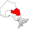 | |
|---|---|---|
| Towns | ||
| Townships | ||
| First Nations | ||
| Indian reserves | ||
| Indian settlements | ||
| Unorganized territories | ||
| Local services boards | ||
| Unincorporated communities | ||
| ||