County State-Aid Highway 21 (Polk County, Minnesota)
County State-Aid Highway 21 (CSAH 21) is a regional county highway in Polk County, Minnesota, which runs from its intersection with CSAH 64 in Grand Forks Township to the Polk–Pennington county line, where it continues on as CSAH 3 in Pennington County.[1] This route also carries the name Center Street. The roads of Polk County are laid out in a grid formation, and while many of them are interrupted by various rivers, bridges, and trails, CSAH 21 runs across the northern part of the county uninterrupted, save for stop signs at MN 220 and US 75. CSAH 21 is 25.591 miles (41.185 km) in length.
| |
|---|---|
| Center Street | |
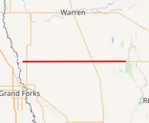
CSAH 21 highlighted in red | |
| Route information | |
| Length | 25.591 mi (41.185 km) |
| Major junctions | |
| West end | |
| |
| East end | |
| Highway system | |
| County Roads in Polk County Inter-County Highways | |

Route description
CSAH 21 serves as an east–west route running across northwestern Polk County, passing through the townships of Grand Forks, Sullivan, Keystone, and Euclid. The unincorporated community of Sherack is located on the route in Keystone Township. It is a major connector between the Greater Grand Forks area and the Thief River Falls area, in addition to rural Pennington County. The route traverses through very flat terrain, and carries a speed limit of 60 miles per hour (97 km/h) for the majority of its duration, except for a 45-mile-per-hour (72 km/h) zone through Sherack.
Functional classification
CSAH 21 is classified as:[2]
- Minor Collector: CSAH 64 to MN 220
- Minor Arterial: MN 220 to Polk-Pennington county line
Road restrictions
CSAH 21 has road restrictions of:[3]
- 10-ton: MN 220 to Polk-Pennington county line
Major intersections
| Location | mi | km | Destinations | Notes | |
|---|---|---|---|---|---|
| Grand Forks Township | 0.000 | 0.000 | Western terminus; roadway continues west as CSAH 64 | ||
| 1.000 | 1.609 | ||||
| Sullivan Township | 5.070 | 8.159 | |||
| 7.000 | 11.265 | Western end of CSAH 66 concurrency | |||
| 7.080 | 11.394 | Eastern end of CSAH 66 concurrency | |||
| Keystone Township | 11.950 | 19.232 | Western end of CSAH 20 concurrency | ||
| 12.080 | 19.441 | Eastern end of CSAH 20 concurrency | |||
| Euclid Township | 17.340 | 27.906 | |||
| Polk–Pennington county line | 25.591 | 41.185 | Eastern terminus; continuation into Pennington County | ||
1.000 mi = 1.609 km; 1.000 km = 0.621 mi
| |||||
References
-
- Office of Transportation System Management (2018). General Highway Map, Polk County (PDF) (Map). Saint Paul: Minnesota Department of Transportation.
- Polk County Functional Classification Map 2015 (PDF)
- 2019 Road Restrictions Map (PDF)