County State-Aid Highway 3 (Pennington County, Minnesota)
County State-Aid Highway 3 (CSAH 3) is a regional county highway in Pennington County, Minnesota. It is a rural two-lane roadway that runs from the Polk–Pennington county line, where it continues west as CSAH 21, to the Pennington–Clearwater county line, where it continues east on the Red Lake Reservation as Bureau of Indian Affairs Highway 100.[1] This route also carries the name Center Street, as it is the north/south dividing line for rural addresses for the counties of Marshall, Pennington, Polk, and Red Lake.[2] The roads of Pennington County are laid out in a grid formation, and while many of them are interrupted by various rivers, bridges, and trails, CSAH 3 runs across the southern part of the county uninterrupted, save for stop signs at MN 32, US 59, and CSAH 27. CSAH 3 is 42.130 miles (67.802 km) in length.
| |
|---|---|
| Center Street | |
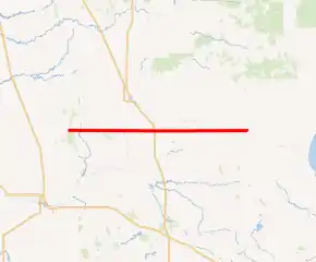
CSAH 3 highlighted in red | |
| Route information | |
| Length | 42.130 mi (67.802 km) |
| Major junctions | |
| West end | |
| |
| East end | BIA 100 at Pennington–Clearwater county line |
| Highway system | |
| County Roads in Pennington County Inter-County Highways | |

Route description
CSAH 3 serves as an east–west route running across southern Pennington County, passing through the townships of Polk Centre, Black River, River Falls, Wyandotte, Mayfield, Deer Park, and Hickory. The route also serves the city of St. Hilaire as well as the unincorporated communities of Hazel and River Valley. Together with CSAH 21, Center Street is a major connector between Pennington County and the Greater Grand Forks area, with a daily traffic volume average between 1,800 and 2,200 vehicles.[3] The route traverses through very flat terrain, and carries a speed limit of 55 miles per hour (89 km/h) for its entire length. The portion from MN 32 to US 59 also serves as a part of the US 59 Thief River Falls Truck Bypass.
Functional classification
CSAH 3 is classified as:[4]
- Minor Arterial: Pennington-Polk county line to CSAH 24
- Major Collector: CSAH 24 to CSAH 27
- Local Road: CSAH 27 to Pennington-Clearwater county line
Road restrictions
CSAH 3 has road restrictions of:[5]
- 10 short tons (9.1 t; 8.9 long tons): Pennington-Polk county line to CSAH 27
- 9 short tons (8.2 t; 8.0 long tons): CSAH 27 to Pennington-Clearwater county line
Business and commercial
There are many establishments along CSAH 3, including Wells Concrete, Kruse In, Ron McKercher Auctions, Carver Performance Inc., Skalsky Electric, B & B Auto Recycling, CHS Northwest Grain Sunflower Processing, St. Hilaire Automotive, and the Seven Clans Casino, Hotel, & Indoor Waterpark. In addition, CSAH 3 indirectly serves many of the establishments in Thief River Falls, including Arctic Cat, Digi-Key, Walmart, Sanford Health, Northland Community and Technical College, and the Thief River Falls Regional Airport.
Major intersections
| Location | mi | km | Destinations | Notes | |
|---|---|---|---|---|---|
| Pennington–Polk county line | 0.00 | 0.00 | Western terminus; continuation into Polk County | ||
| Polk Centre Township | 1.740 | 2.800 | |||
| 2.360 | 3.798 | ||||
| 4.120 | 6.630 | ||||
| 4.500 | 7.242 | ||||
| 5.500 | 8.851 | ||||
| Black River Township | 6.370 | 10.252 | |||
| 6.510 | 10.477 | ||||
| 7.330 | 11.796 | ||||
| 9.020 | 14.516 | ||||
| 9.340 | 15.031 | ||||
| 11.530 | 18.556 | ||||
| St. Hilaire | 12.760 | 20.535 | Western end of US 59 Thief River Falls Truck Bypass concurrency | ||
| River Falls Township | 13.530 | 21.774 | |||
| 14.400 | 23.175 | ||||
| 14.540 | 23.400 | ||||
| 17.350 | 27.922 | ||||
| 17.560 | 28.260 | ||||
| Wyandotte Township | 18.340 | 29.515 | |||
| 20.190 | 32.493 | Eastern end of US 59 Thief River Falls Truck Bypass concurrency; southern terminus of US 59 Thief River Falls Truck Bypass | |||
| 23.180 | 37.305 | ||||
| Mayfield Township | 25.620 | 41.231 | |||
| 26.200 | 42.165 | ||||
| 27.610 | 44.434 | ||||
| 29.190 | 46.977 | ||||
| Deer Park Township | 31.130 | 50.099 | |||
| 31.610 | 50.871 | ||||
| 32.130 | 51.708 | ||||
| 33.150 | 53.350 | ||||
| Red Lake River | 33.187– 33.213 | 53.409– 53.451 | River Valley Bridge | ||
| Deer Park Township | 33.630 | 54.122 | |||
| 34.160 | 54.975 | ||||
| 35.640 | 57.357 | ||||
| Hickory Township | 37.630 | 60.560 | |||
| 40.030 | 64.422 | ||||
| 41.130 | 66.192 | ||||
| Pennington–Clearwater county line | 42.130 | 67.802 | BIA 100 (River Road E) | Eastern terminus; continuation into Clearwater County | |
1.000 mi = 1.609 km; 1.000 km = 0.621 mi
| |||||
References
-
- Office of Transportation System Management (2018). General Highway Map, Pennington County (PDF) (Map). Saint Paul: Minnesota Department of Transportation.
- Pennington County Sheriff Department - 911 Mapping System FAQ's
- Pennington County Traffic Volumes Map 2017 (PDF)
- Pennington County Functional Classification Map 2015 (PDF)
- Pennington County Road Restrictions Map 2017 (PDF)