Minnesota State Highway 220
Minnesota State Highway 220 (MN 220) is a 78.536-mile-long (126.391 km) regional trunk highway in northwest Minnesota, which runs from its intersection with U.S. Highway 75 in Climax and continues north to its northern terminus at its intersection with MN 11 near Drayton, North Dakota. The route runs along and near the Red River.
| ||||
|---|---|---|---|---|
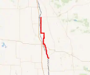
MN 220 highlighted in red | ||||
| Route information | ||||
| Defined by MS § 161.115(151) | ||||
| Maintained by MnDOT | ||||
| Length | 78.536 mi[1] (126.391 km) | |||
| Existed | July 1, 1949[2]–present | |||
| Major junctions | ||||
| South end | ||||
| North end | ||||
| Location | ||||
| Counties | Polk, Marshall, Kittson | |||
| Highway system | ||||
| ||||

For part of its route (4 miles), MN 220 runs together with U.S. Highway 2 in the city of East Grand Forks.
Route description
Highway 220 serves as a north–south route in northwest Minnesota between Climax, East Grand Forks, Alvarado, Oslo, and Robbin.
Red River State Recreation Area is located in the city of East Grand Forks near the junction of Highway 220 and U.S. Highway 2.
Highway 220 parallels Interstate 29 throughout its route.
The route is legally defined as Route 220 in the Minnesota Statutes.[3]
History
Highway 220 was authorized on July 1, 1949.[2] It originally intersected U.S. 75 near Eldred and followed present-day County State-Aid Highway 45 to its current routing. It was rerouted south to intersect U.S. 75 at Climax in the late 1950s.
The route was completely paved by 1970.[4]
Major intersections
| County | Location | mi[1] | km | Destinations | Notes |
|---|---|---|---|---|---|
| Polk | Climax | 0.000 | 0.000 | Southern terminus | |
| Huntsville Township | 23.800 | 38.302 | Eastern end of US 2 overlap | ||
| East Grand Forks | 27.241 | 43.840 | Western end of US 2 overlap | ||
| Marshall | Alvarado | 46.069 | 74.141 | Eastern end of MN 1 overlap | |
| Oak Park Township | 51.070 | 82.189 | Western end of MN 1 overlap | ||
| Fork Township | 66.187 | 106.518 | Eastern terminus of MN 317 | ||
| Kittson | Teien Township | 77.162 | 124.180 | Northern terminus; roadway continues as CSAH 7 north | |
1.000 mi = 1.609 km; 1.000 km = 0.621 mi
| |||||
References
- "Trunk Highway Log Point Listing - Construction District 2" (PDF). Minnesota Department of Transportation. August 23, 2010. Archived from the original (PDF) on December 4, 2008. Retrieved December 11, 2010.
- "Chapter 663-H.F. No. 1792", Session Laws of Minnesota for 1949, Earl L. Berg, Commissioner of Administration, pp. 1177–1185
- "161.115, Additional Trunk Highways". Minnesota Statutes. Office of the Revisor of Statutes, State of Minnesota. 2010. Retrieved December 11, 2010.
- Riner, Steve. "Details of routes 219–287". The Unofficial Minnesota Highways Page. Self-published. Retrieved December 11, 2010.