County of Lytton, Queensland
The County of Lytton is a county (a cadastral division) in the Darling Downs region of Queensland, Australia. It was named and bounded by the Governor in Council on 7 March 1901 under the Land Act 1897.[1][2]
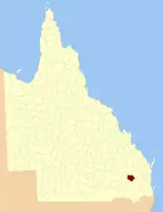
| Lytton Queensland | |||||||||||||||
|---|---|---|---|---|---|---|---|---|---|---|---|---|---|---|---|
 Location within Queensland | |||||||||||||||
| |||||||||||||||
Parishes
Lytton is divided into parishes, as listed below:
| Parish | LGA | Coordinates | |
|---|---|---|---|
| Bell | Western Downs | 26°59′S 151°08′E | |
| Brownlie | Western Downs | 26°32′S 150°44′E | |
| Buchan | Western Downs | 26°31′S 150°50′E | |
| Burncluith | Western Downs | 26°36′S 150°41′E | |
| Canaga | Western Downs | 26°40′S 151°00′E | |
| Chinchilla | Western Downs | 26°46′S 150°40′E | Chinchilla |
| Colamba | Western Downs | 26°42′S 150°36′E | |
| Cooranga | Western Downs | 26°52′S 151°10′E | |
| Diamondy | Western Downs | 26°35′S 151°16′E | |
| Earle | Western Downs | 26°50′S 150°49′E | Brigalow |
| Jandowae | Western Downs | 26°44′S 151°11′E | Jandowae |
| Jingi Jingi | Western Downs | 26°34′S 151°07′E | |
| Logie | Western Downs | 26°39′S 150°50′E | |
| Macalister | Western Downs | 27°01′S 151°04′E | Macalister |
| Mahen | Western Downs | 26°44′S 151°22′E | |
| Nudley | Western Downs | 26°32′S 150°59′E | |
| Palmer | Western Downs | 26°51′S 151°18′E | |
| Thorn | Western Downs | 26°55′S 150°56′E | Warra |
| Tuckerang | Western Downs | 26°48′S 151°00′E | |
| Tully | Western Downs | 26°55′S 151°02′E |
References
- "Lytton (entry 20320)". Queensland Place Names. Queensland Government. Retrieved 8 September 2015.
- Darling Downs District, County of Lytton Maps – D8 Series at Queensland Archives.
External links
This article is issued from Wikipedia. The text is licensed under Creative Commons - Attribution - Sharealike. Additional terms may apply for the media files.