Warra, Queensland
Warra is a town and locality in the Western Downs Region, Queensland, Australia.[2][3]
| Warra Queensland | |||||||||||||||
|---|---|---|---|---|---|---|---|---|---|---|---|---|---|---|---|
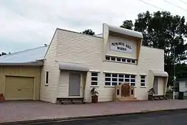
 Warra Memorial Hall | |||||||||||||||
 Warra | |||||||||||||||
| Coordinates | 26.93°S 150.9202°E | ||||||||||||||
| Population | 84 (2006 census)[1] | ||||||||||||||
| • Density | 0.3787/km2 (0.981/sq mi) | ||||||||||||||
| Postcode(s) | 4411 | ||||||||||||||
| Area | 221.8 km2 (85.6 sq mi) | ||||||||||||||
| Location |
| ||||||||||||||
| LGA(s) | Western Downs Region | ||||||||||||||
| State electorate(s) | Callide | ||||||||||||||
| Federal Division(s) | Maranoa | ||||||||||||||
| |||||||||||||||
Geography
Warra is on the Darling Downs, a farming area in Queensland. It is on the Warrego Highway, 256 kilometres (159 mi) north west of the state capital, Brisbane.
History

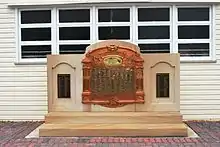
The Warra Honour Board was unveiled on 14 May 1917 by Member of the Queensland Legislative Assembly in Dalby, William Vowles.[4]
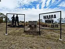
Between December 1915 and July 1919 the Queensland Labor Government operated a coal mine at Warra, one of several such State Enterprises.

The mine supplied coal for the southern railways, and by 1915 was producing 120 tons weekly which could be loaded directly into engines at the pithead. The mine however was plagued from the start with water seepage problems, causing the original shaft to be abandoned after November 1916. The mine yielded a total 13,528 tons of coal, and the net financial result was a loss of £38,058.[5]
At the 2006 census, Warra had a population of 84.[1]
Education
Warra Provisional School opened on 12 April 1881. It became Warra State School on 21 January 1889. A pre-school was added in 1977.[6]
Warra State School is a government co-educational primary (P-6) school in Robinson Street. In 2016, the school had an enrolment of 10 students with 3 teachers (1 full-time equivalent) and 4 non-teaching staff (1 full-time equivalent).[7]
Miscellaneous
The name Warra has been used as a name for a crater on the planet Mars, without specifically commemorating the town.[8]
References
- Australian Bureau of Statistics (25 October 2007). "Warra (Wambo Shire) (State Suburb)". 2006 Census QuickStats. Retrieved 31 March 2009.
- "Warra – town (entry 36561)". Queensland Place Names. Queensland Government. Retrieved 27 June 2017.
- "Warra – locality (entry 47755)". Queensland Place Names. Queensland Government. Retrieved 27 June 2017.
- "Warra War Memorial". Monument Australia. Archived from the original on 22 December 2020. Retrieved 3 April 2014.
- "Warra Coal Mine," Queensland Times, 17th November 1926, page 4 Archived 22 December 2020 at the Wayback Machine. Retrieved 20th December 2020.
- Queensland Family History Society (2010), Queensland schools past and present (Version 1.01 ed.), Queensland Family History Society, ISBN 978-1-921171-26-0
- "Annual Report 2016" (PDF). Warra State School. Archived (PDF) from the original on 19 September 2017. Retrieved 19 September 2017.
- Categories for Naming Features on Planets and Satellites Archived 2 November 2014 at WebCite, Gazetteer of Planetary Nomenclature, USGS Astrogeology Science Center, NASA