County of March
The County of March is a county (a cadastral division) in Queensland, Australia.[1] The county consists of the Noosa area, plus the eastern parts of the Gympie and Fraser Coast regions.[2]
| March Queensland | |||||||||||||||
|---|---|---|---|---|---|---|---|---|---|---|---|---|---|---|---|
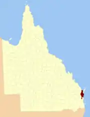 Location within Queensland | |||||||||||||||
| |||||||||||||||
History
March was first created by an Order in Council by the Governor of New South Wales on 30 December 1848.[3] It was named by the Surveyor-General in honour of a medical practitioner based in the area.[1] The county was described in the following terms:
County of March, containing about 1925 square miles. Bounded on the south by Moroochydore river (sic) to its source, thence by the range dividing the system of the river Mary from that of the Brisbane, to the main source of the Mary; on the west by the Mary; on the north-east by the coast of Wide Bay; and on the east by the seacoast to the mouth of the Moroochydore.
On 7 March 1901, the Governor of Queensland proclaimed new boundaries under the Land Act 1897,[4] which were described as follows:
Bounded on the south by the county of Canning; on the west by the western boundaries of the parishes of Kenilworth, Tuchekoi, Traveston, Gympie, Curra, Gutchy, Gundiah, Tiaro, Young, Maryborough, Wallibum and Vernon; on the north by the Pacific Ocean and on the east by Great Sandy Strait and the Pacific Ocean.
Parishes
March is divided into parishes, as listed below:
References
- "March (entry 20922)". Queensland Place Names. Queensland Government. Retrieved 1 September 2015.
- Wide Bay/Burnett District, County of March Maps - D8 Series Archived 2011-07-22 at the Wayback Machine at Queensland Archives.
- "The New Counties". The Moreton Bay Courier. Brisbane: National Library of Australia. 13 January 1849. p. 4. Retrieved 19 June 2013.
- "A Proclamation". Queensland Government Gazette. 75. 8 March 1901. pp. 967–980.
- Split parish with County of Lennox
