Crescent Street station (BMT Jamaica Line)
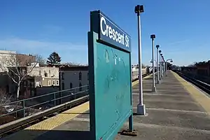
Crescent Street is a station on the BMT Jamaica Line of the New York City Subway. Located at the intersection of Crescent and Fulton Streets in Cypress Hills, Brooklyn, it is served by the J train at all times and the Z during rush hours in the peak direction.
Crescent Street | |||||||||||||||||||||||||||||||||||||||||||||||||||||||||||||||||||||||||||||||||||||||||||||||||||||||
|---|---|---|---|---|---|---|---|---|---|---|---|---|---|---|---|---|---|---|---|---|---|---|---|---|---|---|---|---|---|---|---|---|---|---|---|---|---|---|---|---|---|---|---|---|---|---|---|---|---|---|---|---|---|---|---|---|---|---|---|---|---|---|---|---|---|---|---|---|---|---|---|---|---|---|---|---|---|---|---|---|---|---|---|---|---|---|---|---|---|---|---|---|---|---|---|---|---|---|---|---|---|---|---|
 | |||||||||||||||||||||||||||||||||||||||||||||||||||||||||||||||||||||||||||||||||||||||||||||||||||||||
| Station statistics | |||||||||||||||||||||||||||||||||||||||||||||||||||||||||||||||||||||||||||||||||||||||||||||||||||||||
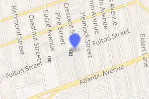
| Address | Crescent Street & Fulton Street Brooklyn, NY 11208 | ||||||||||||||||||||||||||||||||||||||||||||||||||||||||||||||||||||||||||||||||||||||||||||||||||||||
| Borough | Brooklyn | ||||||||||||||||||||||||||||||||||||||||||||||||||||||||||||||||||||||||||||||||||||||||||||||||||||||
| Locale | Cypress Hills | ||||||||||||||||||||||||||||||||||||||||||||||||||||||||||||||||||||||||||||||||||||||||||||||||||||||
| Coordinates | 40.683655°N 73.872414°W | ||||||||||||||||||||||||||||||||||||||||||||||||||||||||||||||||||||||||||||||||||||||||||||||||||||||
| Division | B (BMT) | ||||||||||||||||||||||||||||||||||||||||||||||||||||||||||||||||||||||||||||||||||||||||||||||||||||||
| Line | BMT Jamaica Line BMT Lexington Avenue Line (formerly) | ||||||||||||||||||||||||||||||||||||||||||||||||||||||||||||||||||||||||||||||||||||||||||||||||||||||
| Services | J Z | ||||||||||||||||||||||||||||||||||||||||||||||||||||||||||||||||||||||||||||||||||||||||||||||||||||||
| Transit | |||||||||||||||||||||||||||||||||||||||||||||||||||||||||||||||||||||||||||||||||||||||||||||||||||||||
| Structure | Elevated | ||||||||||||||||||||||||||||||||||||||||||||||||||||||||||||||||||||||||||||||||||||||||||||||||||||||
| Platforms | 1 island platform | ||||||||||||||||||||||||||||||||||||||||||||||||||||||||||||||||||||||||||||||||||||||||||||||||||||||
| Tracks | 2 | ||||||||||||||||||||||||||||||||||||||||||||||||||||||||||||||||||||||||||||||||||||||||||||||||||||||
| Other information | |||||||||||||||||||||||||||||||||||||||||||||||||||||||||||||||||||||||||||||||||||||||||||||||||||||||
| Opened | May 30, 1893[1] | ||||||||||||||||||||||||||||||||||||||||||||||||||||||||||||||||||||||||||||||||||||||||||||||||||||||
| Station code | 087[2] | ||||||||||||||||||||||||||||||||||||||||||||||||||||||||||||||||||||||||||||||||||||||||||||||||||||||
| Opposite- direction transfer | Yes | ||||||||||||||||||||||||||||||||||||||||||||||||||||||||||||||||||||||||||||||||||||||||||||||||||||||
| Traffic | |||||||||||||||||||||||||||||||||||||||||||||||||||||||||||||||||||||||||||||||||||||||||||||||||||||||
| 2019 | 1,391,945[3] | ||||||||||||||||||||||||||||||||||||||||||||||||||||||||||||||||||||||||||||||||||||||||||||||||||||||
| Rank | 308 out of 424[3] | ||||||||||||||||||||||||||||||||||||||||||||||||||||||||||||||||||||||||||||||||||||||||||||||||||||||
| Station succession | |||||||||||||||||||||||||||||||||||||||||||||||||||||||||||||||||||||||||||||||||||||||||||||||||||||||
| Next north | Cypress Hills: J (Z | ||||||||||||||||||||||||||||||||||||||||||||||||||||||||||||||||||||||||||||||||||||||||||||||||||||||
| Next south | Norwood Avenue: J (J | ||||||||||||||||||||||||||||||||||||||||||||||||||||||||||||||||||||||||||||||||||||||||||||||||||||||
| |||||||||||||||||||||||||||||||||||||||||||||||||||||||||||||||||||||||||||||||||||||||||||||||||||||||
| |||||||||||||||||||||||||||||||||||||||||||||||||||||||||||||||||||||||||||||||||||||||||||||||||||||||
| |||||||||||||||||||||||||||||||||||||||||||||||||||||||||||||||||||||||||||||||||||||||||||||||||||||||
| |||||||||||||||||||||||||||||||||||||||||||||||||||||||||||||||||||||||||||||||||||||||||||||||||||||||

History
This station was opened on May 30, 1893 as part of the Brooklyn Elevated Railroad's four stop extension of the Lexington Avenue Line to Cypress Hills.[1]
This station was renovated in 2007. As part of the station renovation project, the stairs were rehabilitated, the floors were renewed, major structural repairs were made, new canopies were installed, the area around the station booth was reconfigured, the platform edge strips were replaced, walls were replaced, and a high-quality public address system was installed.[4] The renovation cost $8.43 million.[5]
Station layout
| 2F Platform level |
Westbound | ← ← |
| Island platform | ||
| Eastbound | | |
| 1F | Mezzanine | Fare control, station agent, MetroCard machines |
| G | Street level | Exit / entrance |
This elevated station has two tracks and one narrow island platform. An arched canopy covers the eastern half (railroad north) of the platform.
An artwork called Wheel of Bloom – Soak Up the Sun by Jung Hyang Kim was installed in this station during a 2007 renovation. It consists of stained glass panels on the platform's sign structures showing subway train wheels lit by sunlight.
Between here and Norwood Avenue, there are the remains of a turn off for the former Chestnut Street incline, which led to the parallel Long Island Rail Road line on Atlantic Avenue. This connection was used primarily for joint service between Williamsburg, Brooklyn and later Lower Manhattan and the beach resorts in Rockaway, Queens.[6] A service was also operated to Jamaica, Queens for a time. The joint operation agreement and all through service via the connector was ended after the 1917 summer season. Unused by passenger service since, the ramp was taken down in 1942 for World War II scrap. A tower continued to stand west of the station to control trains using the incline. The tower was taken down sometime after 1970.
A sharp S Curve moves the line from Fulton Street to Jamaica Avenue immediately north of the station. The first turn, from Fulton Street onto Crescent Street, ranks as the sharpest curve in the B Division, and second sharpest in the entire New York City Subway, second only to the City hall loop on the IRT Lexington Avenue Line.[7] From the late-1950s into the 1960s the New York City Transit Authority had a proposal to realign the BMT Jamaica Line from this station (actually from Grant or Nichols Avenues) northeast to 80th Street and Jamaica Avenue, west of the 85th Street station. This would have also included an express track. The realignment was never carried out.[8]
Exits
The station's small, single station house is on the extreme eastern end of the platform. It has a turnstile bank, token booth, and a single staircase going to an overpass below the tracks that splits into two staircases going down to either side of Fulton Street between Crescent and Pine Streets.[9]
Gallery
 The station as seen from the "S-curve"
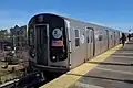 Southbound J train arriving
References
- "Trains Running This Morning The Elevated Road to Cypress Hills Still in Operation". The Brooklyn Daily Eagle. May 30, 1893. p. 10. Retrieved October 2, 2016 – via Brooklyn Newspapers.
- "Station Developers' Information". Metropolitan Transportation Authority. Retrieved June 13, 2017.
- "Facts and Figures: Annual Subway Ridership 2014–2019". Metropolitan Transportation Authority. 2020. Retrieved May 26, 2020.
- "MTA NYC Transit Subway Line Information". mta.info. Metropolitan Transportation Authority. December 21, 2005. Archived from the original on December 21, 2005. Retrieved October 2, 2016.CS1 maint: bot: original URL status unknown (link)
- MTA 2006 Adopted Budget - February Financial Plan - Part 3 (PDF) (Report). Metropolitan Transportation Authority. 2006. p. 46. Archived from the original (PDF) on May 24, 2019. Retrieved March 27, 2020.
- 1942 image from Brooklyn Public Library, via Herbert Maruska (NYCSubway.org)
- "NYC Minimum Curve Radius". Web Archive. Archived from the original on May 13, 2006. Retrieved July 5, 2017.
- "Woodhavenites Fear Loss of Homes by El Improvement: Residents Clamor for Facts About City's Plan to Build El Structure Through Heart of Community; Official Statement Released by Transit Authority". The Leader–Observer. October 2, 1958. Retrieved July 27, 2016 – via Fulton History.
- "MTA Neighborhood Maps: East New York" (PDF). mta.info. Metropolitan Transportation Authority. 2015. Retrieved July 19, 2015.
External links
| Wikimedia Commons has media related to Crescent Street (BMT Jamaica Line). |
- nycsubway.org – BMT Jamaica Line: Crescent Street
- Station Reporter — J Train
- The Subway Nut — Crescent Street Pictures
- MTA's Arts For Transit — Crescent Street (BMT Jamaica Line)
- Crescent Street entrance from Google Maps Street View
- Platform from Google Maps Street View
| Jamaica Line |
|
|---|---|
| |