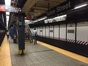
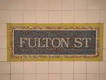
Fulton Street station (New York City Subway)
Fulton Street is a New York City Subway station complex in Lower Manhattan. It consists of four linked stations on the IND Eighth Avenue Line, the IRT Lexington Avenue Line, the BMT Nassau Street Line and the IRT Broadway–Seventh Avenue Line. The complex is served by the 2, 4, A, and J trains at all times. The 3, 5, and C trains stop here at all times except late nights, and the Z stops during rush hours in the peak direction.
Fulton Street | |||||||||||
|---|---|---|---|---|---|---|---|---|---|---|---|
.jpg.webp) Turnstiles in the Fulton Center building, which provide entry to the station | |||||||||||
| Station statistics | |||||||||||
| Address | Fulton Street between Broadway & Nassau Street New York, NY 10007 | ||||||||||
| Borough | Manhattan | ||||||||||
| Locale | Financial District | ||||||||||
| Coordinates | 40°42′37″N 74°00′28″W | ||||||||||
| Division | A (IRT), B (BMT, IND) | ||||||||||
| Line | IND Eighth Avenue Line IRT Broadway–Seventh Avenue Line IRT Lexington Avenue Line BMT Nassau Street Line | ||||||||||
| Services | 2 3 4 5 A C J Z | ||||||||||
| Transit | At Chambers Street–World Trade Center/Park Place/Cortlandt Street via Fulton Center: 2 3 A C E N R W | ||||||||||
| Structure | Underground | ||||||||||
| Levels | 3 (Eighth Avenue Line platforms intersect the other 3 lines; Nassau Street platforms are on 2 levels) | ||||||||||
| Other information | |||||||||||
| Opened | Transfer between IND Eighth Avenue Line, BMT Nassau Street, and IRT Broadway–Seventh Avenue Line: July 1, 1948[1] Transfer to IRT Lexington Avenue Line: August 25, 1950[2] | ||||||||||
| Station code | 628[3] | ||||||||||
| Accessible | |||||||||||
| Traffic | |||||||||||
| 2019 | 27,715,365[4] | ||||||||||
| Rank | 5 out of 424[4] | ||||||||||
| |||||||||||
| |||||||||||
| |||||||||||


The complex comprises four stations, all named Fulton Street. The Lexington Avenue Line station was built for the Interborough Rapid Transit Company (IRT) as part of the city's first subway line, and opened on January 16, 1905. The Broadway–Seventh Avenue Line station, built for the IRT as part of the Dual Contracts, opened on July 1, 1918. The Brooklyn–Manhattan Transit Corporation (BMT)'s Nassau Street Line station was also built under the Dual Contracts and opened on May 29, 1931. The Independent Subway System (IND)'s Eighth Avenue Line station was the final one in the complex to be completed, opening on February 1, 1933. Several modifications have been made to the stations over the years, and they were connected within a single fare control area in 1948. The station was renovated during the 2000s and early 2010s, becoming part of the Fulton Center complex, which opened in 2014.
The Lexington Avenue, Nassau Street, and Broadway–Seventh Avenue Line stations cross Fulton Street at Broadway, Nassau Street, and William Street respectively. The Eighth Avenue Line station is underneath Fulton Street, between Broadway and Nassau Streets. The Lexington Avenue and Nassau Street Line stations each have two tracks and two side platforms, while the Broadway–Seventh Avenue and Eighth Avenue Line stations each have two tracks and one island platform. The complex is connected to the nearby Chambers Street–World Trade Center/Park Place/Cortlandt Street station complex and the World Trade Center Transportation Hub through the out-of-system Dey Street Passageway. The station was the fifth busiest in the system in 2019, with 27,715,365 passengers.[4]
History
First subway
Planning for the city's first subway line dates to the Rapid Transit Act, authorized by the New York State Legislature in 1894.[5]:139–161 The subway plans were drawn up by a team of engineers led by William Barclay Parsons, chief engineer of the Rapid Transit Commission.[6]:3 The Rapid Transit Construction Company, organized by John B. McDonald and funded by August Belmont Jr., signed Contract 1 with the Rapid Transit Commission in February 1900,[7] in which it would construct the subway and maintain a 50-year operating lease from the opening of the line.[5]:182 In 1901, the firm of Heins & LaFarge was hired to design the underground stations.[6]:4 Belmont incorporated the Interborough Rapid Transit Company (IRT) in April 1902 to operate the subway.[5]:162–191
Several days after Contract 1 was signed, the Board of Rapid Transit Railroad Commissioners instructed Parsons to evaluate the feasibility of extending the subway south to South Ferry, and then to Brooklyn. On January 24, 1901, the Board adopted a route that would extend the subway from City Hall to the Long Island Rail Road (LIRR)'s Flatbush Avenue terminal station (now known as Atlantic Terminal) in Brooklyn, via the Joralemon Street Tunnel under the East River.[8]:83–84[9]:260–261 Contract 2, giving a lease of 35 years, was executed between the commission and the Rapid Transit Construction Company on September 11, 1902. Construction began at State Street in Manhattan on November 8, 1902.[5]:162–191 The section of the Contract 2 subway tunnel under the southernmost section of Broadway, between Battery Park and City Hall, was contracted to Degnon-McLean Contracting Company.[10]
The IRT Lexington Avenue Line station opened on January 16, 1905, as part of a one-stop extension southbound from Brooklyn Bridge–City Hall, the previous southernmost express station on the original IRT line. Only the northbound platform was in use when service started at this station.[11] The southbound platform opened for service on June 12, 1905, when the subway was extended one stop to the south at Wall Street.[12][13]
In 1909, to address overcrowding, the New York Public Service Commission proposed lengthening platforms at stations along the original IRT subway.[14]:168 On January 18, 1910, a modification was made to Contracts 1 and 2 to lengthen station platforms to accommodate ten-car express and six-car local trains. In addition to $1.5 million (equivalent to $41.2 million in 2019) spent on platform lengthening, $500,000 (equivalent to $13,719,643 in 2019) was spent on building additional entrances and exits. It was anticipated that these improvements would increase capacity by 25 percent.[15]:15 The northbound platform at the Fulton Street station was extended 150 feet (46 m) to the south, while the southbound platform was extended 135 feet (41 m) to the south. The northbound platform extension required underpinning adjacent buildings, while the southbound platform extension was largely in the basements of adjacent properties and involved extensive reconstruction.[15]:117 On January 23, 1911, ten-car express trains began running on the East Side Line, and the next day, ten-car express trains began running on the West Side Line.[14]:168[16] Staircases from the southbound platform to 195 Broadway, at the northwest corner of Broadway and Dey Street, opened in 1916.[17]
Subsequent lines
After the original IRT opened, the city began planning new lines. In 1913, as part of the Dual Contracts, the New York City Public Service Commission planned to split the original IRT system into three segments: two north-south lines, carrying through trains over the Lexington Avenue and Broadway–Seventh Avenue Lines, and a west-east shuttle under 42nd Street. This would form a roughly "H"-shaped system.[18] The IRT Broadway–Seventh Avenue Line platform was built on the portion of that line south of Times Square–42nd Street. The line first opened as a shuttle to 34th Street–Penn Station on June 3, 1917.[19][20] The line was extended south to South Ferry on July 1, 1918; the Fulton Street station opened on the same date, and was served by a shuttle between Chambers Street and Wall Street, on the line's Brooklyn Branch.[21] On August 1, 1918, the new "H" system was implemented, joining the two halves of the Broadway–Seventh Avenue Line and sending all West Side trains south from Times Square. The Lexington Avenue Line also opened north of Grand Central–42nd Street, and all services at the Lexington Avenue Line station were sent through that line.[22] As a result, shuttle service to the Broadway–Seventh Avenue Line station was replaced by through service.[23]
Also as part of the Dual Contracts, the Brooklyn–Manhattan Transit Corporation (BMT) was assigned to construct and operate the Nassau Street Line. The portion of the line passing through the current Nassau Street station did not start until the mid-1920s. Contracts for the project were awarded, with the portion north of Liberty Street awarded to Marcus Contracting Company and the portion south of Liberty Street awarded to Moranti and Raymond.[24] Work was projected to be completed in 39 months, and in March 1929, sixty percent of the work had been finished.[24] Construction had to be done 20 feet (6.1 m) below the active IRT Lexington Avenue Line, next to buildings along the narrow Nassau Street, and the project encountered difficulties such as quicksand.[24][25] The Nassau Street Loop opened on May 29, 1931.[26] The line was extended two stops from its previous terminus at Chambers Street through the Fulton Street and Broad Street stations and to a connection to the Montague Street Tunnel, which allowed trains to run to Brooklyn.[27]
The Independent Subway System (IND), which was not part of the Dual Contracts, commenced construction on its Eighth Avenue Line in 1925.[28] The majority of the Eighth Avenue Line, from Chambers Street north to 207th Street, was opened to the public just after midnight on September 10, 1932.[29] The Cranberry Street Tunnel, extending the express tracks east under Fulton Street to Jay Street–Borough Hall in Brooklyn, was opened for the morning rush hour on February 1, 1933, with a stop at Broadway/Nassau Street.[30]
20th century
Transfer passageways between the four stations were placed inside fare control on July 1, 1948. The passageways between the Eighth Avenue, Nassau Street, and Broadway–Seventh Avenue platforms all existed at the time, and were simply placed inside fare control. However, a paper transfer was issued to passengers transferring to and from the Lexington Avenue Line.[1] On August 25, 1950, the railings of the Lexington Avenue and Eighth Avenue Line stations were rearranged to allow direct transfers, and the paper transfers were discontinued.[2]
In late 1959, contracts were awarded to extend the platforms at Fulton Street on the Lexington Avenue Line, as well as Bowling Green, Wall Street, Canal Street, Spring Street, Bleecker Street, Astor Place, Grand Central–42nd Street, 86th Street, and 125th Street on the same line, to 525 feet (160 m) to accommodate ten-car trains.[31] During the 1964–1965 fiscal year, the platforms at Fulton Street on the Broadway–Seventh Avenue Line, along with those at four other stations on the line, were lengthened to 525 feet (160 m) to accommodate a ten-car train of 51-foot IRT cars.[32]
Fulton Center
After several pieces of transit infrastructure in Lower Manhattan were destroyed or severely damaged during the September 11, 2001, attacks, officials proposed a $7 billion redesign of transit in the neighborhood.[33]:S.5[34] By April 2003, the MTA had released preliminary plans for a $750 million transit hub at Fulton Street, connecting six subway stations and constructing a new head house and the Dey Street Passageway.[35] In December 2003, the Federal Transit Administration allocated the Fulton Street Transit Center (later the Fulton Center) $750 million.[36] The transit center would be financed using money from the September 11 recovery fund.[37] By May 2006, the budget had grown and the project had been was delayed.[38] Further delays and costs were incurred in February 2007.[39] To remedy the overrun, the MTA downsized the original plans for the transit center.[40][41] Subsequently, the MTA used 2009 federal stimulus money to help fund the project.[42][43][44] In January 2009, the MTA received $497 million in additional stimulus money, bringing the total cost of the Fulton Street Transit Center to $1.4 billion.[42][45][46]
The project rehabilitated two of the four stations in the Fulton Street station complex.[47] The rehabilitation of the Seventh Avenue Line platform, started in 2005.[48] This project was completed by November 2006.[49] The 4 and 5 trains' station at the western end of the complex was rehabilitated beginning in 2008. Historical features, such as the tiling, were preserved. The structure was joined by the Fulton Building on the northbound platform, and the Dey Street Headhouse on the southbound platform, when they opened.[45]
An intricate system of ramps was replaced by two new mezzanines.[50]:11 Work on the IND mezzanine commenced in January 2010; the reconstruction of the transfer mezzanine over the Fulton Street IND platform resulted in traffic flow changes.[51] The Eighth Avenue Line station adopted the "Fulton Street" name in December 2010 to become unified with the other platforms in the station complex.[52] The eastern mezzanine and parts of the western mezzanine had opened by 2011,[53]:44 and the western mezzanine was completed by 2012.[54]:2 Additionally, new entrances were opened as part of the project.[47] In October 2012, a new entrance on Dey Street opened for the Dey Street underpass to Cortlandt Street, and an ADA-accessible elevator was installed for the southbound Lexington Avenue Line platform.[55] In November 2014, the Fulton Center project was completed, and the entire complex was made ADA-accessible.[47]
Station layout
| G | Street level | Exits/entrances
|
| B1 | Mezzanine | Fare control, station agents, connections and retail at Fulton Center |
| Northbound Seventh | ← ← | |
| Island platform | ||
| Southbound Seventh | | |
| Side platform | ||
| Southbound Nassau | | |
| Side platform | ||
| Northbound Lexington | ← ← | |
| Southbound Lexington | | |
| Side platform | ||
| B2 | Eastern mezzanine | Connections between services |
| Northbound Nassau | ← ← | |
| Side platform | ||
| Western mezzanine | Connections and Fulton Center retail | |
| B3 | Northbound Eighth | ← ← |
| Island platform | ||
| Southbound Eighth | | |
Originally, a network of passageways and ramps loosely connected the various lines with each other, causing congestion during peak hours.[50]:11 The transfer mezzanine, also known as the IND mezzanine, replaced these ramps and made several adjacent entrances redundant.[51] Effectively, all transfers were made through the IND Eighth Avenue Line platform.[50]
The stacked-staggered configuration of the BMT Nassau Street Line platforms splits the IND mezzanine levels into halves. The eastern half stretches from Nassau Street to William Street, from the southbound Nassau Street Line platform to the Broadway–Seventh Avenue Line platform. Similarly, the western half of the mezzanine stretches from Nassau Street to Broadway, from the northbound Nassau Street Line to the Lexington Avenue Line platforms. Transferring passengers have to use the third-basement-level IND platform to navigate between both halves of the mezzanine, since the Nassau Street Line's platforms bisect the mezzanine on both the first and second basement levels.[50]:11
| Fulton St to Cortlandt St subway cross-section | |||||||||
| Greenwich St | WTC Transportation Hub (Oculus) / Westfield Shops |
Church St | Broadway | Fulton Center / Westfield Shops |
Nassau St | William St | |||
| 1 | R / W | 4 / 5 | J / Z south | mezzanine | |||||
| underpass | underpass | Dey Street Passageway | underpass | mezzanine | J / Z north | mezzanine | 2 / 3 | ||
| mezzanine | ← A / C → | ||||||||
| PATH | |||||||||
Lower Manhattan transit | ||||||||||||||||||||||||||||||||||||||||||||||||||||||||||||||||||||||||||||||||||||||||||||||||||
|---|---|---|---|---|---|---|---|---|---|---|---|---|---|---|---|---|---|---|---|---|---|---|---|---|---|---|---|---|---|---|---|---|---|---|---|---|---|---|---|---|---|---|---|---|---|---|---|---|---|---|---|---|---|---|---|---|---|---|---|---|---|---|---|---|---|---|---|---|---|---|---|---|---|---|---|---|---|---|---|---|---|---|---|---|---|---|---|---|---|---|---|---|---|---|---|---|---|---|
|
| ||||||||||||||||||||||||||||||||||||||||||||||||||||||||||||||||||||||||||||||||||||||||||||||||||
Exits
Due to the highly fragmented nature of the Fulton Street station, most of its entrances are only signed as serving certain routes, even though all exits technically provide access to all routes. The entire station complex is ADA-accessible via a series of elevators between the platforms and mezzanines.[56]
On Broadway, five entrances are signed as serving the Eighth Avenue Line and southbound Lexington Avenue Line platforms (the A, C, 4, and 5 trains). At Broadway and Fulton Street, two stairs go up to the northwestern corner and one goes to 195 Broadway near the southwestern corner. One stair each goes up to the northwestern corner of Broadway's intersections with Dey and Cortlandt Streets. Additionally, one entrance, a stair at the northeast corner of Maiden Lane and Broadway, is signed as serving the Eighth Avenue Line and northbound Lexington Avenue Line platforms.[57]
Four Broadway entrances are signed as providing access to several routes in the complex. There is a stair and elevator at the southwest corner of Dey Street and Broadway; they are signed as providing access to all services except the northbound Lexington Avenue Line platform, and are also signed as an entrance as the Cortlandt Street station on the R and W trains, a separate station that is connected by the Dey Street Passageway. Two entrances are signed as serving all routes in the complex, as well as the R and W trains at Cortlandt Street: the Fulton Center building at the southeast corner of Fulton Street and Broadway, as well as an entrance through the Corbin Building on John Street east of Broadway. The Fulton Center building has stairs, escalators, and elevators,[57] while the Corbin Building contains escalators.[58]
Seven entrances are signed as serving the Eighth Avenue Line and Broadway–Seventh Avenue Line platforms (the A, C, 2, and 3 trains). At Fulton and William Streets are five entrances: two stairs to the northeastern corner, one to the southeastern corner, and one stair and one elevator to the southwestern corner. There are also two part-time entrances inside the office building at 110 William Street; one is on William Street and the other is on John Street.[59]
Six entrances are signed as serving the Eighth Avenue Line platform and either of the Nassau Street Line platforms (the A, C, J, and Z trains). Two stairs, one on either western corner of Nassau and Fulton Streets, serve the Eighth Avenue Line and northbound Nassau Street Line platforms. Four stairs, one each on either eastern corner of Nassau and Fulton Streets and on either eastern corner of John and Nassau Streets, serve the Eighth Avenue Line and northbound Nassau Street Line platforms. The John and Nassau Streets entrances are open only during rush hours.[60] From the north end of the Nassau Street Line station, there is a sealed exit to Ann Street and passageway to Beekman Street and Pace University to the far north. This passageway was out of system and more than one block long.[61]
 Former entrance in doorway of Royal Building
.JPG.webp) Entrance at William Street and Fulton Street
Entrance at William Street and Fulton Street 33 Maiden Lane
.JPG.webp)
 Dey Street stair
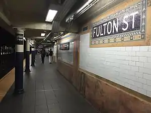
IRT Broadway–Seventh Avenue Line platform
Fulton Street | ||||||||||||||||||||||||||||||||||||||||||||||||||||||||||||||||||||||||||||||||||
|---|---|---|---|---|---|---|---|---|---|---|---|---|---|---|---|---|---|---|---|---|---|---|---|---|---|---|---|---|---|---|---|---|---|---|---|---|---|---|---|---|---|---|---|---|---|---|---|---|---|---|---|---|---|---|---|---|---|---|---|---|---|---|---|---|---|---|---|---|---|---|---|---|---|---|---|---|---|---|---|---|---|---|
 | ||||||||||||||||||||||||||||||||||||||||||||||||||||||||||||||||||||||||||||||||||
| Station statistics | ||||||||||||||||||||||||||||||||||||||||||||||||||||||||||||||||||||||||||||||||||
| Division | A (IRT) | |||||||||||||||||||||||||||||||||||||||||||||||||||||||||||||||||||||||||||||||||
| Line | IRT Broadway–Seventh Avenue Line | |||||||||||||||||||||||||||||||||||||||||||||||||||||||||||||||||||||||||||||||||
| Services | 2 3 | |||||||||||||||||||||||||||||||||||||||||||||||||||||||||||||||||||||||||||||||||
| Platforms | 1 island platform | |||||||||||||||||||||||||||||||||||||||||||||||||||||||||||||||||||||||||||||||||
| Tracks | 2 | |||||||||||||||||||||||||||||||||||||||||||||||||||||||||||||||||||||||||||||||||
| Other information | ||||||||||||||||||||||||||||||||||||||||||||||||||||||||||||||||||||||||||||||||||
| Opened | July 1, 1918[21] | |||||||||||||||||||||||||||||||||||||||||||||||||||||||||||||||||||||||||||||||||
| Station code | 332[3] | |||||||||||||||||||||||||||||||||||||||||||||||||||||||||||||||||||||||||||||||||
| Accessible | ||||||||||||||||||||||||||||||||||||||||||||||||||||||||||||||||||||||||||||||||||
| Opposite- direction transfer | Yes | |||||||||||||||||||||||||||||||||||||||||||||||||||||||||||||||||||||||||||||||||
| Station succession | ||||||||||||||||||||||||||||||||||||||||||||||||||||||||||||||||||||||||||||||||||
| Next north | Park Place: 2 | |||||||||||||||||||||||||||||||||||||||||||||||||||||||||||||||||||||||||||||||||
| Next south | Wall Street: 2 | |||||||||||||||||||||||||||||||||||||||||||||||||||||||||||||||||||||||||||||||||
| ||||||||||||||||||||||||||||||||||||||||||||||||||||||||||||||||||||||||||||||||||
| ||||||||||||||||||||||||||||||||||||||||||||||||||||||||||||||||||||||||||||||||||
Fulton Street on the IRT Broadway–Seventh Avenue Line has two tracks and one island platform. The 2 train stops here at all times,[62] while the 3 train stops here at all times except late nights.[63]
Brooklyn-bound trains use track K2 while uptown trains use track K3. These designations come from track chaining which measures track distances and are not used in normal conversation. Based on this chaining, Fulton Street is about 19,700 feet (3.73 mi) from post zero at Broadway and 44th Street since this is where the West Side Line "merges" with the 42nd Street Shuttle. This is slightly non-standard signage because it is a local station using express track numbers as these tracks become the express tracks on the main line.
The station has two mezzanines, separated at Fulton Street. The full-time entrance is to the north mezzanine, while the south mezzanine is open part-time. Like Wall Street, the next station south, there is a narrow island platform and a number of comparatively narrow staircases up to the mezzanine level.[56] There is an ADA-accessible elevator from platform level to the mezzanine at the platform's extreme south end, connecting to the mezzanine, which has elevators to the rest of the station via the IND Eighth Avenue Line platform. The Marine Grill Murals, salvaged from the restaurant of the same name in the Hotel McAlpin, reside near these elevators.
BMT Nassau Street Line platforms
Fulton Street | |||||||||||||||||||||||||||||||||||||||||||||||||||||||||||||||||||||||||||||||||||||||||
|---|---|---|---|---|---|---|---|---|---|---|---|---|---|---|---|---|---|---|---|---|---|---|---|---|---|---|---|---|---|---|---|---|---|---|---|---|---|---|---|---|---|---|---|---|---|---|---|---|---|---|---|---|---|---|---|---|---|---|---|---|---|---|---|---|---|---|---|---|---|---|---|---|---|---|---|---|---|---|---|---|---|---|---|---|---|---|---|---|---|
.JPG.webp) Broad Street-bound platform | |||||||||||||||||||||||||||||||||||||||||||||||||||||||||||||||||||||||||||||||||||||||||
| Station statistics | |||||||||||||||||||||||||||||||||||||||||||||||||||||||||||||||||||||||||||||||||||||||||
| Division | B (BMT) | ||||||||||||||||||||||||||||||||||||||||||||||||||||||||||||||||||||||||||||||||||||||||
| Line | BMT Nassau Street Line | ||||||||||||||||||||||||||||||||||||||||||||||||||||||||||||||||||||||||||||||||||||||||
| Services | J Z | ||||||||||||||||||||||||||||||||||||||||||||||||||||||||||||||||||||||||||||||||||||||||
| Levels | 2 | ||||||||||||||||||||||||||||||||||||||||||||||||||||||||||||||||||||||||||||||||||||||||
| Platforms | 2 side platforms (1 on each level) | ||||||||||||||||||||||||||||||||||||||||||||||||||||||||||||||||||||||||||||||||||||||||
| Tracks | 2 (1 on each level) | ||||||||||||||||||||||||||||||||||||||||||||||||||||||||||||||||||||||||||||||||||||||||
| Other information | |||||||||||||||||||||||||||||||||||||||||||||||||||||||||||||||||||||||||||||||||||||||||
| Opened | May 29, 1931[64] | ||||||||||||||||||||||||||||||||||||||||||||||||||||||||||||||||||||||||||||||||||||||||
| Station code | 106[3] | ||||||||||||||||||||||||||||||||||||||||||||||||||||||||||||||||||||||||||||||||||||||||
| Accessible | |||||||||||||||||||||||||||||||||||||||||||||||||||||||||||||||||||||||||||||||||||||||||
| Opposite- direction transfer | Yes | ||||||||||||||||||||||||||||||||||||||||||||||||||||||||||||||||||||||||||||||||||||||||
| Station succession | |||||||||||||||||||||||||||||||||||||||||||||||||||||||||||||||||||||||||||||||||||||||||
| Next north | Chambers Street: J | ||||||||||||||||||||||||||||||||||||||||||||||||||||||||||||||||||||||||||||||||||||||||
| Next south | Broad Street: J | ||||||||||||||||||||||||||||||||||||||||||||||||||||||||||||||||||||||||||||||||||||||||
| |||||||||||||||||||||||||||||||||||||||||||||||||||||||||||||||||||||||||||||||||||||||||
| |||||||||||||||||||||||||||||||||||||||||||||||||||||||||||||||||||||||||||||||||||||||||
Fulton Street on the BMT Nassau Street Line has two tracks and two side platforms, with downtown trains on the upper level and uptown trains on the lower level. The J train stops here at all times, while the Z train stops here during rush hours in the peak direction.[65] Because of the curve of Nassau Street at Fulton Street, the station had to be constructed on two levels.[25][64]
The most direct entrances are on the left side of each platform, unlike in other stations. Northbound trains are more directly accessed via entrances on the west side of Nassau Street, and southbound trains are more directly accessed via entrances on the east side of Nassau Street. It is possible to cross between the uptown and downtown sides via the IND platform, which passes underneath both levels of this station.[61] The station is ADA-accessible via the use of elevators to the IND platform, which then leads to the ADA-accessible Fulton Center main building.
 View of bench and platform side mosaics
 Name mosaic
 Letter mosaic
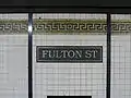 Track side name mosaic
 An R179 Z train at the southbound platform, bound for Broad Street
IRT Lexington Avenue Line platforms
Fulton Street | ||||||||||||||||||||||||||||||||||||||||||||||||||||||||||||||||||||
|---|---|---|---|---|---|---|---|---|---|---|---|---|---|---|---|---|---|---|---|---|---|---|---|---|---|---|---|---|---|---|---|---|---|---|---|---|---|---|---|---|---|---|---|---|---|---|---|---|---|---|---|---|---|---|---|---|---|---|---|---|---|---|---|---|---|---|---|---|
 Uptown platform | ||||||||||||||||||||||||||||||||||||||||||||||||||||||||||||||||||||
| Station statistics | ||||||||||||||||||||||||||||||||||||||||||||||||||||||||||||||||||||
| Division | A (IRT) | |||||||||||||||||||||||||||||||||||||||||||||||||||||||||||||||||||
| Line | IRT Lexington Avenue Line | |||||||||||||||||||||||||||||||||||||||||||||||||||||||||||||||||||
| Services | 4 5 | |||||||||||||||||||||||||||||||||||||||||||||||||||||||||||||||||||
| Platforms | 2 side platforms | |||||||||||||||||||||||||||||||||||||||||||||||||||||||||||||||||||
| Tracks | 2 | |||||||||||||||||||||||||||||||||||||||||||||||||||||||||||||||||||
| Other information | ||||||||||||||||||||||||||||||||||||||||||||||||||||||||||||||||||||
| Opened | January 16, 1905[11] | |||||||||||||||||||||||||||||||||||||||||||||||||||||||||||||||||||
| Station code | 412[3] | |||||||||||||||||||||||||||||||||||||||||||||||||||||||||||||||||||
| Accessible | ||||||||||||||||||||||||||||||||||||||||||||||||||||||||||||||||||||
| Opposite- direction transfer | Yes | |||||||||||||||||||||||||||||||||||||||||||||||||||||||||||||||||||
| Station succession | ||||||||||||||||||||||||||||||||||||||||||||||||||||||||||||||||||||
| Next north | Brooklyn Bridge–City Hall: 4 | |||||||||||||||||||||||||||||||||||||||||||||||||||||||||||||||||||
| Next south | Wall Street: 4 | |||||||||||||||||||||||||||||||||||||||||||||||||||||||||||||||||||
| ||||||||||||||||||||||||||||||||||||||||||||||||||||||||||||||||||||
| ||||||||||||||||||||||||||||||||||||||||||||||||||||||||||||||||||||
New York City Landmark | ||||||||||||||||||||||||||||||||||||||||||||||||||||||||||||||||||||
| Designated | October 23, 1979[6] | |||||||||||||||||||||||||||||||||||||||||||||||||||||||||||||||||||
| Reference no. | 1096 | |||||||||||||||||||||||||||||||||||||||||||||||||||||||||||||||||||
Fulton Street is a station on the IRT Lexington Avenue Line with two tracks and two side platforms. It is situated underneath Broadway between Cortlandt and Fulton Streets. The 4 train stops here at all times,[66] while the 5 train stops here at all times except late nights.[67] The platforms were originally 350 feet (110 m) long, as at other Contract 2 stations,[6]:4 but were lengthened during the 1959 expansion of the station.[31]
As with other stations built as part of the original IRT, the tunnel is covered by a "U"-shaped trough that contains utility pipes and wires. The bottom of this trough contains a foundation of concrete no less than 4 inches (100 mm) thick.[68]:9 Each platform consists of 3-inch-thick (7.6 cm) concrete slabs, beneath which are drainage basins. The original platforms contain circular, cast-iron Doric-style columns away from the platform edge, spaced every 15 feet (4.6 m), while the platform extensions contain I-beam columns near the platform edge. Additional columns between the tracks, spaced every 5 feet (1.5 m), support the jack-arched concrete station roofs.[6]:4[68]:9 There is a 1-inch (25 mm) gap between the trough wall and the platform walls, which are made of 4-inch (100 mm)-thick brick covered over by a tiled finish.[68]:9
There are fare control areas at platform level. The walls along the platforms near the fare control areas consist of a pink marble wainscoting on the lowest part of the wall, with bronze air vents along the wainscoting, and white glass tiles above. The platform walls are divided at 15-foot (4.6 m) intervals by pink marble pilasters, or vertical bands. In the original portion of the station, each pilaster is topped by blue-and-green tile plaques, which contain the letter "F" surrounded by a buff-yellow and blue-green Greek key carving. Above these "F" plaques are faience mosaics that depict a mosaic of the Clermont, the steamboat built by Robert Fulton. These mosaics are topped by blue faience swags and are connected by a faience cornice with scrolled and foliate detail. This decorative design is extended to the fare control areas adjacent to the original portions of the station. White-on-blue tile plaques with the words "Fulton Street" and floral motifs are also placed on the walls.[6]:7 On the northern end of the southbound platform, there is a 75-foot-long (23 m) granite wall separating it from the basement of 195 Broadway. Within the granite wall there are bronze sliding gates and a long window separated by bronze mullions. The sliding gates used to provide access to the station, a purpose that is now served by turnstiles.[69]
 An R142 5 train at the southbound platform, bound for Bowling Green
 Tilework trim detail
 Column
 Name mosaic
IND Eighth Avenue Line platform
Fulton Street | ||||||||||||||||||||||||||||||||||||||||||||||||||||||||||||||||||||||||||||||||||
|---|---|---|---|---|---|---|---|---|---|---|---|---|---|---|---|---|---|---|---|---|---|---|---|---|---|---|---|---|---|---|---|---|---|---|---|---|---|---|---|---|---|---|---|---|---|---|---|---|---|---|---|---|---|---|---|---|---|---|---|---|---|---|---|---|---|---|---|---|---|---|---|---|---|---|---|---|---|---|---|---|---|---|
_03_-_IND_Platform.jpg.webp) The IND Eighth Avenue Line platform | ||||||||||||||||||||||||||||||||||||||||||||||||||||||||||||||||||||||||||||||||||
| Station statistics | ||||||||||||||||||||||||||||||||||||||||||||||||||||||||||||||||||||||||||||||||||
| Division | B (IND) | |||||||||||||||||||||||||||||||||||||||||||||||||||||||||||||||||||||||||||||||||
| Line | IND Eighth Avenue Line | |||||||||||||||||||||||||||||||||||||||||||||||||||||||||||||||||||||||||||||||||
| Services | A C | |||||||||||||||||||||||||||||||||||||||||||||||||||||||||||||||||||||||||||||||||
| Platforms | 1 island platform | |||||||||||||||||||||||||||||||||||||||||||||||||||||||||||||||||||||||||||||||||
| Tracks | 2 | |||||||||||||||||||||||||||||||||||||||||||||||||||||||||||||||||||||||||||||||||
| Other information | ||||||||||||||||||||||||||||||||||||||||||||||||||||||||||||||||||||||||||||||||||
| Opened | February 1, 1933[30] | |||||||||||||||||||||||||||||||||||||||||||||||||||||||||||||||||||||||||||||||||
| Station code | 172[3] | |||||||||||||||||||||||||||||||||||||||||||||||||||||||||||||||||||||||||||||||||
| Accessible | ||||||||||||||||||||||||||||||||||||||||||||||||||||||||||||||||||||||||||||||||||
| Opposite- direction transfer | Yes | |||||||||||||||||||||||||||||||||||||||||||||||||||||||||||||||||||||||||||||||||
| Former/other names | Broadway – Nassau Street | |||||||||||||||||||||||||||||||||||||||||||||||||||||||||||||||||||||||||||||||||
| Station succession | ||||||||||||||||||||||||||||||||||||||||||||||||||||||||||||||||||||||||||||||||||
| Next north | Chambers Street: A | |||||||||||||||||||||||||||||||||||||||||||||||||||||||||||||||||||||||||||||||||
| Next south | High Street: A | |||||||||||||||||||||||||||||||||||||||||||||||||||||||||||||||||||||||||||||||||
| ||||||||||||||||||||||||||||||||||||||||||||||||||||||||||||||||||||||||||||||||||
| ||||||||||||||||||||||||||||||||||||||||||||||||||||||||||||||||||||||||||||||||||
Fulton Street (formerly Broadway–Nassau Street) on the IND Eighth Avenue Line has two tracks and one island platform. The A train stops here at all times,[70] while the C train stops here at all times except late nights.[71]
The station is located approximately 60 feet (18 m) below ground level. Similar to other stations near it, Fulton Street utilizes a tube station design because of its depth. The tile on this station is colored purple, with wall tiles reading "FULTON". An alternating pattern of "BWAY" and "NASSAU" was the original tiling.
An Arts for Transit piece, Nancy Holt's Astral Grating, was formerly located on the mezzanine but was removed during renovation.
Elevators lead from this line's platform to the mezzanines for the IRT Broadway–Seventh Avenue Line platform, both of the BMT Nassau Street Line's platforms, and both of the IRT Lexington Avenue Line's platforms.
 Mezzanine before reconstruction. Note the Marine Grill Murals on the walls
.jpg.webp) Mezzanine after reconstruction
Mezzanine after reconstruction Cliff Street Substation supplies power
Notable places nearby
References
- "Transfer Points Under Higher Fare; Board of Transportation Lists Stations and Intersections for Combined Rides". The New York Times. June 30, 1948. p. 19. ISSN 0362-4331. Retrieved April 21, 2020.
- "Subway Transfer Made Easier". The New York Times. August 25, 1950. ISSN 0362-4331. Retrieved December 30, 2020.
- "Station Developers' Information". Metropolitan Transportation Authority. Retrieved June 13, 2017.
- "Facts and Figures: Annual Subway Ridership 2014–2019". Metropolitan Transportation Authority. 2020. Retrieved May 26, 2020.
- Walker, James Blaine (1918). Fifty Years of Rapid Transit — 1864 to 1917. New York, N.Y.: Law Printing. Retrieved November 6, 2016.
- "Interborough Rapid Transit System, Underground Interior" (PDF). New York City Landmarks Preservation Commission. October 23, 1979. Retrieved November 19, 2019.
- Report of the Board of Rapid Transit Railroad Commissioners for the City of New York For The Year Ending December 31, 1904 Accompanied By Reports of the Chief Engineer and of the Auditor. Board of Rapid Transit Railroad Commissioners. 1905. pp. 229–236.
- Report of the Board of Rapid Transit Railroad Commissioners For And In The City of New York Up to December 31, 1901. Board of Rapid Transit Railroad Commissioners. 1902.
- Scott, Charles (1978). "Design and Construction of the IRT: Civil Engineering" (PDF). Historic American Engineering Record. pp. 208–282 (PDF pp. 209–283). Retrieved December 20, 2020.
 This article incorporates text from this source, which is in the public domain.
 - "A New Method of Tunneling Under Broadway, New York". Engineering Record. 48 (17): 492–494. October 24, 1903.
- "Subway at Fulton Street Busy" (PDF). Retrieved September 4, 2016.
- "Subway Trains Run Again This Morning; Through Service Promised for the rush-Hour Crowds. Tunnel Pumped out at Last; Big Water Main That Burst Was an Old One, Pressed Into Service Again After a Five-Hour Watch" (PDF). Retrieved September 18, 2016.
- "Subway to Wall St. Open in Ten Days; And All the Way to the Bronx by July 1. Whole Road Ready in August As to the Air Therein, William Barclay Parsons Says It Is Pure and Can't Be Bettered" (PDF). Retrieved September 18, 2016.
- Hood, Clifton (1978). "The Impact of the IRT in New York City" (PDF). Historic American Engineering Record. pp. 146–207 (PDF pp. 147–208). Retrieved December 20, 2020. This article incorporates text from this source, which is in the public domain.
- Report of the Public Service Commission for the First District of the State of New York For The Year Ending December 31, 1910. Public Service Commission. 1911.
- "Ten-car Trains in Subway to-day; New Service Begins on Lenox Av. Line and Will Be Extended to Broadway To-morrow". The New York Times. January 23, 1911. ISSN 0362-4331. Retrieved April 5, 2018.
- New York (State). Legislature. Senate (1917). Documents of the Senate of the State of New York. pp. 317, 320. Retrieved January 6, 2021.
- "MONEY SET ASIDE FOR NEW SUBWAYS; Board of Estimate Approves City Contracts to be Signed To-day with Interboro and B.R.T." (PDF). The New York Times. March 19, 1913. ISSN 0362-4331. Retrieved November 10, 2017.
- "Three New Links of the Dual Subway System Opened, Including a Shuttle Service from Times Square to Thirty-Fourth Street — Service on the Jerome Avenue Branch From 149th Street North to About 225th Street Began Yesterday Afternoon — The Event Celebrated by Bronx Citizens and Property Owners — The Seventh Avenue Connection Opened This Morning" (PDF). The New York Times. June 3, 1917. p. 1. ISSN 0362-4331. Retrieved November 6, 2016.
- "Annual report. 1916-1917". HathiTrust. Interborough Rapid Transit Company. December 12, 2013. p. 22. Retrieved September 5, 2016.
- "Open New Subway to Regular Traffic — First Train on Seventh Avenue Line Carries Mayor and Other Officials — To Serve Lower West Side — Whitney Predicts an Awakening of the District — New Extensions of Elevated Railroad Service" (PDF). The New York Times. July 2, 1918. p. 11. ISSN 0362-4331. Retrieved November 6, 2016.
- "Open New Subway Lines to Traffic; Called a Triumph — Great H System Put in Operation Marks an Era in Railroad Construction — No Hitch in the Plans — But Public Gropes Blindly to Find the Way in Maze of New Stations — Thousands Go Astray — Leaders in City's Life Hail Accomplishment of Great Task at Meeting at the Astor" (PDF). The New York Times. August 2, 1918. p. 1. ISSN 0362-4331. Retrieved November 6, 2016.
- Whitney, Travis H. (March 10, 1918). "The Seventh and Lexington Avenue Subways Will Revive Dormant Sections — Change in Operation That Will Transform Original Four-Tracked Subway Into Two Four-Tracked Systems and Double Present Capacity of the Interborough" (PDF). The New York Times. p. 12. ISSN 0362-4331. Retrieved August 26, 2016.
- Linder, Bernard (February 2016). "Contract 4 Subway Controversy". The Bulletin. Electric Railroaders' Association. 59 (2). Retrieved July 28, 2016.
- "Nassau St. Subway To Open On May 30; Its Construction an Engineering Feat Because Many Buildings Had to Be Underpinned. Cost $10,072,000 To Build It Will Link B.M.T.'s Centre Street Loop With Tunnel Under East River. 14th St. Extension Ready Connection With Eighth Avenue Line Will Go Into Operation on the Same Day". The New York Times. May 10, 1931. ISSN 0362-4331. Retrieved July 28, 2016.
- Cunningham, Joseph; DeHart, Leonard O. (January 1, 1993). A History of the New York City Subway System. J. Schmidt, R. Giglio, and K. Lang.
- Derrick, Peter (April 1, 2002). Tunneling to the Future: The Story of the Great Subway Expansion That Saved New York. NYU Press. ISBN 9780814719541.
- "Will Break Ground Today for New Uptown Subway". The New York Times. March 14, 1925. p. 15. ISSN 0362-4331. Retrieved June 29, 2018.
- "Gay Midnight Crowd Rides First Trains in New Subway". The New York Times. September 10, 1932. p. 1. ISSN 0362-4331. Retrieved June 29, 2018.
- "City Opens Subway to Brooklyn Today". The New York Times. February 1, 1933. p. 19. ISSN 0362-4331. Retrieved June 29, 2018.
- Annual Report For The Year Ending June 30, 1959 (PDF). New York City Transit Authority. 1959. p. 9.
- Annual Report 1964–1965. New York City Transit Authority. 1965.
- Port Authority of New York and New Jersey (2007). Permanent WTC PATH Terminal: Environmental Impact Statement. United States Department of Transportation; Federal Transit Administration.
- Wyatt, Edward; Kennedy, Randy (April 20, 2002). "$7.3 Billion Vision To Rebuild Transit Near Ground Zero". The New York Times. ISSN 0362-4331. Retrieved February 3, 2018.
- Collins, Glenn (April 28, 2003). "A Distant Urban Past Is Just a Local Stop; Rails and History Meet at Fulton St". The New York Times. ISSN 0362-4331. Retrieved February 24, 2018.
- Dunlap, David W. (December 4, 2003). "$2.85 Billion for 3 Transit Sites, With Strings". The New York Times. ISSN 0362-4331. Retrieved February 24, 2018.
- Chamberlain, Lisa (May 22, 2005). "The Underground Economy: Subway Retailing". The New York Times. ISSN 0362-4331. Retrieved February 24, 2018.
- Lueck, Thomas J. (May 23, 2006). "Over Budget, Fulton Street Transit Hub Faces a Redesign". The New York Times. ISSN 0362-4331. Retrieved February 25, 2018.
- Neuman, William; Dunlap, David W. (January 8, 2007). "Planners Clash Over Transit Hub, and Riders Win". The New York Times. ISSN 0362-4331. Retrieved February 25, 2018.
- Pogrebin, Robin (April 10, 2008). "Proposal Would Relocate Ground Zero Arts Center to Transit Hub". The New York Times. ISSN 0362-4331. Retrieved February 26, 2018.
- Shapiro, Julie (March 13, 2008). "Some sort of building will rise at Fulton, M.T.A. says". DOWNTOWN EXPRESS | The Newspaper of Lower Manhattan. Retrieved February 26, 2018.
- Neuman, William (2009). "M.T.A. Planning to Spend Stimulus on Fulton St. Hub". The New York Times. ISSN 0362-4331. Retrieved February 26, 2018.
- "Fulton Center". MTA. Retrieved February 23, 2014.
- "Fulton Street Transit Center | No. 7 Subway Extension". Therealdeal.com. March 25, 2014. Retrieved May 1, 2014.
- "Project Updates: Fulton Center". Lower Manhattan Development Corp. May 2009. Archived from the original on August 16, 2006.
- "Back on Track: Fulton Transit Center" (PDF). MTA. June 9, 2009. Archived from the original (PDF) on April 8, 2014.
- Yee, Vivian (November 9, 2014). "Out of Dust and Debris, a New Jewel Rises". The New York Times. ISSN 0362-4331.
- Chan, Sewell (June 29, 2005). "M.T.A. Scales Back Lower Manhattan Transit Complex, Citing Cost". The New York Times. ISSN 0362-4331. Retrieved February 25, 2018.
- "Construction Update | Construction Schedule". Archived from the original on April 8, 2014.
- "Chapter 1: Purpose and Need". Fulton Street Transit Center, Final Environmental Impact Statement and Section 4(f) Evaluation (PDF). Metropolitan Transportation Authority. Retrieved January 3, 2015.
- "Fulton Street Transit Center Construction Update and Service Changes January 9–11 and January 16–17" (Press release). New York Metropolitan Transportation Authority. January 7, 2010. Retrieved February 7, 2010.
- "Fulton Street Transit Center: Construction Update and Subway Service Changes". mta.info. Metropolitan Transportation Authority. December 2010. Archived from the original on December 17, 2010. Retrieved December 28, 2020.
- "Fulton Street Transit Center – Community Board 1 Quarterly Construction Update" (PDF). Metropolitan Transportation Authority. February 13, 2012. Retrieved February 21, 2018.
- "Fulton Street Transit Center – Community Board 1 Quarterly Construction Update" (PDF). Metropolitan Transportation Authority. October 2012. Retrieved October 2, 2016.
- "New Dey Street Entrance Opened". mta.info. Metropolitan Transportation Authority. Retrieved July 4, 2016.
- "MTA Neighborhood Maps: Lower Manhattan". Metropolitan Transportation Authority. 2015. Retrieved August 16, 2016.
- "MTA Neighborhood Maps: Fulton St (4)(5)". Metropolitan Transportation Authority. 2018. Retrieved December 19, 2020.
- Dunlap, David W. (June 2, 2013). "Spared Demolition, an 1889 Building Gets a Second Life". City Room. Retrieved August 5, 2020.
- "MTA Neighborhood Maps: Fulton St (2)(3)". Metropolitan Transportation Authority. 2018. Retrieved December 19, 2020.
- "MTA Neighborhood Maps: Fulton St (J)(Z)". Metropolitan Transportation Authority. 2018. Retrieved December 19, 2020.
- "Broadway Nassau Fulton Street Complex". April 27, 2005. Archived from the original on April 27, 2005. Retrieved July 4, 2016.CS1 maint: unfit URL (link)
- "2 Subway Timetable, Effective September 13, 2020". Metropolitan Transportation Authority. Retrieved December 9, 2020.
- "3 Subway Timetable, Effective September 13, 2020". Metropolitan Transportation Authority. Retrieved December 9, 2020.
- Photo, Times Wide World (May 30, 1931). "Mayor Drives Train In New Subway Link; The Mayor Becomes A Motorman". The New York Times. ISSN 0362-4331. Retrieved July 28, 2016.
- "J Subway Timetable, Effective November 8, 2020" (PDF). Metropolitan Transportation Authority. Retrieved December 9, 2020.
- "4 Subway Timetable, Effective September 13, 2020". Metropolitan Transportation Authority. Retrieved December 9, 2020.
- "5 Subway Timetable, Effective September 13, 2020". Metropolitan Transportation Authority. Retrieved December 9, 2020.
- Framberger, David J. (1978). "Architectural Designs for New York's First Subway" (PDF). Historic American Engineering Record. pp. 1-46 (PDF pp. 367-412). Retrieved December 20, 2020. This article incorporates text from this source, which is in the public domain.
- "American Telephone and Telegraph Building" (PDF). New York City Landmarks Preservation Commission. July 25, 2006. p. 14. Retrieved December 30, 2020.
- "A Subway Timetable, Effective November 8, 2020" (PDF). Metropolitan Transportation Authority. Retrieved December 9, 2020.
- "C Subway Timetable, Effective November 8, 2020" (PDF). Metropolitan Transportation Authority. Retrieved December 9, 2020.
Further reading
External links
| Wikimedia Commons has media related to Fulton Street (New York City Subway). |
nycsubway.org:
- nycsubway.org – IRT East Side Line: Fulton Street
- nycsubway.org – IRT West Side Line: Fulton Street
- nycsubway.org – BMT Nassau St./Jamaica Line: Fulton Street
- nycsubway.org – IND 8th Avenue: Broadway/Nassau Street
- nycsubway.org — Marine Grill Murals, 1913 Artwork by Fred Dana Marsh (2000)
- nycsubway.org — Astral Grating Artwork by Nancy Holt (1987)
Station Reporter:
- Station Reporter — Broadway Nassau/Fulton Street Complex
MTA's Arts For Transit:
- MTA's Arts For Transit — Fulton Street/William Street
Google Maps Street View:
- Broadway & Dey Street entrance (Dey Street Headhouse)
- Broadway & Fulton Street entrance (street)
- Broadway & Fulton Street entrance (Fulton Center building)
- Broadway & John Street entrance
- Broadway, Maiden Lane, and Cortlandt Street entrance
- Nassau Street & Fulton Street entrance
- Nassau Street & John Street entrance
- William Street & Fulton Street entrance
- IRT Lexington Avenue Line platforms
- IND platform
- BMT platform
- IRT Broadway - Seventh Avenue Line platform
- IND mezzanine
| Broadway– Seventh Ave. Line |
| ||||
|---|---|---|---|---|---|
| Lexington Ave. Line |
| ||||
| Eighth Ave. Line |
| ||||
| Nassau St. Line | |||||
| |||||