Dardanup, Western Australia
Dardanup is a small town in the South West region of Western Australia. The town is in the fertile Ferguson valley and is near the Ferguson River.
| Dardanup Western Australia | |
|---|---|
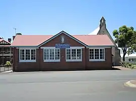
 Our Lady of Lourdes School | |
 Dardanup | |
| Coordinates | 33°24′S 115°45′E |
| Population | 370 (2006 census)[1] |
| Established | 1923 |
| Postcode(s) | 6236 |
| Elevation | 30 m (98 ft) |
| Location | |
| LGA(s) | Shire of Dardanup |
| State electorate(s) | Collie-Preston |
| Federal Division(s) | Forrest |
The first European settlement in the area was in 1852 by Thomas Little who named his property Dardanup Park. The word Dardanup is believed to be a variation of the Indigenous Australian word Dudingup the meaning of which is unknown.[2]
Construction of the local Agricultural Hall commenced in 1893 by J. and H. Gibbs who had submitted the lowest tender.[3] The Hall, constructed of Jarrah and weatherboard, was opened in 1894 by the Hon. H. W. Venn.[4]
The population of the area was 118 (81 males and 37 females) in 1898.[5]
Little later gave land to the Catholic Church and a community was soon established in the locale. The government acquired land in the area in the 1920s and the townsite was gazetted in 1923.[2]
See also
 Media related to Dardanup, Western Australia at Wikimedia Commons
 Western Australia portal
References
- Australian Bureau of Statistics (25 October 2007). "Dardanup(State Suburb)". 2006 Census QuickStats. Retrieved 16 October 2008.
- Western Australian Land Information Authority. "History of country town names – D". Retrieved 17 October 2008.
- "General News". The Daily News. Perth, Western Australia: National Library of Australia. 10 November 1893. p. 2. Retrieved 2 October 2013.
- "Opening of the Dardanup Agricultural Hall". Bunbury Herald. Western Australia: National Library of Australia. 21 March 1894. p. 3. Retrieved 2 October 2013.
- "Population of Western Australia". Western Mail. Perth, Western Australia: National Library of Australia. 22 April 1898. p. 23. Retrieved 31 May 2012.