Deep Springs, California
Deep Springs (formerly, Deep Spring) is an unincorporated community in Inyo County, California.[1] It lies within the treaty territory of the Western Bands of the Shoshone Nation of Indians (Timbisha Band of Western Shoshone Indians). It is located in the northeastern section of Deep Springs Valley, 22 miles (35 km) east of Bishop,[2] 2.6 km (1.6 mi) north of Soldier Pass, and 6.4 km (4 mi) southwest of Chocolate Mountain (formerly Piper Mountain),[3] at an elevation of 5194 feet (1583 m).[1]
Deep Springs | |
|---|---|
 Deep Springs Location in California | |
| Coordinates: 37°22′18″N 117°59′06″W | |
| Country | United States |
| State | California |
| County | Inyo County |
| Elevation | 5,194 ft (1,583 m) |
Deep Springs College is located in Deep Springs Valley, although not at the site of the springs. The Deep Springs post office operated from 1881 to 1883[2] and from 1920 to 1953.[2] The springs, after which the town was named, are now called Buckhorn Springs.[2]
References
- "Deep Springs". Geographic Names Information System. United States Geological Survey.
- Durham, David L. (1998). California's Geographic Names: A Gazetteer of Historic and Modern Names of the State. Clovis, Calif.: Word Dancer Press. p. 1159. ISBN 1-884995-14-4.
- "Chocolate Mountain". Geographic Names Information System. United States Geological Survey.
Municipalities and communities of Inyo County, California, United States | ||
|---|---|---|
| City | 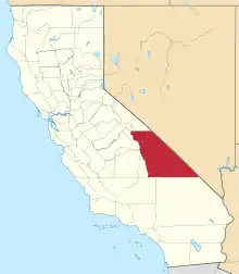 Inyo County map | |
| CDPs | ||
| Unincorporated communities |
| |
| Indian reservations | ||
| Ghost towns |
| |
| Other | ||
| ||