Haiwee, California
Haiwee (formerly McGuire's,[2] Haiwai,[3] Hawaii and Hayways[4]) is an unincorporated community in Inyo County, California.[1] It is located on the Southern Pacific Railroad 24 miles (39 km) south-southwest of Keeler,[4] at an elevation of 4075 feet (1242 m).[1]
Haiwee | |
|---|---|
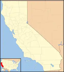 Haiwee Location in California  Haiwee Haiwee (the United States) | |
| Coordinates: 36°08′48″N 117°58′33″W | |
| Country | United States |
| State | California |
| County | Inyo County |
| Elevation | 4,075 ft (1,242 m) |
The settlement there began in 1864, as a waystop at Haiwai Meadows on the road between Visalia and the Owens Valley. The stop was run by a man named McGuire and his wife and young son. McGuire's wife and son were killed in an Indian attack while he was away on January 1, 1865. Owens Valley settler militia avenged their deaths, with an attack on the Indian village where the killers had taken refuge, in the Owens Lake Massacre on January 6, 1865. This was one of the last fights in the Owens Valley Indian War.[2]
The original settlement site and the Haiwai Meadows are under the water of the Haiwee Reservoir.[4] The town moved to a site west of the reservoir.[4] A post office operated at Haiwee from 1906 to 1913, moving in 1909.[4]
Climate
Haiwee has a hot-summer Mediterranean climate(Köppen climate classification: Csa) with winters being cold and summers being very hot. Due to its high elevation and low humidity, it experiences dramatic diurnal temperature variation, and it is common to have a difference of 30℉ between daily highs and lows.
| Climate data for Haiwee, California | |||||||||||||
|---|---|---|---|---|---|---|---|---|---|---|---|---|---|
| Month | Jan | Feb | Mar | Apr | May | Jun | Jul | Aug | Sep | Oct | Nov | Dec | Year |
| Average high °F (°C) | 58.2 (14.6) |
62.1 (16.7) |
69.4 (20.8) |
76.3 (24.6) |
86.0 (30.0) |
95.4 (35.2) |
101.6 (38.7) |
99.8 (37.7) |
93.1 (33.9) |
81.4 (27.4) |
68.0 (20.0) |
57.6 (14.2) |
79.1 (26.1) |
| Daily mean °F (°C) | 45.6 (7.6) |
48.7 (9.3) |
54.8 (12.7) |
61.0 (16.1) |
70.0 (21.1) |
78.5 (25.8) |
84.8 (29.3) |
83.0 (28.3) |
76.1 (24.5) |
65.3 (18.5) |
53.5 (11.9) |
44.9 (7.2) |
63.9 (17.7) |
| Average low °F (°C) | 32.9 (0.5) |
35.3 (1.8) |
40.2 (4.6) |
45.6 (7.6) |
53.9 (12.2) |
61.6 (16.4) |
68.0 (20.0) |
66.3 (19.1) |
59.2 (15.1) |
49.3 (9.6) |
39.0 (3.9) |
32.1 (0.1) |
48.6 (9.2) |
| Average rainfall inches (mm) | 1.2 (30) |
1.4 (36) |
1.0 (25) |
0.3 (7.6) |
0.3 (7.6) |
0.1 (2.5) |
0.3 (7.6) |
0.3 (7.6) |
0.3 (7.6) |
0.2 (5.1) |
0.5 (13) |
0.9 (23) |
6.8 (172.6) |
| Average snowfall inches (cm) | 1.0 (2.5) |
0.9 (2.3) |
0 (0) |
0.1 (0.25) |
0 (0) |
0 (0) |
0 (0) |
0 (0) |
0 (0) |
0 (0) |
0.1 (0.25) |
0.4 (1.0) |
2.5 (6.3) |
| Average precipitation days | 3 | 3 | 2 | 1 | 1 | 0 | 1 | 0 | 1 | 0 | 1 | 2 | 15 |
| Source 1: NOAA (precipitation)[5] | |||||||||||||
| Source 2: Western Regional Climate Center (temperatures 1981-2010)[6] | |||||||||||||
References
- U.S. Geological Survey Geographic Names Information System: Haiwee, California
- Willie Arthur Chalfant, The story of Inyo, Hammond Press, W. B. Conkey Company, Chicago, 1922, p. 180–183
- Erwin Gustin Guide. California Place Names. University of California Press, 1960. p. 132.
- Durham, David L. (1998). California's Geographic Names: A Gazetteer of Historic and Modern Names of the State. Clovis, Calif.: Word Dancer Press. p. 1168. ISBN 1-884995-14-4.
- "Haiwee, Ca Weather Averages". NOAA. Retrieved June 13, 2020.
- "Haiwee, California - NCDC 1981-2010 Monthly Normals". Western Regional Climate Center. Retrieved June 13, 2020.
Municipalities and communities of Inyo County, California, United States | ||
|---|---|---|
| City | 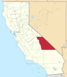 Inyo County map | |
| CDPs | ||
| Unincorporated communities |
| |
| Indian reservations | ||
| Ghost towns | ||
| Other | ||
| ||
