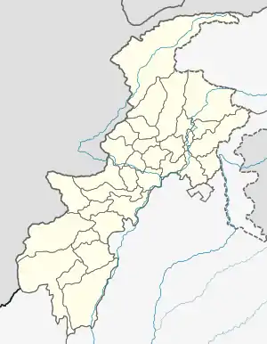
Dir, Pakistan
Dir (Urdu, Pashto: دیر) is a town in Upper Dir District, Khyber-Pakhtunkhwa province, Pakistan at an elevation of 1420 m. It is sometimes known as Dir Khas ("Proper Dir") to distinguish it from the district. It lies at the foot of the Lowarai Pass, the main motor road to Chitral, on the Dir River, a tributary of the Panjkora River.
Dir
دیر | |
|---|---|
Town | |
 Dir دیر  Dir دیر | |
| Coordinates: 35°12′24″N 71°52′36″E | |
| Country | Pakistan |
| Province | Khyber Pakhtunkhwa |
| District | Upper Dir District |
| Elevation | 1,420 m (4,660 ft) |
| Time zone | UTC+5 (PKT) |
Dir was founded in the 17th century. It was the capital of the former princely state of Dir, until its abolition in 1969. The former royal palace is on a hill above the town. Dir was then the capital of Dir District, but was replaced as capital by Timergara, before the district was divided in 1996.
Language & Tribes
Pashto is the main language spoken in the town.
Climate
Like most of the southern slopes of Khyber Pakhtunkhwa, Dir has a humid subtropical climate (Köppen Cfa). Owing to the town's exposed location, rainfall from frontal cyclones from the west is heavier than in any other part of Pakistan, and their passage, as well as very penetrative monsoonal periods, are usually accompanied by heavy thunderstorms.
| Climate data for Dir, Khyber Pakhtunkhwa | |||||||||||||
|---|---|---|---|---|---|---|---|---|---|---|---|---|---|
| Month | Jan | Feb | Mar | Apr | May | Jun | Jul | Aug | Sep | Oct | Nov | Dec | Year |
| Record high °C (°F) | 22.2 (72.0) |
23.9 (75.0) |
30.6 (87.1) |
33.9 (93.0) |
38.1 (100.6) |
41.5 (106.7) |
38.1 (100.6) |
37.4 (99.3) |
35.0 (95.0) |
33.9 (93.0) |
28.0 (82.4) |
23.0 (73.4) |
41.5 (106.7) |
| Average high °C (°F) | 11.3 (52.3) |
12.0 (53.6) |
16.1 (61.0) |
22.5 (72.5) |
27.9 (82.2) |
32.4 (90.3) |
31.2 (88.2) |
30.1 (86.2) |
28.9 (84.0) |
25.3 (77.5) |
20.1 (68.2) |
13.9 (57.0) |
22.6 (72.7) |
| Daily mean °C (°F) | 4.4 (39.9) |
5.3 (41.5) |
9.5 (49.1) |
15.0 (59.0) |
19.8 (67.6) |
23.9 (75.0) |
25.1 (77.2) |
24.2 (75.6) |
21.2 (70.2) |
16.3 (61.3) |
11.2 (52.2) |
6.4 (43.5) |
15.1 (59.2) |
| Average low °C (°F) | −2.5 (27.5) |
−1.5 (29.3) |
3.0 (37.4) |
7.6 (45.7) |
11.6 (52.9) |
15.5 (59.9) |
19.1 (66.4) |
18.3 (64.9) |
13.5 (56.3) |
7.3 (45.1) |
2.4 (36.3) |
−1.2 (29.8) |
7.8 (46.0) |
| Record low °C (°F) | −10.6 (12.9) |
−13.9 (7.0) |
−4.4 (24.1) |
−1.1 (30.0) |
2.9 (37.2) |
8.3 (46.9) |
10.0 (50.0) |
7.9 (46.2) |
3.3 (37.9) |
0.1 (32.2) |
−7.2 (19.0) |
−9.4 (15.1) |
−13.9 (7.0) |
| Average precipitation mm (inches) | 120.6 (4.75) |
176.7 (6.96) |
253.7 (9.99) |
166.3 (6.55) |
86.1 (3.39) |
54.4 (2.14) |
160.0 (6.30) |
168.6 (6.64) |
83.7 (3.30) |
50.3 (1.98) |
58.1 (2.29) |
90.3 (3.56) |
1,468.8 (57.85) |
| Mean monthly sunshine hours | 131.6 | 129.7 | 145.8 | 195.4 | 254.2 | 282.4 | 247.1 | 223.8 | 224.1 | 221.7 | 202.5 | 140.0 | 2,398.3 |
| Source: NOAA (1971-1990)[1] | |||||||||||||
References
- "Dir Climate Normals 1971-1990". National Oceanic and Atmospheric Administration. Retrieved January 16, 2013.
