Doi Lo District
Doi Lo (Thai: ดอยหล่อ, pronounced [dɔ̄ːj lɔ̀ː]; Northern Thai: ![]() ) is a district (amphoe) of Chiang Mai Province in northern Thailand.
) is a district (amphoe) of Chiang Mai Province in northern Thailand.
Doi Lo
ดอยหล่อ | |
|---|---|
 Wat Phra That Doi Noi | |
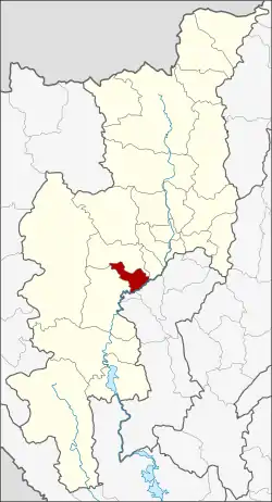 District location in Chiang Mai Province | |
| Coordinates: 18°28′28″N 98°47′1″E | |
| Country | Thailand |
| Province | Chiang Mai |
| Seat | Doi Lo |
| Area | |
| • Total | 260.1 km2 (100.4 sq mi) |
| Population (2005) | |
| • Total | 27,623 |
| • Density | 106.2/km2 (275/sq mi) |
| Time zone | UTC+7 (ICT) |
| Postal code | 50160 |
| Geocode | 5024 |
Geography
Neighboring districts are (from the southwest clockwise) Chom Thong, Mae Wang, San Pa Tong of Chiang Mai Province, Pa Sang and Wiang Nong Long of Lamphun Province.
History
The minor district (king amphoe) was established on 1 April 1995, when four tambons were split off from Chom Thong.[1]
On 15 May 2007, all 81 minor districts were upgraded to full districts.[2] On 24 August the upgrade became official.[3]
Administration
The district is divided into four sub-districts (tambon), which are further subdivided into 54 villages (muban). There are no municipal (thesaban) areas, and four tambon administrative organizations (TAO).
| No. | Name | Thai name | Villages | Pop. | |
|---|---|---|---|---|---|
| 1. | Doi Lo | ดอยหล่อ | 26 | 12,809 | |
| 2. | Song Khwae | สองแคว | 8 | 5,560 | |
| 3. | Yang Khram | ยางคราม | 11 | 5,182 | |
| 4. | Santi Suk | สันติสุข | 9 | 4,072 |
References
- ประกาศกระทรวงมหาดไทย เรื่อง แบ่งเขตท้องที่อำเภอจอมทอง จังหวัดเชียงใหม่ ตั้งเป็นกิ่งอำเภอดอยหล่อ (PDF). Royal Gazette (in Thai). 112 (Special 9 ง): 65. March 22, 2007.
- แถลงผลการประชุม ครม. ประจำวันที่ 15 พ.ค. 2550 (in Thai). Manager Online.
- พระราชกฤษฎีกาตั้งอำเภอฆ้องชัย...และอำเภอเหล่าเสือโก้ก พ.ศ. ๒๕๕๐ (PDF). Royal Gazette (in Thai). 124 (46 ก): 14–21. August 24, 2007.
External links
This article is issued from Wikipedia. The text is licensed under Creative Commons - Attribution - Sharealike. Additional terms may apply for the media files.