Wiang Haeng District
Wiang Haeng (Thai: เวียงแหง, pronounced [wīa̯ŋ hɛ̌ːŋ]) is a district (amphoe) in the northern part of Chiang Mai Province, northern Thailand.
Wiang Haeng
เวียงแหง | |
|---|---|
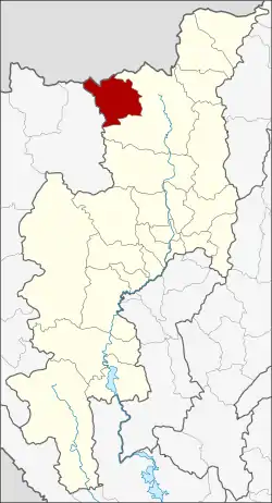 District location in Chiang Mai Province | |
| Coordinates: 19°33′34″N 98°38′8″E | |
| Country | Thailand |
| Province | Chiang Mai |
| Seat | Mueang Haeng |
| Area | |
| • Total | 672.2 km2 (259.5 sq mi) |
| Population (2005) | |
| • Total | 28,876 |
| • Density | 93.8/km2 (243/sq mi) |
| Time zone | UTC+7 (ICT) |
| Postal code | 50350 |
| Geocode | 5020 |
History
The area of tambon Wiang was very far from Chiang Dao District center. The government separated Tambon Mueang Haeng and Piang Luang to create a minor district (king amphoe) on 5 May 1981.[1] It was upgraded to a full district on 4 November 1993.[2]
Geography
Neighboring districts are (from the northeast clockwise) Chiang Dao of Chiang Mai Province, Pai of Mae Hong Son Province and Shan State of Myanmar.
The source of the Taeng River lies in the mountains of the Daen Lao Range in the north of the district.
Administration
The district is divided into three sub-districts (tambon), which are further subdivided into 26 villages (muban). There are no municipal (thesaban) areas, and three tambon administrative organizations (TAO).
| No. | Name | Thai name | Villages | Pop. | |
|---|---|---|---|---|---|
| 1. | Mueang Haeng | เมืองแหง | 12 | 8,631 | |
| 2. | Piang Luang | เปียงหลวง | 9 | 16,757 | |
| 3. | Saen Hai | แสนไห | 5 | 3,488 |
References
- ประกาศกระทรวงมหาดไทย เรื่อง แบ่งท้องที่อำเภอเชียงดาว จังหวัดเชียงใหม่ ตั้งเป็นกิ่งอำเภอเวียงแหง (PDF). Royal Gazette (in Thai). 98 (68 ง): 1282. May 5, 1981.
- พระราชกฤษฎีกาตั้งอำเภอลำทับ อำเภอร่องคำ อำเภอเวียงแหง อำเภอนาโยง อำเภอแก้งสนามนาง อำเภอโนนแดง อำเภอบ้านหลวง อำเภอกะพ้อ อำเภอศรีบรรพต อำเภอแก่งกระจาน อำเภอหนองสูง อำเภอสบเมย อำเภอเมยวดี อำเภอโคกเจริญ อำเภอทุ่งหัวช้าง อำเภอผาขาว อำเภอวังหิน อำเภอดอนพุด อำเภอบึงโขงหลง และอำเภอห้วยคต พ.ศ. ๒๕๓๖ (PDF). Royal Gazette (in Thai). 110 (179 ก special): 1–3. November 3, 1993.