Dolenja Vas pri Črnomlju
Dolenja Vas pri Črnomlju (pronounced [dɔˈleːnja ˈʋaːs pɾi tʃəɾˈnoːmlju]; Slovene: Dolenja vas pri Črnomlju) is a settlement on the left bank of the Lahinja River, immediately east of the town of Črnomelj in the White Carniola area of southeastern Slovenia. The area is part of the traditional region of Lower Carniola and is now included in the Southeast Slovenia Statistical Region.[2]
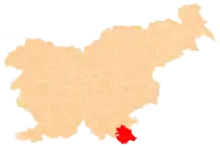
Dolenja Vas pri Črnomlju | |
|---|---|
 Dolenja Vas pri Črnomlju Location in Slovenia | |
| Coordinates: 45°34′20.6″N 15°12′39.6″E | |
| Country | |
| Traditional region | White Carniola |
| Statistical region | Southeast Slovenia |
| Municipality | Črnomelj |
| Area | |
| • Total | 2.32 km2 (0.90 sq mi) |
| Elevation | 157.6 m (517.1 ft) |
| Population (2002) | |
| • Total | 126 |
| [1] | |
Name
The name of the settlement was changed from Dolenja vas to Dolenja vas pri Črnomlju in 1955.[3]
References
- Statistical Office of the Republic of Slovenia
- Črnomelj municipal site
- Spremembe naselij 1948–95. 1996. Database. Ljubljana: Geografski inštitut ZRC SAZU, DZS.
External links
This article is issued from Wikipedia. The text is licensed under Creative Commons - Attribution - Sharealike. Additional terms may apply for the media files.