Pobrežje, Črnomelj
Pobrežje (pronounced [pɔˈbɾeːʒjɛ]; German: Freithurn[2]) is a small settlement on the left bank of the Kolpa River north of Adlešiči in the Municipality of Črnomelj in the White Carniola area of southeastern Slovenia. The area is part of the traditional region of Lower Carniola and is now included in the Southeast Slovenia Statistical Region.[3]
Pobrežje | |
|---|---|
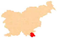
 Pobrežje Location in Slovenia | |
| Coordinates: 45°31′53.34″N 15°18′42.71″E | |
| Country | |
| Traditional region | White Carniola |
| Statistical region | Southeast Slovenia |
| Municipality | Črnomelj |
| Area | |
| • Total | 0.15 km2 (0.06 sq mi) |
| Elevation | 169.4 m (555.8 ft) |
| Population (2002) | |
| • Total | 8 |
| [1] | |
It is dominated by the ruins of an extensive 16th-century fort that was part of the defence system against Ottoman raids. It was burned down on 22 March 1945 by German and Ustaša forces.[4][5]
References
- Statistical Office of the Republic of Slovenia
- Leksikon občin kraljestev in dežel zastopanih v državnem zboru, vol. 6: Kranjsko. 1906. Vienna: C. Kr. Dvorna in Državna Tiskarna, p. 4.
- Črnomelj municipal site
- Slovenian Ministry of Culture register of national heritage reference number ešd 9560
- Godina, Ferdo. 1970. Požgane slovenske vasiLjubljana: Borec, p. 190.
External links
 Media related to Pobrežje, Črnomelj at Wikimedia Commons
- Pobrežje on Geopedia
This article is issued from Wikipedia. The text is licensed under Creative Commons - Attribution - Sharealike. Additional terms may apply for the media files.