Donnelly, Alaska
Donnelly is an unincorporated community in Southeast Fairbanks Census Area, Alaska, United States. Its elevation is 1,785 feet (544 m). Located along the Richardson Highway 26 miles (42 km) south of Delta Junction, it was founded around 1904 as a telegraph station between Chitina and Fairbanks.[1] Donnelly's buildings during its early years were log constructed.[2]
Donnelly | |
|---|---|
 Donnelly Location within the state of Alaska | |
| Coordinates: 63°40′25″N 145°53′0″W | |
| Country | United States |
| State | Alaska |
| Census area | Southeast Fairbanks |
| Government | |
| • State senator | Mike Dunleavy (R) |
| • State rep. | George Rauscher (R) |
| Elevation | 1,785 ft (544 m) |
| Time zone | UTC-9 (Alaska (AKST)) |
| • Summer (DST) | UTC-8 (AKDT) |
| GNIS feature ID | 1401340[1] |
Demographics
| Historical population | |||
|---|---|---|---|
| Census | Pop. | %± | |
| 1970 | 7 | — | |
| U.S. Decennial Census[3] | |||
Donnelly was incorporated as a city on December 15, 1960, too late to appear on the 1960 U.S. Census. It appeared once on the 1970 census with just seven residents.[4] On March 7, 1974, it was dissolved as an inactive city (i.e. due to very low population).[5] It has not appeared on the census since.
References
- "Donnelly, Alaska". Geographic Names Information System. United States Geological Survey.
- Donnelly telegraph station, Alaska's Digital Archives, University of Alaska Anchorage, picture taken c. 1910-1920. Accessed 2008-09-16.
- "U.S. Decennial Census". Census.gov. Retrieved June 6, 2013.
- https://www2.census.gov/prod2/decennial/documents/1970a_ak-01.pdf
- https://www.commerce.alaska.gov/web/Portals/4/pub/LBC/04_29_15%20LIST%20OF%20DISSOLVED%20ALASKA%20CITY%20GOVERNMENTS.pdf
Municipalities and communities of Southeast Fairbanks Census Area, Alaska, United States | ||
|---|---|---|
| Cities | 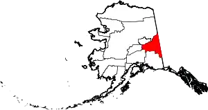 Southeast Fairbanks Census Area map | |
| CDPs | ||
| Unincorporated communities | ||
| ||
This article is issued from Wikipedia. The text is licensed under Creative Commons - Attribution - Sharealike. Additional terms may apply for the media files.