Northway Junction, Alaska
Northway Junction is a census-designated place (CDP) in Southeast Fairbanks Census Area, Alaska, United States. The population was 54 at the 2010 census, down from 72 in 2000.
Northway Junction, Alaska | |
|---|---|
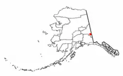 Location of Northway Junction, Alaska | |
| Coordinates: 63°0′23″N 141°46′41″W | |
| Country | United States |
| State | Alaska |
| Census Area | Southeast Fairbanks |
| Government | |
| • State senator | Click Bishop (R) |
| • State rep. | Dave Talerico (R) |
| Area | |
| • Total | 8.6 sq mi (22.2 km2) |
| • Land | 8.5 sq mi (21.9 km2) |
| • Water | 0.1 sq mi (0.3 km2) |
| Elevation | 1,693 ft (516 m) |
| Population (2010) | |
| • Total | 54 |
| • Density | 6.3/sq mi (2.4/km2) |
| Time zone | UTC-9 (Alaska (AKST)) |
| • Summer (DST) | UTC-8 (AKDT) |
| Area code(s) | 907 |
| FIPS code | 02-56250 |
| GNIS feature ID | 1866965 |
Geography
Northway Junction is located at 63°0′23″N 141°46′41″W (63.006408, -141.777993).[1]
According to the United States Census Bureau, the CDP has a total area of 8.6 square miles (22 km2), of which, 8.5 square miles (22 km2) of it is land and 0.1 square miles (0.26 km2) of it (1.40%) is water.
Demographics
| Historical population | |||
|---|---|---|---|
| Census | Pop. | %± | |
| 1990 | 88 | — | |
| 2000 | 72 | −18.2% | |
| 2010 | 54 | −25.0% | |
| U.S. Decennial Census[2] | |||
Northway Junction first appeared on the 1990 U.S. Census as a census-designated place (CDP).
As of the census[3] of 2000, there were 72 people, 23 households, and 18 families residing in the CDP. The population density was 8.5 people per square mile (3.3/km2). There were 29 housing units at an average density of 3.4/sq mi (1.3/km2). The racial makeup of the CDP was 41.67% White, 48.61% Native American, and 9.72% from two or more races. 4.17% of the population were Hispanic or Latino of any race.
There were 23 households, out of which 47.8% had children under the age of 18 living with them, 56.5% were married couples living together, 8.7% had a female householder with no husband present, and 21.7% were non-families. 17.4% of all households were made up of individuals, and none had someone living alone who was 65 years of age or older. The average household size was 3.13 and the average family size was 3.44.
In the CDP, the age distribution of the population shows 38.9% under the age of 18, 6.9% from 18 to 24, 34.7% from 25 to 44, 19.4% from 45 to 64, . The median age was 27 years. For every 100 females, there were 84.6 males. For every 100 females age 18 and over, there were 131.6 males.
The median income for a household in the CDP was $67,500, and the median income for a family was $63,750. Males had a median income of $38,750 versus $36,250 for females. The per capita income for the CDP was $16,439. There were 11.1% of families and 15.8% of the population living below the poverty line, including 20.0% of under eighteens and none of those over 64.
References
- "US Gazetteer files: 2010, 2000, and 1990". United States Census Bureau. 2011-02-12. Retrieved 2011-04-23.
- "U.S. Decennial Census". Census.gov. Retrieved June 6, 2013.
- "U.S. Census website". United States Census Bureau. Retrieved 2008-01-31.
Municipalities and communities of Southeast Fairbanks Census Area, Alaska, United States | ||
|---|---|---|
| Cities | 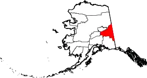 Southeast Fairbanks Census Area map | |
| CDPs | ||
| Unincorporated communities | ||
| ||