Dourgne
Dourgne is a commune in the Tarn department and Occitanie region of southern France.
Dourgne | |
|---|---|
_mairie.JPG.webp) The town hall in Dourgne | |
.svg.png.webp) Coat of arms | |
Location of Dourgne 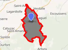
| |
 Dourgne  Dourgne | |
| Coordinates: 43°29′11″N 2°08′21″E | |
| Country | France |
| Region | Occitanie |
| Department | Tarn |
| Arrondissement | Castres |
| Canton | La Montagne noire |
| Intercommunality | Pays de Dourgne |
| Government | |
| • Mayor (2014–2020) | Christian Rey |
| Area 1 | 22.75 km2 (8.78 sq mi) |
| Population (2017-01-01)[1] | 1,315 |
| • Density | 58/km2 (150/sq mi) |
| Time zone | UTC+01:00 (CET) |
| • Summer (DST) | UTC+02:00 (CEST) |
| INSEE/Postal code | 81081 /81110 |
| Elevation | 186–804 m (610–2,638 ft) (avg. 250 m or 820 ft) |
| 1 French Land Register data, which excludes lakes, ponds, glaciers > 1 km2 (0.386 sq mi or 247 acres) and river estuaries. | |
Demographics
| Year | Pop. | ±% p.a. |
|---|---|---|
| 1968 | 1,299 | — |
| 1975 | 1,250 | −0.55% |
| 1982 | 1,233 | −0.20% |
| 1990 | 1,211 | −0.22% |
| 1999 | 1,186 | −0.23% |
| 2007 | 1,286 | +1.02% |
| 2012 | 1,303 | +0.26% |
| 2017 | 1,315 | +0.18% |
| Source: INSEE[2] | ||
Sites and monuments
Dourgne is known for its two Benedictine monasteries, the En Calcat Abbey and the Sainte Scholastique Abbey, both founded in 1890.[3]
You can see the ruins of the Château de Castellas, destroyed by Simon de Montfort.
References
- "Populations légales 2017". INSEE. Retrieved 6 January 2020.
- Population en historique depuis 1968, INSEE
- "Some Notes from Our History" (in French). En Calcat Abbey. Retrieved 2011-02-11.
External links
| Wikimedia Commons has media related to Dourgne. |
- Dourgne (in French)
- Sainte Scholastique Abbey (in French)
- En Calcat Abbey (in French)
| Authority control |
|
|---|
This article is issued from Wikipedia. The text is licensed under Creative Commons - Attribution - Sharealike. Additional terms may apply for the media files.