East Brooklyn, Illinois
East Brooklyn is a village in Grundy County, Illinois, United States. The population was 106 at the 2010 census.
East Brooklyn | |
|---|---|
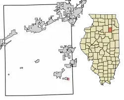 Location of East Brooklyn in Grundy County, Illinois. | |
.svg.png.webp) Location of Illinois in the United States | |
| Coordinates: 41°10′21″N 88°15′57″W | |
| Country | United States |
| State | Illinois |
| County | Grundy |
| Government | |
| • Mayor | Mary Kay Yatuni |
| Area | |
| • Total | 0.05 sq mi (0.13 km2) |
| • Land | 0.05 sq mi (0.13 km2) |
| • Water | 0.00 sq mi (0.00 km2) |
| Elevation | 584 ft (178 m) |
| Population (2010) | |
| • Total | 106 |
| • Estimate (2019)[2] | 105 |
| • Density | 2,019.23/sq mi (786.97/km2) |
| Time zone | UTC-6 (CST) |
| • Summer (DST) | UTC-5 (CDT) |
| ZIP Code(s) | 60474 |
| Area code(s) | 815 & 779 |
| FIPS code | 17-21579 |
| FIPS code | 17-21579 |
| GNIS ID | 2398770 |
| Wikimedia Commons | East Brooklyn, Illinois |
Geography
East Brooklyn is located at 41°10′21″N 88°15′57″W (41.172464, -88.265729).[3]
According to the 2010 census, East Brooklyn has a total area of 0.051 square miles (0.13 km2), of which 0.05 square miles (0.13 km2) (or 98.04%) is land and 0.001 square miles (0.00 km2) (or 1.96%) is water.[4]
Demographics
| Historical population | |||
|---|---|---|---|
| Census | Pop. | %± | |
| 1910 | 446 | — | |
| 1920 | 204 | −54.3% | |
| 1930 | 79 | −61.3% | |
| 1940 | 68 | −13.9% | |
| 1950 | 65 | −4.4% | |
| 1960 | 68 | 4.6% | |
| 1970 | 72 | 5.9% | |
| 1980 | 84 | 16.7% | |
| 1990 | 80 | −4.8% | |
| 2000 | 123 | 53.8% | |
| 2010 | 106 | −13.8% | |
| 2019 (est.) | 105 | [2] | −0.9% |
| U.S. Decennial Census[5] | |||
As of the census[6] of 2000, there were 123 people, 46 households, and 33 families residing in the village. The population density was 2,369.4 people per square mile (949.8/km2). There were 51 housing units at an average density of 982.4 per square mile (393.8/km2). The racial makeup of the village was 95.12% White, 0.81% Asian, 2.44% from other races, and 1.63% from two or more races. Hispanic or Latino of any race were 2.44% of the population.
There were 46 households, out of which 37.0% had children under the age of 18 living with them, 71.7% were married couples living together, and 26.1% were non-families. 23.9% of all households were made up of individuals, and 13.0% had someone living alone who was 65 years of age or older. The average household size was 2.67 and the average family size was 3.24.
In the village, the population was spread out, with 29.3% under the age of 18, 3.3% from 18 to 24, 32.5% from 25 to 44, 22.8% from 45 to 64, and 12.2% who were 65 years of age or older. The median age was 34 years. For every 100 females, there were 75.7 males. For every 100 females age 18 and over, there were 93.3 males.
The median income for a household in the village was $40,000, and the median income for a family was $47,500. The per capita income for the village was $21,470. There were 8.3% of families and 12.7% of the population living below the poverty line, including 14.7% of under eighteens and none of those over 64.
References
- "2019 U.S. Gazetteer Files". United States Census Bureau. Retrieved July 14, 2020.
- "Population and Housing Unit Estimates". United States Census Bureau. May 24, 2020. Retrieved May 27, 2020.
- "US Gazetteer files: 2010, 2000, and 1990". United States Census Bureau. 2011-02-12. Retrieved 2011-04-23.
- "G001 - Geographic Identifiers - 2010 Census Summary File 1". United States Census Bureau. Archived from the original on 2020-02-13. Retrieved 2015-08-03.
- "Census of Population and Housing". Census.gov. Retrieved June 4, 2015.
- "U.S. Census website". United States Census Bureau. Retrieved 2008-01-31.
Municipalities and communities of Grundy County, Illinois, United States | ||
|---|---|---|
| Cities | Map of Illinois highlighting Grundy County | |
| Villages | ||
| Townships | ||
| Unincorporated communities | ||
| Footnotes | ‡This populated place also has portions in an adjacent county or counties | |
| ||