South Wilmington, Illinois
South Wilmington is a village in Grundy County, Illinois, United States. The population was 681 at the 2010 census.
South Wilmington | |
|---|---|
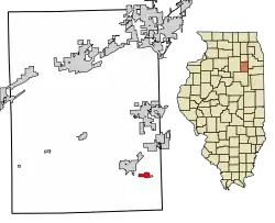 Location of South Wilmington in Grundy County, Illinois. | |
.svg.png.webp) Location of Illinois in the United States | |
| Coordinates: 41°10′24″N 88°16′35″W | |
| Country | United States |
| State | Illinois |
| County | Grundy |
| Government | |
| • Mayor | Richard Alderson |
| Area | |
| • Total | 0.49 sq mi (1.27 km2) |
| • Land | 0.49 sq mi (1.27 km2) |
| • Water | 0.00 sq mi (0.00 km2) |
| Elevation | 585 ft (178 m) |
| Population (2010) | |
| • Total | 681 |
| • Estimate (2019)[2] | 644 |
| • Density | 1,308.94/sq mi (505.49/km2) |
| Time zone | UTC-6 (CST) |
| • Summer (DST) | UTC-5 (CDT) |
| ZIP Code(s) | 60474 |
| Area code(s) | 815 and 779 |
| FIPS code | 17-71370 |
| Wikimedia Commons | South Wilmington, Illinois |
| Website | villageofsouthwilmington |
Although the name might indicate proximity to the city of Wilmington, South Wilmington is approximately 11 miles southwest of Wilmington, and is separated from it by several communities, including Gardner, Braceville, Godley, and Braidwood.
History
Louis Bottino (1907–1979), Illinois state representative and educator, was born in South Wilmington,[3]
Geography
South Wilmington is located at 41°10′24″N 88°16′35″W (41.173268, -88.276271).[4]
According to the 2010 census, South Wilmington has a total area of 0.56 square miles (1.45 km2), all land.[5]
Demographics
| Historical population | |||
|---|---|---|---|
| Census | Pop. | %± | |
| 1900 | 711 | — | |
| 1910 | 2,403 | 238.0% | |
| 1920 | 1,362 | −43.3% | |
| 1930 | 722 | −47.0% | |
| 1940 | 642 | −11.1% | |
| 1950 | 662 | 3.1% | |
| 1960 | 730 | 10.3% | |
| 1970 | 725 | −0.7% | |
| 1980 | 747 | 3.0% | |
| 1990 | 698 | −6.6% | |
| 2000 | 621 | −11.0% | |
| 2010 | 681 | 9.7% | |
| 2019 (est.) | 644 | [2] | −5.4% |
| U.S. Decennial Census[6] | |||
As of the census[7] of 2000, there were 621 people, 260 households, and 165 families residing in the village. The population density was 1,089.8 people per square mile (420.6/km2). There were 287 housing units at an average density of 503.7 per square mile (194.4/km2). The racial makeup of the village was 98.39% White, 0.97% from other races, and 0.64% from two or more races. Hispanic or Latino of any race were 2.42% of the population.
There were 260 households, out of which 26.9% had children under the age of 18 living with them, 52.7% were married couples living together, 7.7% had a female householder with no husband present, and 36.2% were non-families. 28.8% of all households were made up of individuals, and 18.1% had someone living alone who was 65 years of age or older. The average household size was 2.38 and the average family size was 2.98.
In the village, the population was spread out, with 23.5% under the age of 18, 6.6% from 18 to 24, 27.5% from 25 to 44, 20.8% from 45 to 64, and 21.6% who were 65 years of age or older. The median age was 40 years. For every 100 females, there were 93.5 males. For every 100 females age 18 and over, there were 96.3 males.
The median income for a household in the village was $39,688, and the median income for a family was $48,438. Males had a median income of $40,066 versus $28,750 for females. The per capita income for the village was $19,078. About 2.5% of families and 7.9% of the population were below the poverty line, including 15.5% of those under age 18 and none of those age 65 or over.
References
- "2019 U.S. Gazetteer Files". United States Census Bureau. Retrieved July 14, 2020.
- "Population and Housing Unit Estimates". United States Census Bureau. May 24, 2020. Retrieved May 27, 2020.
- "Illinois Blue Book 1959-1960, pg. 277-278
- "US Gazetteer files: 2010, 2000, and 1990". United States Census Bureau. 2011-02-12. Retrieved 2011-04-23.
- "G001 - Geographic Identifiers - 2010 Census Summary File 1". United States Census Bureau. Archived from the original on 2020-02-13. Retrieved 2015-12-25.
- "Census of Population and Housing". Census.gov. Retrieved June 4, 2015.
- "U.S. Census website". United States Census Bureau. Retrieved 2008-01-31.
Municipalities and communities of Grundy County, Illinois, United States | ||
|---|---|---|
| Cities | Map of Illinois highlighting Grundy County | |
| Villages | ||
| Townships | ||
| Unincorporated communities | ||
| Footnotes | ‡This populated place also has portions in an adjacent county or counties | |
| ||