Maine Township, Grundy County, Illinois
Maine Township is one of seventeen townships in Grundy County, Illinois, USA. As of the 2010 census, its population was 330 and it contained 120 housing units.[2]
Maine Township | |
|---|---|
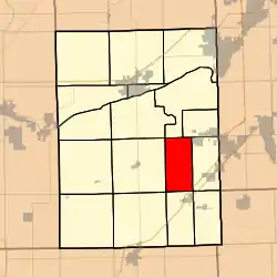 Location in Grundy County | |
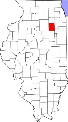 Grundy County's location in Illinois | |
| Coordinates: 41°14′40″N 88°19′54″W | |
| Country | United States |
| State | Illinois |
| County | Grundy |
| Established | March 18, 1898 |
| Area | |
| • Total | 18.09 sq mi (46.9 km2) |
| • Land | 17.91 sq mi (46.4 km2) |
| • Water | 0.18 sq mi (0.5 km2) 1.00% |
| Elevation | 558 ft (170 m) |
| Population (2010) | |
| • Estimate (2016)[1] | 323 |
| • Density | 18.4/sq mi (7.1/km2) |
| Time zone | UTC-6 (CST) |
| • Summer (DST) | UTC-5 (CDT) |
| ZIP codes | 60416, 60424, 60444 |
| FIPS code | 17-063-46175 |
Geography
According to the 2010 census, the township has a total area of 18.09 square miles (46.9 km2), of which 17.91 square miles (46.4 km2) (or 99.00%) is land and 0.18 square miles (0.47 km2) (or 1.00%) is water.[2]
Cities, towns, villages
- Coal City (southwest edge)
Unincorporated towns
- Gorman at 41.261143°N 88.341731°W
- Harrisonville at 41.287254°N 88.304786°W
(This list is based on USGS data and may include former settlements.)
Major highways
Airports and landing strips
- Matteson RLA Airport
School districts
- Coal City Community Unit School District 1
Political districts
- Illinois' 11th congressional district
- State House District 75
- State Senate District 38
References
- "Maine Township, Grundy County, Illinois". Geographic Names Information System. United States Geological Survey. Retrieved 2010-01-17.
- United States Census Bureau 2007 TIGER/Line Shapefiles
- United States National Atlas
- "Population and Housing Unit Estimates". Retrieved June 9, 2017.
- "Population, Housing Units, Area, and Density: 2010 - County -- County Subdivision and Place -- 2010 Census Summary File 1". United States Census. Archived from the original on 2020-02-12. Retrieved 2013-05-28.
- "Census of Population and Housing". Census.gov. Retrieved June 4, 2016.
External links
Places adjacent to Maine Township, Grundy County, Illinois | |
|---|---|
Municipalities and communities of Grundy County, Illinois, United States | ||
|---|---|---|
| Cities | Map of Illinois highlighting Grundy County | |
| Villages | ||
| Townships | ||
| Unincorporated communities | ||
| Footnotes | ‡This populated place also has portions in an adjacent county or counties | |
| ||
| Authority control |
|
|---|
This article is issued from Wikipedia. The text is licensed under Creative Commons - Attribution - Sharealike. Additional terms may apply for the media files.