East Huntspill
East Huntspill is a village and civil parish on the Huntspill Level, near Highbridge, Somerset, England. The civil parish includes Cote, Hackness and Bason Bridge.
| East Huntspill | |
|---|---|
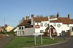
 The Crown Inn and road junction | |
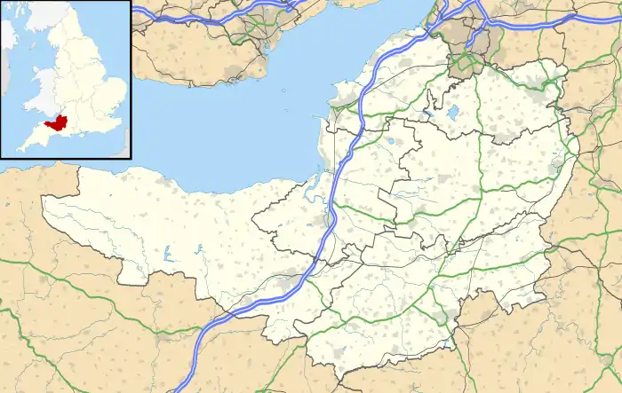
 East Huntspill Location within Somerset | |
| Population | 1,146 (2011)[1] |
| OS grid reference | ST344454 |
| Civil parish |
|
| District | |
| Shire county | |
| Region | |
| Country | England |
| Sovereign state | United Kingdom |
| Post town | HIGHBRIDGE |
| Postcode district | TA9 |
| Dialling code | 01278 |
| Police | Avon and Somerset |
| Fire | Devon and Somerset |
| Ambulance | South Western |
| UK Parliament | |
The parish of East Huntspill has a population of 1,146.[1]
History
Huntspill was listed in the Domesday Book of 1086 as Honspil, meaning 'Huna's creek' possibly from the Old English personal name Huna and from the Celtic pwll.[2]
The parish of Huntspill was part of the Huntspill and Puriton Hundred.[3]
Three 18th century farmhouses in East Huntspill, Hackney, New Road and Phippins, have all been designated as Grade II listed buildings.[4][5][6]
In 1949 the civil parish of Huntspill was abolished and divided into Huntspill All Saints and West Huntspill along the line of the Bristol and Exeter Railway.[7] The parish of Huntspill All Saints was renamed East Hunstspill in 1972.[8]
Governance
The village falls within the Non-metropolitan district of Sedgemoor, which was formed on 1 April 1974 under the Local Government Act 1972, having previously been part of Bridgwater Rural District.[9]
Religious sites

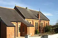
The Anglican parish Church of All Saints in East Huntspill was built in 1839 by G P Manners, as a chapel-of-ease to the then parish church at Huntspill. It became the parish church in 1845, when the chapelry was formed into a parochial district,[8] and the bell-chamber was added in the late 19th century.[10] It has been designated as a Grade II listed building.[11] It is on the Heritage at Risk Register because of the condition of the roof.[12]
There was a United Methodist chapel in East Huntspill built in 1923, which replaced an earlier building in Chapel Lane. The chapel closed by 1997.[8]
See also
References
- "Statistics for Wards, LSOAs and Parishes — SUMMARY Profiles" (Excel). Somerset Intelligence. Retrieved 4 January 2014.
- Robinson, Stephen (1992). Somerset Place Names. Wimborne, Dorset: The Dovecote Press Ltd. ISBN 1-874336-03-2.
- "Somerset Hundreds". GENUKI. Retrieved 15 October 2011.
- Historic England. "Phippins Farmhouses, Barn and Forecourt Wall, New Road (1173314)". National Heritage List for England. Retrieved 25 January 2015.
- Historic England. "New Road Farmhouse (1296263)". National Heritage List for England. Retrieved 25 January 2015.
- Historic England. "Hackney Farmhouse with attached outbuilding and wall (1344660)". National Heritage List for England. Retrieved 25 January 2015.
- Vision of Britain website
- Robert Dunning, ed. (2004). "Huntspill". A History of the County of Somerset: Volume 8, the Poldens and the Levels. Victoria County History. British History Online. pp. 91–112. Retrieved 25 January 2015.
- "Bridgwater RD". A vision of Britain Through Time. University of Portsmouth. Retrieved 4 January 2014.
- Historic England. "Church of All Saints (1060130)". National Heritage List for England. Retrieved 20 February 2009.
- Historic England. "Church of all Saints (1060130)". National Heritage List for England. Retrieved 25 January 2015.
- "Church of All Saints, Church Road, East Huntspill — Sedgemoor". Heritage at Risk. English Heritage. Archived from the original on 8 January 2014. Retrieved 14 October 2013.
- Moore, R. (2005) A Parish Survey of East Huntspill and Bason Bridge (available via Somerset Studies Library, Taunton)
External links
![]() Media related to East Huntspill at Wikimedia Commons
Media related to East Huntspill at Wikimedia Commons
- A History of the County of Somerset: Volume 8: The Poldens and the Levels: Huntspill (2004)
- The Somerset Urban Archaeological Survey: Burnham and Highbridge by Clare Gathercole

