East Rockingham, Western Australia
East Rockingham is an industrial suburb within the Kwinana Industrial Area, part of Perth, and located within the City of Rockingham. It is home to two caravan parks.
| East Rockingham Perth, Western Australia | |||||||||||||||
|---|---|---|---|---|---|---|---|---|---|---|---|---|---|---|---|
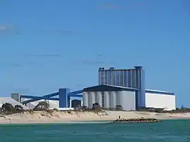 CBH Grain Terminal, East Rockingham | |||||||||||||||
 East Rockingham | |||||||||||||||
| Coordinates | 32.259°S 115.770°E | ||||||||||||||
| Population | 211 (2006 census)[1] | ||||||||||||||
| Postcode(s) | 6168 | ||||||||||||||
| LGA(s) | City of Rockingham | ||||||||||||||
| State electorate(s) | Rockingham | ||||||||||||||
| Federal Division(s) | Brand | ||||||||||||||
| |||||||||||||||
History
The suburb developed as a rural community in the 1850s when various pioneers took up land and settled in the area along Mandurah Road; however, the community declined following the opening of the port at Rockingham in 1872.[2] The Rockingham Road Board's offices were located in East Rockingham between 1905 and 1929.[3]
The Stephenson-Hepburn Plan for Perth and Fremantle (1955) identified the strategic importance of the locality for industrial development. The suburb today contains various industrial developments, with LandCorp making plans to release more land for industrial purposes.[4] The Water Corporation intends to construct a wastewater treatment facility in East Rockingham.[5]
The suburb was named Challenger for a period between 1992 and 1996.
Places of natural and cultural heritage significance
As of 2020, 113 places are heritage-listed in the City of Rockingham,[6] of which seven are on the State Register of Heritage Places, with five of those located in East Rockingham.[7]
Significant places:
- The Pines and Paradise (ruins, sites of farm cottages)
- Mona's Mount (a.k.a. Key Cottage) - farm cottage
- Wheatfields - former farm cottage
- Smirk's Cottage - former farm cottage
- Sloan's Cottage - former farm cottage.
- WW2 coastal defence bunker
- East Rockingham School site
- East Rockingham Roads Board office site
- East Rockingham Pioneer Cemetery
- Hymus house and dairy
- Chesterfield inn (ruin) and dairy (ruin)
- Woodbine (a.k.a. Bell's Cottage) ruin
- Sam Chalwell's house site
- Ellendale (a.k.a. Day Cottage)
- Old Abattoir (ruin)
- Lealholm (ruin)
- Lake Cooloongup Flora and Fauna Reserve
References
- Australian Bureau of Statistics (25 October 2007). "East Rockingham (State Suburb)". 2006 Census QuickStats. Retrieved 5 October 2008.
- Taggart, Nora. Rockingham Looks Back. Rockingham District Historical Society (Inc.), 1984
- Draper, Richard. Rockingham - The Vision Unfolds. City of Rockingham, 1997
- Rockingham Industry Zone
- East Rockingham Wastewater Treatment Plant Archived 3 March 2011 at the Wayback Machine
- "City of Rockingham Heritage Places". inherit.stateheritage.wa.gov.au. Heritage Council of Western Australia. Retrieved 8 February 2020.
- "City of Rockingham State Register of Heritage Places". inherit.stateheritage.wa.gov.au. Heritage Council of Western Australia. Retrieved 8 February 2020.