List of State Register of Heritage Places in the City of Rockingham
This is a list of State Register of Heritage Places in the City of Rockingham, Western Australia. The State Register of Heritage Places is maintained by the Heritage Council of Western Australia.
As of 2020, 113 places are heritage-listed in the City of Rockingham,[1] of which seven are on the State Register of Heritage Places.[2]
List
State Register of Heritage Places
The Western Australian State Register of Heritage Places, as of 2020, lists the following seven state registered places within the City of Rockingham. An eighth place, the Rockingham Hotel, was added to the State Register of Heritage Places in 2008 but removed again on 7 June 2011:[3]
| Place name | Place # | Location | Suburb or town | Co-ordinates | Built | Stateregistered | Notes | Photo |
|---|---|---|---|---|---|---|---|---|
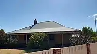
| Bell Cottage | 2329 | 371 Mandurah Road | East Rockingham | 32°15′44″S 115°46′52″E | 1868 | 27 September 2002 |
|
 |
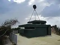
| Cape Peron K Battery Complex | 3365 | End of Point Peron Road, Cape Peron | Peron | 32°16′11″S 115°41′19″E | 1942–45 | 13 October 2019 |
|
 |
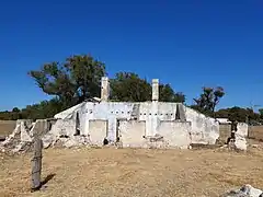
| Chesterfield Inn | 2325 | Chesterfield Road | East Rockingham | 32°15′51″S 115°46′40″E | 1855 | 27 June 2003 |
|
 |
| Chesterfield Inn Stables | 2326 | Chesterfield Road | East Rockingham | 32°15′45″S 115°46′40″E |
|
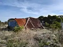 | ||
| Day Cottage | 4015 | Day Road | East Rockingham | 32°16′24″S 115°46′35″E | 1882 | 4 May 2001 |
|
%252C_September_2019_03.jpg.webp) |
| Hymus House and Outbuildings | 2320 | 303 Mandurah Road | East Rockingham | 32°15′34″S 115°46′53″E | 1895 | 17 February 2006 |
|
 |
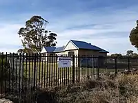
| Lake Richmond | 18483 | Richmond Avenue | Rockingham | 32°17′08″S 115°42′41″E | Formed approximately 4000 years ago | 30 June 2017 |
|
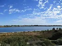 |
City of Rockingham heritage-listed places
The following places are heritage listed in the City of Rockingham but are not State registered:
| Place name | Place # | Street number | Street name | Suburb or town | Co-ordinates | Notes & former names | Photo |
|---|---|---|---|---|---|---|---|
| Rockingham Infant Health Centre | 119 | Corner Wanliss and Smythe Streets | Rockingham | ||||
| Rockingham Hotel | 2321 | 26 | Kent Street | Rockingham | 32.275674°S 115.731428°E | Port Hotel (former) | 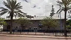 |
| Site of Old Chalwell House † | 2322 | Mandurah Road | Rockingham | 32.268930°S 115.778212°E | Demolished | ||
| Anglican Church (former) | 2323 | 63-65 | Kent Street | Rockingham | 32.273631°S 115.735876°E | St Nicholas Church |  |
| Second Roads Board Office (former) | 2324 | 41 | Kent Street | Rockingham | 32.275298°S 115.732773°E | Rockingham Museum, Rockingham Districts Historical Society | 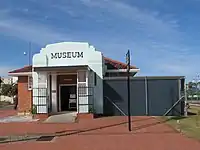 |
| Uniting Church | 2328 | 11 | Florence Street | Rockingham | 32.279246°S 115.725963°E | Methodist Church, Lutheran Church | 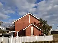 |
| Abattoir (former), East Rockingham | 3126 | Corner | Dixon Road & Darile Street | Hillman | 32.277931°S 115.772357°E | 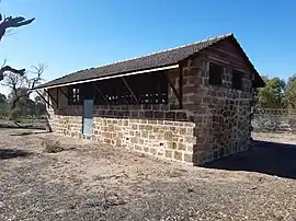 | |
| Baldivis Primary School | 3127 | 342 | Baldivis Road | Baldivis | 32.307365°S 115.817079°E | Baldivis Play Group, Day Centre & Art Centre | 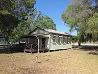 |
| Bell and Churchill Parks | 3141 | Lot 148-149 | Rockingham Beach Road | Rockingham | 32.275059°S 115.729782°E | 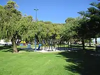 | |
| Bush Reserve | 3144 | Baldivis & Karnup Roads surrounds | Baldivis | ||||
| East Rockingham Cemetery | 3145 | 231 | Mandurah Road | East Rockingham | 32.253069°S 115.782583°E | 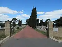 | |
| Cruising Yacht Club | 3146 | 2 | Val Street | Rockingham | 32.276064°S 115.727516°E | Friday Club | 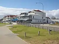 |
| Frank Churcher's Residence - site † | 3147 | 163 | Rockingham Beach Road | Rockingham | 32.264967°S 115.744422°E | Demolished in 2005 | |
| Freshwater Coral Site | 3148 | 2 | Lodge Drive | East Rockingham | 32.268722°S 115.777875°E | ||
| Group Settler's Home | 3149 | 118 | Fifty Road | Baldivis | 32.309281°S 115.807116°E | ||
| Millars Cottages (former) - Site † | 3150 | 196 | Parkin Street | Rockingham | 32.277939°S 115.728873°E | Demolished in 2002 | |
| Natural Bush Reserve, Rear of Baldivis School | 3158 | 342 | Baldivis Road | Baldivis | 32.306368°S 115.819404°E | 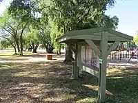 | |
| Penguin Island and Mersey Point | 3164 | Penguin Island | Shoalwater | 32.304310°S 115.700664°E | 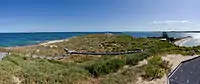 | ||
| Pine Tree (site of) | 3174 | Corner | Rockingham Beach Road & Wanliss Street | Rockingham | Lone Pine | ||
| Monkhouse Residence - Site † | 3183 | 54 | Penguin Road | Shoalwater | 32.303219°S 115.709294°E | Demolished in 2005 | |
| Turtle Factory (former) † | 3203 | Point Peron Road | Peron | 32.275525°S 115.703997°E | Peron House, Cruising Yacht Club, Sacred Heart ConventDemolished around 1978 | 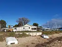 | |
| Rockingham Beach Primary School | 3205 | 30 | Bay View Street | Rockingham | 32.282242°S 115.722357°E | Heritage Building | 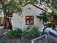 |
| Rockingham Hotel Walls | 3217 | 32.275576°S 115.731728°E | Kent Street | Rockingham |  | ||
| Rockingham Hotel Trees | 3218 | 26-40 | Kent Street | Rockingham | 32.275443°S 115.731593°E | Four pine trees | 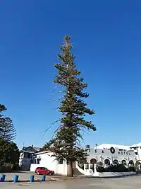 |
| Rockingham Oval and Memorial | 3225 | Kent Street, Flinders Lane, Patterson Street | Rockingham | 32.276235°S 115.732890°E | Showground, Village Green,War Memorial | 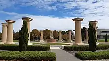 | |
| Rockingham Park Kindergarten (former) | 3243 | Lot 716 | Centaurus Street | Rockingham | 32.290013°S 115.738531°E | Bungaree Kindergarten and Pre-primary | 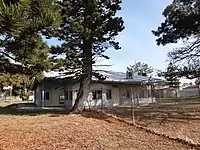 |
| Rockingham Park Underpasses | 3245 | 1 | Council Avenue | Rockingham | 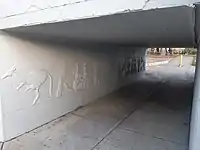 | ||
| Safety Bay Butcher's Shop (former) | 3250 | 44 | Penguin Road | Safety Bay | 32.303637°S 115.708189°E | ||
| Safety Bay Yacht Club | 3252 | Safety Bay Road | Safety Bay | 32.304636°S 115.711719°E | 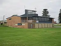 | ||
| Peelhurst (ruins), Golden Bay | 3256 | 178 | Dampier Drive | Golden Bay | 32.426240°S 115.769718°E | Thomas Peel Reserve, Thomas Peel Juniors Homestead | 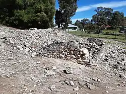 |
| Trocadero Dance Hall - Site † | 3258 | 25 | Rockingham Beach Road | Rockingham | 32.274670°S 115.731578°E | Palais de Dance, The Hostel, Trocadero Dance HallDemolished in 2009 | |
| Challenger Battery | 3301 | Entrance Point | Garden Island | 32.1587°S 115.6647°E | "J" Heavy Battery | 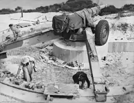 | |
| Port Kennedy Scientific Park | 3361 | Port Kennedy Dve | Port Kennedy | 32.374019°S 115.728619°E |  | ||
| Lucy Saw Home | 3370 | 65 | Parkin Street | Rockingham | 32.280042°S 115.718501°E | Saw Family Home, Lakeside, Serenity Lodge | 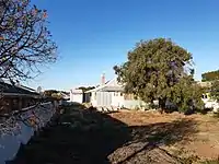 |
| Site of Bell Homestead and Pine Tree † | 3637 | 43 | Rockingham Beach Road | Rockingham | 32.274295°S 115.732184°E | Bell House, Malibu Diving, Lone PineBuilding demolished in the 1960s, tree removed in 1997 | |
| East Rockingham Heritage Precinct | 3841 | Rockingham | 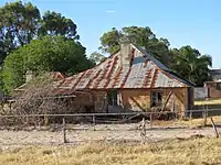 | ||||
| Penguin Island Kitchen & Store Cave | 4287 | East Side of | Penguin Island | Shoalwater Bay | 32.303126°S 115.690693°E | ||
| Penguin Island Well | 4303 | East Side of | Penguin Island | Shoalwater Bay | 32.304182°S 115.690580°E | ||
| Tuart Tree | 4375 | Anstey Swamp | Rockingham | ||||
| Garden Island | 4501 | North of | Rockingham | 32.193333°S 115.671111°E | Bauche Island | 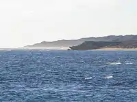 | |
| Paganoni Swamp & Adjacent Areas | 4502 | Mandurah Road | Rockingham | 32.440163°S 115.782724°E | 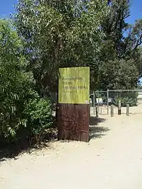 | ||
| Point Peron Recreational Camp | 4646 | Point Peron Road | Rockingham | 32.269945°S 115.691116°E | 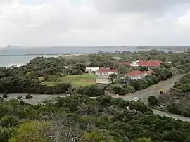 | ||
| Date Palm Tree | 4863 | Civic Boulevard | Rockingham | ||||
| Linear Wetlands | 10310 | Quindalup Dunes | Port Kennedy | ||||
| St Nicholas Church & Z-Force Memorial | 11613 | Corner | Baralda Court & Council Avenue | Rockingham | 32.291433°S 115.744699°E | 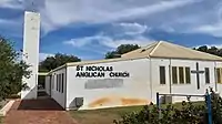 | |
| St George's Church | 11615 | 14 | Scott Road | Safety Bay | 32.298530°S 115.711898°E | 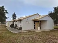 | |
| Rectory | 11636 | 28 | Brixham Way | Warnbro | 32.333140°S 115.754169°E | ||
| Rockingham Sunday Markets | 12990 | Flinders Lane | Rockingham | ||||
| Flinder's Hall and Rose Garden (former) † | 13053 | 1 | Empress Corner | Rockingham | 32.276035°S 115.733650°E | Demolished in 2007 | |
| Z-Force Memorial, Rockingham | 13166 | The Esplanade | Rockingham | 32.276900°S 115.720445°E | Catalpa Park |  | |
| Iluka | 13651 | 13 | The Esplanade | Rockingham | 32.275708°S 115.712372°E | 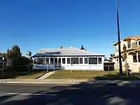 | |
| Z-Force Memorial | 13778 | Garden Island North of | Rockingham | 32.222947°S 115.686316°E | |||
| Rockingham Fire Station | 14638 | Dixon Road | Rockingham | 32.276654°S 115.768225°E | 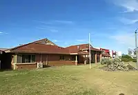 | ||
| Rockingham Fire Station | 14639 | Hefron Street | Rockingham | 32.291624°S 115.745955°E |  | ||
| Rockingham Police Station & Courthouse (former) † | 16784 | Corner of Smythe Street & Flinders Lane | Rockingham | 32.276878°S 115.734379°E | Demolished in 2003 | ||
| Palm Beach Precinct | 16809 | Bounded by Hymus, Lake & Fisher Streets, & beach parallel to The Esplanade | Rockingham | 32.276671°S 115.720509°E | |||
| House | 16810 | 211 | Safety Bay Road | Safety Bay | 32.302239°S 115.710680°E | 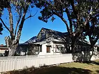 | |
| Rockingham Police Station & CIB † | 17316 | Smyth Street | Rockingham | 32.276878°S 115.734379°E | Demolished in 2003 | ||
| Elanora - site † | 17814 | 49 | Rockingham Beach Road | Rockingham | 32.273981°S 115.733127°E | Music House, Bell HouseDemolished around 2007 | |
| Rockingham Hotel Site | 17865 | 25 | Rockingham Beach Road | Rockingham | |||
| Cliff Point Historic Site | 18184 | Sulphur Bay | Garden Island | 32.187559°S 115.676519°E | Well at Sulphur Bay and Sulphur Town, Foundations of Stirling's Hut | ||
| J.F. Mills' Residence – Site and Tree | 18481 | Garden Island | 32.229815°S 115.686384°E | ||||
| Kwinana Grain Terminal, Granary Museum & Jetty | 18482 | Lot 1304 & 1585 Rockingham Beach Road | East Rockingham | 32.258705°S 115.751428°E | 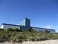 | ||
| Timber Railway - site † | 18484 | Railway Terrace | Rockingham | 32.276395°S 115.729281°E | Railway tracks removed in 1949 | ||
| Police Station - site † | 18485 | Lot 8002 | Kent Street | Rockingham | 32.276306°S 115.731057°E | Demolished in 1976 | |
| Rockingham Beach School - site † | 18486 | 9 | Kent Street | Rockingham | 32.276760°S 115.730738°E | Demolished in the 1960s | |
| Fisher's Bakery - site † | 18487 | 175 | Parkin Street | Rockingham | 32.277320°S 115.729569°E | Demolished, date unknown | |
| Rockingham Cairn | 18488 | Lot 439 | Rockingham Beach Road | East Rockingham | 32.261435°S 115.747139°E | 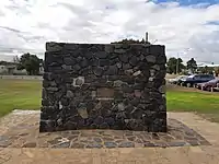 | |
| Founders' Memorial | 18489 | Railway Terrace | Rockingham | 32.277056°S 115.730000°E | 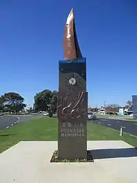 | ||
| Rockingham Beach Post Office - site † | 18490 | Corner Kent Street & Railway Terrace | Rockingham | 32.276478°S 115.729797°E | Demolished around 1984 | ||
| Masonic Hall | 18491 | 13 | Wanliss Street | Rockingham | 32.275838°S 115.736763°E | 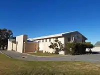 | |
| Alfred Hines Seaside Home | 18492 | 1 | Hymus Street | Peron | 32.276047°S 115.710628°E | Seaside Camp for Children, Crippled Children's Seaside Home | 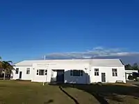 |
| A.J.H. Watts Land Sales Office (former) | 18493 | 229 | Safety Bay Road | Safety Bay | 32.303676°S 115.711197°E | Glenway Realty | 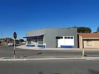 |
| Palm Beach Jetty - site † | 18494 | End of Fisher Street, Palm Beach, Mangles Bay | Rockingham | 32.275988°S 115.720586°E | Naval Jetty (Site of), Fisher Street Jetty, Pine Beach JettyDemolished in 2008 and replaced with a new jetty in 2010 | 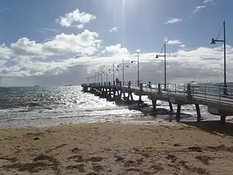 | |
| Garden Island Batteries | 18495 | Cockburn Sound Locations 9 & 696 | Garden Island | Beacon Battery, Scriven Hill Battery and Collie Section Battery, Challenger Battery | |||
| Sites of Three Timber Jetties † | 18496 | Palm Beach, west of Railway Terrace | Rockingham | 32.274732°S 115.728158°E | Final structures removed in 2009 | ||
| Dato Shipwreck | 18622 | Careening Bay | Garden Island | 32.237500°S 115.691389°E | |||
| Chalmers Shipwreck | 18632 | Port Kennedy | 32.367167°S 115.690617°E | ||||
| Hero of the Nile Shipwreck | 18654 | Port Kennedy | 32.364450°S 115.705950°E | ||||
| Star Shipwreck | 18732 | Murray Reefs | 3km West of Port Kennedy/Warnbro Sound | 32.376500°S 115.683833°E | |||
| Rockingham Jetty † | 18779 | Opposite Railway Road | Rockingham | 32.275316°S 115.726483°E | Final structures of original jetty removed in 2009, replaced by new jetty | 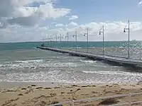 | |
| Secret Harbour Police Station | 19000 | Oneida Road | Secret Harbour | ||||
| Carinya Court | 19932 | 153 | Esplanade | Rockingham | 32.276369°S 115.727157°E | Esplanade Flats | 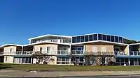 |
| CWA Centre | 19933 | 12 | Watts Road | Shoalwater | 32.300885°S 115.709554°E | 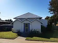 | |
| Arcadia House - Site † | 19934 | 216 | Arcadia Drive | Safety Bay | 32.304189°S 115.710479°E | Ye Olde Safety Bay Inn, Safety Bay Guest House, Arcadia Lodge, C Side Lodge, Gregmar Lodge, Kingsview LodgeDemolished in 2007 | |
| Golf Course - Site † | 19935 | Corner | Patterson Road and Read Street | Rockingham | 32.282218°S 115.739879°E | Relocated in 1985 | |
| Racecourse - Site | 19936 | Flinders Lane | Rockingham | 32.274977°S 115.733841°E | |||
| Rockingham Roads Board Site | 19937 | 90 | Office Road | East Rockingham | 32.250213°S 115.781995°E | Roads Boards Office and East Rockingham School - Site | 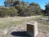 |
| Rockingham Theatres - site † | 19938 | Kent Street | Rockingham | 32.275219°S 115.732202°E & 32.276401°S 115.730193°E | Demolished | ||
| Aloha & Oahu | 19939 | 166 - 168 | Arcadia Drive | Shoalwater | 32.305055°S 115.703652°E | 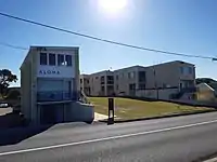 | |
| Residence, 118 Arcadia Drive | 19940 | 118 | Arcadia Drive | Shoalwater | 32.301001°S 115.704270°E | 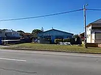 | |
| Residence, 250 Safety Bay Road | 19941 | 250 | Safety Bay Road | Safety Bay | 32.304039°S 115.713762°E | ||
| Residence, 505 Safety Bay Road | 19942 | 505 | Safety Bay Road | Safety Bay | 32.315080°S 115.738895°E | ||
| Residence, 623 Safety Bay Road | 19943 | 623 | Safety Bay Road | Waikiki | 32.324381°S 115.746966°E | ||
| Residence, 72a Penguin Road | 19944 | 72a | Penguin Road | Safety Bay | 32.303108°S 115.711969°E | ||
| Residence, 188 Safety Bay Road | 19945 | 188 | Safety Bay Road | Safety Bay | 32.299873°S 115.710585°E | 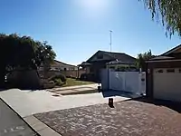 | |
| Residence, 218 Safety Bay Road | 19946 | 218 | Safety Bay Road | Safety Bay | 32.302621°S 115.711384°E | ||
| Residence, 3 Chalwell Street | 19947 | 3 | Chalwell Street | Rockingham | 32.277491°S 115.717211°E | ||
| Residence, 21 Waimea Road | 19948 | 21 | Waimea Road | Safety Bay | 32.299915°S 115.713818°E | ||
| Residence, 5 Martell Street | 19949 | 5 | Martell Street | Warnbro | 32.332351°S 115.749614°E | ||
| Residence, 274 Safety Bay Road | 19950 | 274 | Safety Bay Road | Safety Bay | 32.304743°S 115.716412°E | 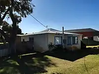 | |
| Residence, 124 Arcadia Drive | 20047 | 124 | Arcadia Drive | Shoalwater | 32.301551°S 115.704087°E | ||
| Limestone Quarry | 24537 | Chesterfield Road | East Rockingham | 32.264363°S 115.774087°E | |||
| AIW Centre, Peron † | 25661 | 2058 | Point Peron Road | Peron | 32.276512°S 115.709025°E | Demolished in 2017 | |
| RSL Caravan Park, Peron | 25662 | Lot 501 | Point Peron Road | Peron | 32.276446°S 115.707536°E | 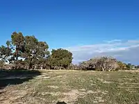 |
- † Denotes building has been demolished
References
- "City of Rockingham Heritage Places". inherit.stateheritage.wa.gov.au. Heritage Council of Western Australia. Retrieved 8 February 2020.
- "City of Rockingham State Register of Heritage Places". inherit.stateheritage.wa.gov.au. Heritage Council of Western Australia. Retrieved 8 February 2020.
- "Rockingham Hotel (Place Number 02321)". inherit.stateheritage.wa.gov.au. Heritage Council of Western Australia. Retrieved 14 May 2020.
External links
This article is issued from Wikipedia. The text is licensed under Creative Commons - Attribution - Sharealike. Additional terms may apply for the media files.