East Stratton
East Stratton is an estate village in the parish of Micheldever at the entrance to the landscaped grounds of Stratton Park, some eight miles northeast of Winchester, Hampshire, England.[1][2] Both park and village demonstrate the evolution of a landscape directed by three eminent families - Wriothesley, Russell and Baring - during the 17th, 18th and 19th centuries.
| East Stratton | |
|---|---|
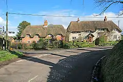
 Thatched houses in East Stratton | |
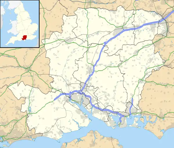
 East Stratton Location within Hampshire | |
| Population | 200 |
| OS grid reference | SU541400 |
| District | |
| Shire county | |
| Region | |
| Country | England |
| Sovereign state | United Kingdom |
| Post town | WINCHESTER |
| Postcode district | SO21 |
| Dialling code | 01962 |
| Police | Hampshire |
| Fire | Hampshire |
| Ambulance | South Central |
| UK Parliament | |
In East Stratton can clearly be seen a sequence of village development stretching over four centuries. At the north end, thatched cottages dating from the 17th and 18th centuries border the lane which sweeps down to the entrance of the Park. Around the village cross-roads and War Memorial are grouped other cottages and the 'new' 19th-century church, All Saints, East Stratton and farm. Further south are five pairs of early 19th-century estate cottages and the 19th-century Plough Inn (now renamed the Northbrook Arms). A dozen houses erected in this century by the Rural District and Forestry Commission now extend the village as far as Cold Harbour, once a small separate hamlet.
The name Stratton comes from Old English and means farmstead or village on a Roman road.[3]
History
The Manor of East Stratton was granted to the New Minster (Hyde Abbey) about AD900 by King Edward the Elder and remained in the Abbey's hands until the Dissolution. In 1564 the manor was purchased for £1,318 by Sir Thomas Wriothesley, later Earl of Southampton (d.1550). The last earl, Thomas (d.1667), made "the house at Stratton Park one of his chief seats in the Country." He was probably responsible for first enclosing the park.
In 1667 the manor passed to Thomas's daughter Lady Rachel and her husband William, Lord Russell who is said to have "pulled down part of the town or hamlet of Stratton and laid it into his Dear Park". Lord and Lady Russell improved the estate and house, laying out "orchards, gardens and avenues, planted groves, wildernesses and other ornaments to adorn and accommodate this beautiful and pleasant scene". Lord Russell was executed in 1683 for complicity in the Rye House Plot but Lady Russell continued to look after the estate until her death in 1723.
In 1723 the estate passed to Lady Russell's grandson Wriothesley Russell, 3rd Duke of Bedford. He is generally credited with the demolition of "a great part of the ancient mansion at Stratton Park lest it should cause the magnificent residence at Woburn Abbey to be neglected ..."
In 1801 Sir Francis Baring purchased the estate for £150,000 and the Baring family have owned the Stratton estate ever since. Sir Francis immediately started improving the estate. The old house was removed and remodelled in the classic style by George Dance Jnr who designed the 'new cottages'. The House became The Vyne Stratton School in the 1920s, but not for long.
Open fields round the village were closed in 1800–1850, the park was twice extended south and new cottages and the Plough Inn were erected at the south end of the village. East Stratton Farm lay in the middle of the new road to the New Farm. By the middle of the century much of the old village had been knocked down for improvements to the park.
Opposite where the old church had stood a new school was built, to replace the old one which had burnt down, by Sir Thomas Baring in 1846, he described it as 'a neat Elizabethan style' and it still stand in the park today. The school could accommodate 150 children but its average attendance was 60. It was closed in the 1960s
The old church which had been largely rebuilt in 1810 was demolished and a cross was built in its place. The new church, All Saints, was built in the village and was opened in 1888.
References
- Ordnance Survey: Landranger map sheet 185 Winchester & Basingstoke (Andover & Romsey) (Map). Ordnance Survey. 2013. ISBN 9780319228845.
- "Ordnance Survey: 1:50,000 Scale Gazetteer" (csv (download)). www.ordnancesurvey.co.uk. Ordnance Survey. 1 January 2016. Retrieved 18 February 2016.
- Mills, A.D. (2011) [first published 1991]. A Dictionary of British Place Names (First edition revised 2011 ed.). Oxford: Oxford University Press. p. 441. ISBN 9780199609086.
