Eden Township, Decatur County, Iowa
Eden Township is a township in Decatur County, Iowa, USA. As of the 2000 census, its population was 279.
Eden Township | |
|---|---|
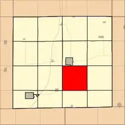 Location in Decatur County | |
| Coordinates: 40°41′12″N 93°43′14″W | |
| Country | United States |
| State | |
| County | Decatur |
| Area | |
| • Total | 36.17 sq mi (93.67 km2) |
| • Land | 36.13 sq mi (93.58 km2) |
| • Water | 0.03 sq mi (0.09 km2) 0.1% |
| Elevation | 1,086 ft (331 m) |
| Population (2000) | |
| • Total | 279 |
| • Density | 7.7/sq mi (3/km2) |
| GNIS feature ID | 0467763 |
Geography
Eden Township covers an area of 36.17 square miles (93.67 square kilometers); of this, 0.03 square miles (0.09 square kilometers) or 0.1 percent is water. The streams of Britton Branch and McGruder Creek run through this township.
Unincorporated towns
- Blockly
(This list is based on USGS data and may include former settlements.)
Adjacent townships
- Center Township (north)
- High Point Township (northeast)
- Woodland Township (east)
- Morgan Township (southeast)
- Hamilton Township (south)
- New Buda Township (southwest)
- Burrell Township (west)
- Decatur Township (northwest)
- Leon Township (northwest)
Cemeteries
The township contains eight cemeteries: Bethel, Campbell, Chastain, County Home, Hatfield, Manchester, Meek and Mount Tabor.
Major highways
Climate
This region has significant seasonal temperature differences, going from warm summers to very cold winters. There is precipitation year-round, and snowfall occurs in almost areas. Most summer rainfall occurs during thunderstorms and a very occasional tropical system. Area is only classified as humid because it is not dry enough to be classified as semi-arid or arid.[1]
| Climate data for Eden Township, Iowa | |||||||||||||
|---|---|---|---|---|---|---|---|---|---|---|---|---|---|
| Month | Jan | Feb | Mar | Apr | May | Jun | Jul | Aug | Sep | Oct | Nov | Dec | Year |
| Average high °C (°F) | −2 (28) |
1 (33) |
8 (46) |
17 (62) |
22 (72) |
27 (81) |
29 (85) |
28 (83) |
24 (76) |
18 (64) |
8 (47) |
0 (32) |
15 (59) |
| Average low °C (°F) | −12 (10) |
−9 (15) |
−3 (26) |
3 (38) |
9 (49) |
14 (58) |
17 (62) |
16 (60) |
11 (51) |
5 (41) |
−2 (28) |
−9 (16) |
3 (38) |
| Average precipitation days | 1.1 | 1.0 | 2.1 | 3.4 | 4.2 | 4.4 | 3.9 | 3.7 | 3.4 | 2.4 | 1.8 | 1.4 | 32.7 |
| Source: Weatherbase [2] | |||||||||||||
References
- http://www.weatherbase.com/weather/weather-summary.php3?s=865831&cityname=Vinton%2C+Iowa%2C+United+States+of+America&units=
- "Weatherbase". Weatherbase. 2013. Retrieved on May 5, 2013.
External links
Municipalities and communities of Decatur County, Iowa, United States | ||
|---|---|---|
| Cities | Map of Iowa highlighting Decatur County | |
| Townships | ||
| Unincorporated communities | ||
| ||