Eglinton Island
Eglinton Island an uninhabited island of the Canadian Arctic Archipelago in the Northwest Territories, Canada. Eglinton is one of the Queen Elizabeth Islands. Located at 75°48'N 118°30'W, it measures 1,541 km2 (595 sq mi) in size, 73 kilometres (45 mi) long and 44 kilometres (27 mi) wide in measurements. It lies on the north side of the M'Clure Strait, just south of the much larger Prince Patrick Island and is uninhabited with no known human activity.
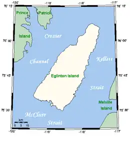 Closeup of Eglinton Island | |
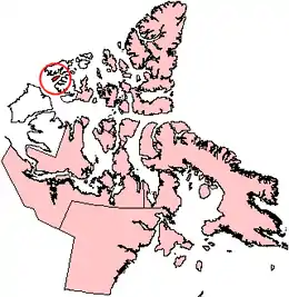 Eglinton Island, Northwest Territories | |
| Geography | |
|---|---|
| Location | Northern Canada |
| Coordinates | 75°46′N 118°27′W |
| Archipelago | Queen Elizabeth Islands Canadian Arctic Archipelago |
| Area | 1,541 km2 (595 sq mi) |
| Length | 73 km (45.4 mi) |
| Width | 44 km (27.3 mi) |
| Administration | |
Canada | |
| Territory | Northwest Territories |
| Demographics | |
| Population | Uninhabited |
The first European sighting of Eglinton Island was in 1853 by George Mecham, and explored by him and Francis Leopold McClintock in the spring of that year.[1]
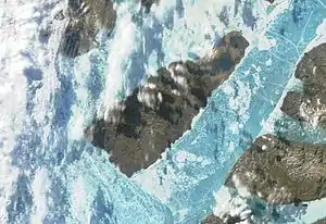
Terra/MODIS satellite image of Eglinton Island
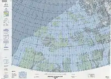
Map including Eglinton Island
References
- M'Dougall, George F. (1857). The eventful voyage of H.M. discovery ship "Resolute" to the Arctic regions, in search of Sir John Franklin and the missing crews of H.M. discovery ships "Erebus" and "Terror," 1852, 1853, 1854. London: Longman, Brown, Green, Longmans, & Roberts. p. 452.
The Eventful Voyages of HMS Resolute.
Sources
- Eglinton Island - Canada's Arctic
This article is issued from Wikipedia. The text is licensed under Creative Commons - Attribution - Sharealike. Additional terms may apply for the media files.