Truro Island
Truro Island lies within the Canadian Arctic Archipelago in the Qikiqtaaluk Region of northern Canada's territory of Nunavut. It is one of the mid-waterway islands in the McDougall Sound between Bathurst Island and Cornwallis Island. Long and narrow, the island is 21 km2 (8.1 sq mi).[1]
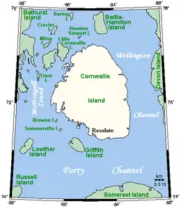 A closeup map showing Truro Island | |
| Geography | |
|---|---|
| Location | Northern Canada |
| Coordinates | 75°17′N 97°11′W |
| Archipelago | Queen Elizabeth Islands Canadian Arctic Archipelago |
| Area | 21 km2 (8.1 sq mi) |
| Administration | |
Canada | |
| Territory | Nunavut |
| Region | Qikiqtaaluk |
| Demographics | |
| Population | Uninhabited |
Collaborative Interdisciplinary Cryospheric Experiment
Truro Island was the base camp for several Collaborative Interdisciplinary Cryospheric Experiment (C-ICE) studies which provide data on atmosphere, sea ice, and ocean interaction, including C-ICE'2000,[2] C-ICE'2001,[3] and C-ICE'2002.[4]
See also
References
- "Truro Island". nrcan.gc.ca. 2006-02-06. Retrieved 2008-04-30.
- Johnston, M.; Frederking, R. (September 2000). "Seasonal Decay of First Year Sea Ice". Canadian Hydraulics Centre, National Research Council of Canada. Retrieved 2008-04-30.
- "C-ICE 2001 Data Report". Centre for Earth Observation Science, University of Manitoba. Retrieved 2008-04-30.
- Mosscrop, David R.; Barber, D.G. (2005-02-25). "Annual Report for Research Centers and Institutes". Centre for Earth Observation Science, University of Manitoba. Retrieved 2008-04-30.
External links
- Truro Island in the Atlas of Canada - Toporama; Natural Resources Canada
- Collaborative Interdisciplinary Cryospheric Experiment (C-ICE)- scientific experiments on Truro Island
- Synopsis Of The Polaris Zn-Pb-Cu District, Canadian Arctic Islands, Nunavut- mining on Truro Island
This article is issued from Wikipedia. The text is licensed under Creative Commons - Attribution - Sharealike. Additional terms may apply for the media files.