Eitzen, Minnesota
Eitzen is a city in Houston County, Minnesota, United States. The population was 243 at the 2010 census.[6]
Eitzen | |
|---|---|
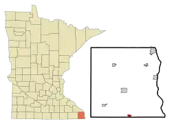 Location of Eitzen, Minnesota | |
| Coordinates: 43°30′30″N 91°27′53″W | |
| Country | United States |
| State | Minnesota |
| County | Houston |
| Area | |
| • Total | 0.61 sq mi (1.58 km2) |
| • Land | 0.61 sq mi (1.58 km2) |
| • Water | 0.00 sq mi (0.00 km2) |
| Elevation | 1,155 ft (352 m) |
| Population | |
| • Total | 243 |
| • Estimate (2019)[3] | 249 |
| • Density | 408.20/sq mi (157.69/km2) |
| Time zone | UTC-6 (Central (CST)) |
| • Summer (DST) | UTC-5 (CDT) |
| ZIP code | 55931 |
| Area code(s) | 507 |
| FIPS code | 27-18368[4] |
| GNIS feature ID | 0643220[5] |
| Website | www |
History
A post office called Eitzen has been in operation since 1868.[7] A share of the early settlers being natives of Eitzen, Germany, caused the name to be selected.[8]
In September 2020, while visiting randomly selected households in Eitzen, a group of CDC officials claimed to have been confronted, and to have had their cars surrounded, by residents of houses who did not believe they were who they claimed to be; the incident was one of several that led to the discontinuation of the program.[9] This account was disputed by mayor Jeff Adamson, who claimed the city was never informed about the plan to approach random households, and said "I think they owe the city of Eitzen and its citizens an apology".[10] He further said that "a city official and two other residents responded to concerns about people going door-to-door in an unmarked car with California plates [...] Two vehicles driven by the city official and residents were parked on either side of the COVID-19 team's vehicle, but it was never blocked."[10]
Geography
According to the United States Census Bureau, the city has a total area of 0.58 square miles (1.50 km2), all of it land.[11]
Demographics
| Historical population | |||
|---|---|---|---|
| Census | Pop. | %± | |
| 1950 | 151 | — | |
| 1960 | 181 | 19.9% | |
| 1970 | 208 | 14.9% | |
| 1980 | 226 | 8.7% | |
| 1990 | 221 | −2.2% | |
| 2000 | 229 | 3.6% | |
| 2010 | 243 | 6.1% | |
| 2019 (est.) | 249 | [3] | 2.5% |
| U.S. Decennial Census[12] | |||
2010 census
As of the census[2] of 2010, there were 243 people, 112 households, and 61 families living in the city. The population density was 419.0 inhabitants per square mile (161.8/km2). There were 119 housing units at an average density of 205.2 per square mile (79.2/km2). The racial makeup of the city was 100.0% White.
There were 112 households, of which 24.1% had children under the age of 18 living with them, 49.1% were married couples living together, 4.5% had a female householder with no husband present, 0.9% had a male householder with no wife present, and 45.5% were non-families. 33.0% of all households were made up of individuals, and 18.8% had someone living alone who was 65 years of age or older. The average household size was 2.17 and the average family size was 2.89.
The median age in the city was 44.5 years. 17.7% of residents were under the age of 18; 11% were between the ages of 18 and 24; 22.7% were from 25 to 44; 20.2% were from 45 to 64; and 28.4% were 65 years of age or older. The gender makeup of the city was 49.4% male and 50.6% female.
2000 census
As of the census[4] of 2000, there were 229 people, 108 households, and 60 families living in the city. The population density was 394.4 people per square mile (152.4/km2). There were 111 housing units at an average density of 191.2 per square mile (73.9/km2). The racial makeup of the city was 100.00% White.
There were 108 households, out of which 20.4% had children under the age of 18 living with them, 50.0% were married couples living together, 1.9% had a female householder with no husband present, and 44.4% were non-families. 39.8% of all households were made up of individuals, and 25.9% had someone living alone who was 65 years of age or older. The average household size was 2.12 and the average family size was 2.83.
In the city, the population was spread out, with 22.3% under the age of 18, 3.1% from 18 to 24, 26.6% from 25 to 44, 18.3% from 45 to 64, and 29.7% who were 65 years of age or older. The median age was 43 years. For every 100 females, there were 99.1 males. For every 100 females age 18 and over, there were 85.4 males.
The median income for a household in the city was $29,688, and the median income for a family was $36,607. Males had a median income of $26,250 versus $16,667 for females. The per capita income for the city was $16,440. About 3.0% of families and 3.5% of the population were below the poverty line, including none of those under the age of eighteen and 2.9% of those 65 or over.
References
- "2019 U.S. Gazetteer Files". United States Census Bureau. Retrieved July 26, 2020.
- "U.S. Census website". United States Census Bureau. Retrieved 2012-11-13.
- "Population and Housing Unit Estimates". United States Census Bureau. May 24, 2020. Retrieved May 27, 2020.
- "U.S. Census website". United States Census Bureau. Retrieved 2008-01-31.
- "US Board on Geographic Names". United States Geological Survey. 2007-10-25. Retrieved 2008-01-31.
- "2010 Census Redistricting Data (Public Law 94-171) Summary File". American FactFinder. United States Census Bureau. Retrieved 27 April 2011.
- "Houston County". Jim Forte Postal History. Archived from the original on 6 July 2015. Retrieved 5 July 2015.
- Upham, Warren (1920). Minnesota Geographic Names: Their Origin and Historic Significance. Minnesota Historical Society. p. 238.
- Cox, Peter (25 September 2020). Minnesota Public Radio https://www.mprnews.org/story/2020/09/25/covid19-factfinding-leads-to-threats-against-health-workers-in-minnesota. Retrieved 27 September 2020. Missing or empty
|title=(help) - MPR News Staff (26 September 2020). "Mayor of Minnesota city disputes MDH reports of health workers being threatened". Retrieved 27 September 2020.
- "US Gazetteer files 2010". United States Census Bureau. Archived from the original on 2012-01-25. Retrieved 2012-11-13.
- "Census of Population and Housing". Census.gov. Retrieved June 4, 2015.
External links
Municipalities and communities of Houston County, Minnesota, United States | ||
|---|---|---|
| Cities | 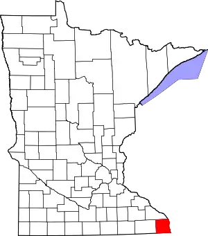 Map of Minnesota highlighting Houston County | |
| Townships | ||
| Unincorporated communities | ||
| Indian reservation | ||
| Footnotes | ‡This populated place also has portions in an adjacent county or counties | |
| ||