El Moro, Colorado
El Moro is an unincorporated community and a census-designated place (CDP) located in and governed by Las Animas County, Colorado, United States. The population of the El Moro CDP was 221 at the United States Census 2010.[4] The Trinidad post office (Zip Code 81082) serves the area.[3]
El Moro, Colorado | |
|---|---|
 The former El Moro Public School (now privately held). | |
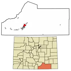 Location of the El Moro CDP in Las Animas County, Colorado. | |
 El Moro Location of the El Moro CDP in the United States. | |
| Coordinates: 37°14′06″N 104°26′57″W[1] | |
| Country | |
| State | |
| County | Las Animas County |
| Government | |
| • Type | unincorporated community |
| Area | |
| • Total | 11.116 sq mi (28.791 km2) |
| • Land | 11.091 sq mi (28.725 km2) |
| • Water | 0.025 sq mi (0.066 km2) |
| Elevation | 5,879 ft (1,792 m) |
| Population (2010) | |
| • Total | 221 |
| • Density | 20/sq mi (8/km2) |
| Time zone | UTC-7 (MST) |
| • Summer (DST) | UTC-6 (MDT) |
| ZIP Code[3] | Trinidad 81082 |
| Area code(s) | 719 |
| GNIS feature[2] | El Moro CDP |
History
The El Moro post office was established in 1876, and remained in operation until 1933.[5] El Moro is a name derived from Spanish meaning "the Moor".[6]
Geography
El Moro is in west-central Las Animas County, bordering the northeast side of the city of Trinidad, the county seat. U.S. Route 160 runs along the southeast edge of the CDP, leading southwest 3.5 miles (5.6 km) to the center of Trinidad and east 119 miles (192 km) to Springfield. U.S. Route 350 branches off from US 160 at the eastern edge of El Moro and leads northeast 73 miles (117 km) to La Junta. The city of Pueblo is 81 miles (130 km) to the north via Interstate 25, which runs just west of the El Moro CDP. The Purgatoire River runs through the community, flowing northeast toward the Arkansas River.
The El Moro CDP has an area of 7,114 acres (28.791 km2), including 16 acres (0.066 km2) of water.[1]
Demographics
The United States Census Bureau initially defined the El Moro CDP for the United States Census 2010.
| Year | Pop. | ±% |
|---|---|---|
| 2010 | 221 | — |
| 2020 | — | |
| Source: United States Census Bureau | ||
See also
- Outline of Colorado
- State of Colorado
- Colorado cities and towns
- Colorado counties
References
- "State of Colorado Census Designated Places - BAS20 - Data as of January 1, 2020". United States Census Bureau. Retrieved December 23, 2020.
- "U.S. Board on Geographic Names: Domestic Names". United States Geological Survey. Retrieved December 30, 2020.
- "Look Up a ZIP Code". United States Postal Service. Retrieved December 23, 2020.
- "2010: DEC Summary File 1". United States Census Bureau. Retrieved December 23, 2020.
- "Post Offices". Jim Forte Postal History. Archived from the original on 6 March 2016. Retrieved 25 June 2016.
- Dawson, John Frank. Place Names in Colorado: Why 700 Communities Were So Named, 150 of Spanish or Indian Origin. Denver, CO: The J. Frank Dawson Publishing Co. p. 20.
External links
Municipalities and communities of Las Animas County, Colorado, United States | ||
|---|---|---|
| City | 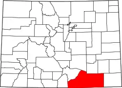 Map of Colorado highlighting Las Animas County | |
| Towns | ||
| CDPs | ||
| Unincorporated communities | ||
| Ghost towns | ||
| ||
