Stonewall Gap, Colorado
Stonewall Gap (also known as Stonewall) is an unincorporated community and a census-designated place (CDP) located in and governed by Las Animas County, Colorado, United States. The population of the Stonewall Gap CDP was 67 at the United States Census 2010.[4] The Weston post office (Zip Code 81091) serves the area.[3]
Stonewall Gap, Colorado | |
|---|---|
 Stonewall Gap and Colorado State Highway 12. | |
 Location of the Stonewall Gap CDP in Las Animas County, Colorado. | |
 Stonewall Gap Location of the Stonewall Gap CDP in the United States. | |
| Coordinates: 37°09′38″N 105°02′03″W[1] | |
| Country | |
| State | |
| County | Las Animas County |
| Government | |
| • Type | unincorporated community |
| Area | |
| • Total | 1.920 sq mi (4.974 km2) |
| • Land | 1.920 sq mi (4.974 km2) |
| • Water | 0.000 sq mi (0.000 km2) |
| Elevation | 7,963 ft (2,427 m) |
| Population (2010) | |
| • Total | 67 |
| • Density | 35/sq mi (13/km2) |
| Time zone | UTC-7 (MST) |
| • Summer (DST) | UTC-6 (MDT) |
| ZIP Code[3] | Weston 81091 |
| Area code(s) | 719 |
| GNIS feature[2] | Stonewall Gap CDP |
Geography
Stonewall Gap lies along Colorado State Highway 12 at a gap formed by the Middle Fork of the Purgatoire River through the 8,400 feet (2,600 meters) elevation Stonewall Ridge. Highway 12 leads east down the Purgatoire River valley 33 miles (53 km) to Trinidad, the Las Animas county seat, and north over Cucharas Pass in the Sangre de Cristo Mountains 32 miles (51 km) to La Veta.
The Stonewall Gap CDP has an area of 1,229 acres (4.974 km2), all land.[1]
Demographics
The United States Census Bureau initially defined the Stonewall Gap CDP for the United States Census 2010.
| Year | Pop. | ±% |
|---|---|---|
| 2010 | 67 | — |
| 2020 | — | |
| Source: United States Census Bureau | ||
See also
- Outline of Colorado
- State of Colorado
- Colorado cities and towns
- Colorado counties
References
- "State of Colorado Census Designated Places - BAS20 - Data as of January 1, 2020". United States Census Bureau. Retrieved December 23, 2020.
- "U.S. Board on Geographic Names: Domestic Names". United States Geological Survey. Retrieved December 23, 2020.
- "Zip Code 81091 Map and Profile". zipdatamaps.com. 2020. Retrieved December 23, 2020.
- "2010: DEC Summary File 1". United States Census Bureau. Retrieved December 23, 2020.
External links
Municipalities and communities of Las Animas County, Colorado, United States | ||
|---|---|---|
| City | 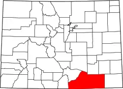 Map of Colorado highlighting Las Animas County | |
| Towns | ||
| CDPs | ||
| Unincorporated communities | ||
| Ghost towns | ||
| ||
